Category:Dūkštas in maps
This category includes the images that spot Dūkštas city in larger geographical area. For maps that specifically represent the city of Dūkštas more in detail, see Category:Maps of Dūkštas.
Media in category "Dūkštas in maps"
The following 4 files are in this category, out of 4 total.
-
 R200 N35-02sw.jpg 2,303 × 1,477; 5.06 MB
-
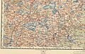
 WIG Mapa Operacyjna Polski - 27 Wilkomierz 1930.jpg 6,421 × 5,785; 16.76 MB
-
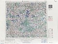 USSR map NN 35-2 Daugavpils.jpg 5,724 × 4,385; 8.52 MB
-
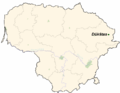 LietuvaDukstas.png 721 × 556; 28 KB


