Category:Důl Barbora
| Object location | | View all coordinates using: OpenStreetMap |
|---|
|
This is a category about a cultural monument of the Czech Republic,
number: 49082/8-4012. |
mine in Karviná, Czech Republic .JPG) | |||||
| Upload media | |||||
| Instance of | |||||
|---|---|---|---|---|---|
| Location | Doly, Karviná, Karviná District, Moravian-Silesian Region, Czechia | ||||
| Heritage designation | |||||
 | |||||
Subcategories
This category has only the following subcategory.
W
Media in category "Důl Barbora"
The following 10 files are in this category, out of 10 total.
-
 Dul barbora 1911.jpg 965 × 641; 115 KB
-
 Dul Barbora Karvina M262.JPG 4,320 × 3,240; 6.89 MB
-
 Důl Barbora v Karviné.jpg 2,500 × 1,667; 1.44 MB
-
 Karviná, důl Barbora (1).JPG 2,675 × 3,684; 4.86 MB
-
 Karviná, důl Barbora (2).JPG 3,756 × 2,249; 4.81 MB
-
 Karviná, důl Barbora (3).JPG 2,189 × 2,956; 3.82 MB
-
 Karviná, důl Barbora (4).JPG 3,362 × 2,276; 3.93 MB
-
 Karviná, důl Barbora (5).JPG 4,608 × 3,456; 6.59 MB
-
 Karviná, důl Barbora (6).JPG 4,608 × 3,456; 6.82 MB
-
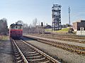
 Teplárna Karviná (důl Barbora) a vlak Slezského železničního spolku.jpg 8,000 × 6,000; 10.45 MB


.JPG)
.JPG)
.JPG)
.JPG)
.JPG)
_a_vlak_Slezsk%C3%A9ho_%C5%BEelezni%C4%8Dn%C3%ADho_spolku.jpg)