Category:Dakota Formation
Dakota Formation is the broadest classification of the earliest Western Interior Seaway formations, having the widest use and is inclusive of the non-sandstone beds. Dakota Group is used where members are sufficiently developed to be assigned formation rank; and as particularly used in and around Colorado, the groups can include formations younger and older than those considered by other states as included in the Dakota sequences.
Dakota Sandstone is the narrowest classification and in general use refers only to rock from sandstone beds in the Dakota Formation.
rock units in Midwestern North America  | |||||
| Upload media | |||||
| Instance of | |||||
|---|---|---|---|---|---|
| Named after | |||||
| Location |
| ||||
| Has part(s) |
| ||||
| Said to be the same as | Dakota Group | ||||
| |||||
Subcategories
This category has the following 13 subcategories, out of 13 total.
*
+
D
F
P
Media in category "Dakota Formation"
The following 28 files are in this category, out of 28 total.
-
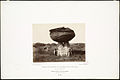
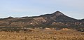 Badito Cone.JPG 5,968 × 2,856; 10.16 MB
-
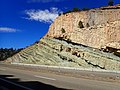
 Burro canyon formation.jpg 4,608 × 3,456; 6.59 MB
-

-
 Cuchara Valley (Colorado).JPG 4,840 × 2,412; 7.1 MB
-
 Dakota Fm.jpg 720 × 459; 271 KB
-
 Dakota Formation KS Ellsworth Co, KS 03.jpg 2,560 × 1,920; 2.18 MB
-
 Dakota Formation KS Russell Co, KS 01.jpg 4,032 × 1,253; 1.79 MB
-
 Dakota Formation KS Saline Co, KS 02.jpg 4,032 × 1,334; 2.05 MB
-
 Dakota ripples.jpg 1,184 × 785; 259 KB
-
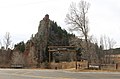 Dakota Wall at Stonewall Gap.JPG 4,739 × 3,139; 11.04 MB
-
 Dinosaur ridge roadcut I-70.jpg 1,181 × 625; 203 KB
-
-

-

-

-
 Kanopolissp.JPG 2,560 × 1,920; 1.08 MB
-
-
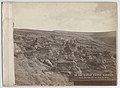
 No. 32. Mushroom Rocks at Elm Creek. (6860437674).jpg 750 × 548; 88 KB
-
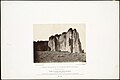
 No. 38. Coal Canon at Wilson, Kansas. (6860533946).jpg 750 × 548; 88 KB
-
-
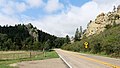
 North Lake (Las Animas County, Colorado).JPG 5,654 × 3,280; 11.3 MB
-
 Pawnee Rock P5310475.JPG 3,072 × 2,304; 1.1 MB
-
 Pawnee Rock P5310476.JPG 3,072 × 2,304; 1.19 MB
-
 Pawnee Rock P5310526.JPG 2,048 × 1,536; 544 KB
-
 Romeroville Roadcut.jpg 4,000 × 3,000; 2.9 MB
-
 Skolithos in Dakota Formation.jpg 4,608 × 3,456; 6.6 MB
-
 Stonewall Gap, Colorado.JPG 5,370 × 3,331; 9.65 MB
-
 The Gap near Cuchara, Colorado.JPG 5,822 × 3,297; 13.69 MB


.jpg)
.JPG)


.jpg)
.jpg)
.jpg)

.jpg)
.jpg)
.jpg)
.jpg)
.JPG)


