Category:Dakota Sandstone maps
Media in category "Dakota Sandstone maps"
The following 7 files are in this category, out of 7 total.
-
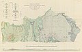 Baker 1936 USGS Bulletin 865 plate-1.jpg 17,361 × 10,939; 12.57 MB
-
 NPS bryce-canyon-geologic-map.jpg 3,262 × 4,054; 2.17 MB
-
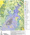
 NPS canyonlands-geologic-map.jpg 3,724 × 5,392; 6.02 MB
-
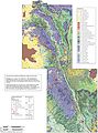
 NPS canyonlands-national-park-geologic-map.jpg 4,064 × 4,736; 5.19 MB
-
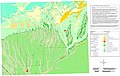
 NPS capitol-reef-geologic-map.jpg 4,222 × 5,695; 5.81 MB
-
 NPS dinosaur-geologic-map.jpg 6,373 × 4,188; 6.03 MB
-
 NPS mesa-verde-geologic-map.jpg 4,264 × 2,696; 1.67 MB


