Category:Dambergwarte
| Object location | | View all coordinates using: OpenStreetMap |
|---|
 | |||||
| Upload media | |||||
| Instance of | |||||
|---|---|---|---|---|---|
| Made from material | |||||
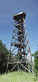
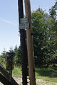
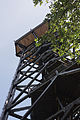
| Location | Damberg, Garsten, Steyr-Land District, Upper Austria, Austria | ||||
| Inception |
| ||||
| Height |
| ||||
 | |||||
Subcategories
This category has the following 2 subcategories, out of 2 total.
D
V
- Views from Dambergwarte (13 F)
Media in category "Dambergwarte"
The following 10 files are in this category, out of 10 total.
-
 Komplettansicht der Dambergwarte 04-07-2014.jpg 2,306 × 4,955; 9.03 MB
-
 Konstruktion der Dambergwarte 1.jpg 2,592 × 3,888; 11.43 MB
-
 Konstruktion der Dambergwarte 2.jpg 2,592 × 3,888; 10.06 MB
-
 Konstruktion der Dambergwarte 3.jpg 2,592 × 3,888; 6.33 MB
-
 Konstruktion der Dambergwarte 4.jpg 3,818 × 2,499; 8.44 MB
-
 Konstruktion der Dambergwarte 5.jpg 2,592 × 3,888; 5.43 MB
-
 Sankt Ulrich bei Steyr Dambergwarte Stütze mit Verstrebung-9667.jpg 3,673 × 5,509; 16.34 MB
-
 Sankt Ulrich bei Steyr Dambergwarte Treppe-9659.jpg 3,653 × 5,480; 14.8 MB
-
 Sankt Ulrich bei Steyr Dambergwarte-41-212.jpg 5,401 × 8,101; 12.01 MB
-
 Tafeln am Fuss der Dambergwarte 04-07-2014.jpg 3,847 × 2,531; 6.27 MB


