Category:Daugai in maps
This category includes the images that spot Daugai city in larger geographical area. For maps that specifically represent the city of Daugai more in detail, see Category:Maps of Daugai.
Media in category "Daugai in maps"
The following 5 files are in this category, out of 5 total.
-
 Reymanns Merecz.jpg 5,659 × 3,929; 4.65 MB
-
 WIG Mapa Operacyjna Polski - 37 Wilno 1930.jpg 6,471 × 5,923; 15.46 MB
-
 R200 N35-07nw.jpg 2,362 × 1,464; 4.95 MB
-
 USSR map NN 35-4 Vilnius.jpg 5,749 × 4,358; 8.38 MB
-
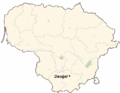 LietuvaDaugai.png 721 × 556; 28 KB


