Category:De Brink (Zeist)
| Object location | | View all coordinates using: OpenStreetMap |
|---|
building in Zeist, Netherlands  | |||||
| Upload media | |||||
| Instance of | |||||
|---|---|---|---|---|---|
| Part of | |||||
| Location | Zeist, Utrecht, Netherlands | ||||
| Street address |
| ||||
| Located on street | |||||
| Heritage designation |
| ||||
 | |||||
|
This is a category about rijksmonument number 520111
|
| Address |
|
Media in category "De Brink (Zeist)"
The following 35 files are in this category, out of 35 total.
-
 Achtergevel - Zeist - 20368846 - RCE.jpg 1,200 × 803; 219 KB
-
 Achtergevel - Zeist - 20368847 - RCE.jpg 1,200 × 800; 246 KB
-
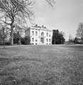
 De Brink Zeist.jpg 1,536 × 1,047; 385 KB
-
 De eerste steen van landhuis De Brink - Zeist - 20372041 - RCE.jpg 1,190 × 1,200; 464 KB
-
 Exterieur OVERZICHT ACHTERZIJDE MET PARK - Zeist - 20340064 - RCE.jpg 1,190 × 1,200; 370 KB
-
 Exterieur OVERZICHT VOORGEVEL - Zeist - 20340003 - RCE.jpg 1,179 × 1,200; 395 KB
-
 Exterieur OVERZICHT VOORGEVEL - Zeist - 20340005 - RCE.jpg 1,171 × 1,200; 433 KB
-
 Exterieur OVERZICHT VOORGEVEL VANUIT LANDSCHAPSPARK - Zeist - 20340004 - RCE.jpg 1,197 × 1,200; 537 KB
-
 HUA-135868-Gezicht op de voorgevel van het huis De Brink te Zeist.jpg 4,087 × 3,449; 4.32 MB
-
 HUA-202421-Gezicht op de voorgevel van het huis De Brink te Zeist.jpg 4,426 × 3,600; 5.65 MB
-
 Interieur, begane grond, kamer - Zeist - 20368857 - RCE.jpg 943 × 1,200; 149 KB
-
 Interieur, begane grond, kamer, schouw met kachel - Zeist - 20368858 - RCE.jpg 1,200 × 1,195; 202 KB
-
 Interieur, hal - Zeist - 20368848 - RCE.jpg 938 × 1,200; 139 KB
-
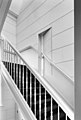
 Interieur, hal met trappenhuis - Zeist - 20368849 - RCE.jpg 945 × 1,200; 143 KB
-
 Interieur, kamer met betegelde schouw - Zeist - 20368867 - RCE.jpg 1,200 × 956; 146 KB
-
 Interieur, kamer met betegelde schouw - Zeist - 20368868 - RCE.jpg 807 × 1,200; 99 KB
-
 Interieur, kelder - Zeist - 20368861 - RCE.jpg 807 × 1,200; 123 KB
-
 Interieur, salon - Zeist - 20368852 - RCE.jpg 1,200 × 947; 161 KB
-
 Interieur, salon met schouw , kachel - Zeist - 20368853 - RCE.jpg 805 × 1,200; 116 KB
-
 Interieur, salon, detail stucplafond - Zeist - 20368856 - RCE.jpg 1,192 × 1,200; 280 KB
-

-
 Interieur, salon, stucplafond met kroonluchter - Zeist - 20368854 - RCE.jpg 834 × 1,200; 199 KB
-
 Interieur, schouw - Zeist - 20368859 - RCE.jpg 1,200 × 1,200; 207 KB
-
 Interieur, souterrain, betegelde keuken - Zeist - 20368862 - RCE.jpg 1,200 × 966; 174 KB
-
 Interieur, souterrain, betegelde keuken - Zeist - 20368863 - RCE.jpg 1,200 × 949; 170 KB
-

-

-

-
 Interieur, trappenhuis - Zeist - 20368850 - RCE.jpg 953 × 1,200; 137 KB
-
 Interieur, trappenhuiskamertje - Zeist - 20368851 - RCE.jpg 807 × 1,200; 117 KB
-
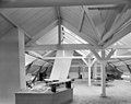 Interieur, zolder, werkruimte onder de kap - Zeist - 20368860 - RCE.jpg 1,200 × 950; 162 KB
-
 Rijksstraatweg, De Brink, overzicht - Zeist - 20221693 - RCE.jpg 1,200 × 805; 230 KB
-
 Voorgevel - Zeist - 20368845 - RCE.jpg 1,200 × 802; 208 KB
-
 Zeist - De Brink Park RM520112.JPG 4,608 × 2,455; 1.51 MB
-
 Zeist - De Brink Toegangshekken RM520114.JPG 4,533 × 3,348; 3.41 MB


