Category:De Burd (windmill)
| Object location | | View all coordinates using: OpenStreetMap |
|---|
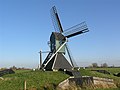
windmill in Akkrum, Netherlands  | |||||
| Upload media | |||||
| Instance of | |||||
|---|---|---|---|---|---|
| Location |
| ||||
| Street address |
| ||||
| Has use |
| ||||
| Heritage designation |
| ||||
| Source of energy | |||||
 | |||||
|
This is a category about rijksmonument number 22915
|
| Address |
|
Media in category "De Burd (windmill)"
The following 3 files are in this category, out of 3 total.
-
 8673 Grouw.JPG 2,288 × 1,712; 2.1 MB
-
 Mûne "De Burd", Grou.jpg 1,794 × 1,058; 819 KB
-
 Spinnenkopmolen schuin van voren gefotografeerd - Grou - 20352379 - RCE.jpg 788 × 1,200; 143 KB

