Category:De Dijk 14, Dokkum
| Object location | | View all coordinates using: OpenStreetMap |
|---|
 | |||||
| Upload media | |||||
| Instance of |
| ||||
|---|---|---|---|---|---|
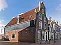
| Location | Dokkum, Noardeast-Fryslân, Friesland, Netherlands | ||||
| Located on street | |||||
| Heritage designation |
| ||||
 | |||||
|
This is a category about rijksmonument number 13116
|
| Address |
|
Media in category "De Dijk 14, Dokkum"
The following 5 files are in this category, out of 5 total.
-
 De Dijk 14 Dokkum.jpg 1,824 × 1,368; 578 KB
-
 De Dijk 14, Dokkum.JPG 3,024 × 4,032; 2.48 MB
-
 En Vleesmarkt van af Diepswal - Dokkum - 20058942 - RCE.jpg 1,200 × 953; 232 KB
-
 Overzicht - Dokkum - 20058943 - RCE.jpg 1,176 × 1,200; 243 KB
-
 Vier huizen aan een straat - Dokkum - 20323483 - RCE.jpg 1,200 × 773; 162 KB


