Category:De Hamer, Harlingen
| Object location | | View all coordinates using: OpenStreetMap |
|---|
 | |||||
| Upload media | |||||
| Instance of | |||||
|---|---|---|---|---|---|
| Location | Harlingen, Friesland, Netherlands | ||||
| Located on street |
| ||||
| Heritage designation |
| ||||
 | |||||
|
This is a category about rijksmonument number 20640
|
| Address |
|
Media in category "De Hamer, Harlingen"
The following 21 files are in this category, out of 21 total.
-
 Pakhuis, achtergevel - Harlingen - 20102189 - RCE.jpg 955 × 1,200; 240 KB
-
 Pakhuis, achtergevel - Harlingen - 20102190 - RCE.jpg 1,200 × 956; 366 KB
-
 Pakhuis, dakramen - Harlingen - 20102191 - RCE.jpg 1,200 × 1,190; 429 KB
-
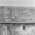 Pakhuis, dakramen - Harlingen - 20102192 - RCE.jpg 1,200 × 1,190; 452 KB
-
 Pakhuis, linkerzijgevel - Harlingen - 20102184 - RCE.jpg 1,200 × 1,200; 500 KB
-
 Pakhuis, linkerzijgevel - Harlingen - 20102185 - RCE.jpg 1,200 × 954; 360 KB
-
 Pakhuis, linkerzijgevel - Harlingen - 20102186 - RCE.jpg 1,200 × 1,195; 519 KB
-
 Pakhuis, overzicht - Harlingen - 20102175 - RCE.jpg 1,200 × 949; 200 KB
-
 Pakhuis, overzicht - Harlingen - 20102176 - RCE.jpg 1,200 × 953; 195 KB
-
 Pakhuis, overzicht - Harlingen - 20102177 - RCE.jpg 1,200 × 959; 207 KB
-
 Pakhuis, overzicht - Harlingen - 20102178 - RCE.jpg 1,200 × 955; 251 KB
-
 Pakhuis, overzicht achtergevel - Harlingen - 20102188 - RCE.jpg 1,200 × 953; 233 KB
-
 Pakhuis, overzicht achterzijde - Harlingen - 20102187 - RCE.jpg 1,200 × 958; 236 KB
-
 Pakhuis, rechterzijgevel - Harlingen - 20102183 - RCE.jpg 1,193 × 1,200; 340 KB
-
 Pakhuis, rechterzijgevel en verder, zie kaart IA - Harlingen - 20102180 - RCE.jpg 1,200 × 1,200; 377 KB
-
 Pakhuis, voorgevel - Harlingen - 20102179 - RCE.jpg 960 × 1,200; 313 KB
-
 RM20640 Harlingen - Rozengracht 6.jpg 1,944 × 2,592; 1.1 MB
-
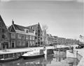
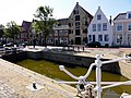 Rozengracht De Hamer Harlingen.jpg 3,648 × 2,736; 912 KB
-
 Rozengracht De Valk en De Hamer Harlingen.jpg 3,648 × 2,736; 901 KB
-
 Rozengracht De Valk Harlingen.jpg 825 × 1,368; 601 KB
-
 Rozengracht6 De Hamer2 Harlingen.jpg 1,212 × 1,962; 1.12 MB


