Category:De Harn, Bennekom
| Object location | | View all coordinates using: OpenStreetMap |
|---|
 | |||||
| Upload media | |||||
| Instance of | |||||
|---|---|---|---|---|---|
| Location | Bennekom, Ede, Gelderland, Netherlands | ||||
| Street address |
| ||||
| Heritage designation |
| ||||
 | |||||
Nederlands: Boerderij de Harn
|
This is a category about rijksmonument number 14453
|
| Address |
|
Media in category "De Harn, Bennekom"
The following 90 files are in this category, out of 90 total.
-
 Achter- en zijgevel - Ede - 20459285 - RCE.jpg 1,200 × 953; 69 KB
-
 Achter- en zijgevel woongedeelte - Ede - 20459298 - RCE.jpg 1,200 × 900; 226 KB
-
 Achtergevel - Ede - 20459304 - RCE.jpg 1,200 × 900; 153 KB
-
 Achtergevel - Ede - 20459335 - RCE.jpg 1,200 × 900; 131 KB
-
 Achtergevel nr. B19-A - Bennekom - 20473169 - RCE.jpg 1,200 × 900; 143 KB
-
 Achtergevel nr. B20-A - Bennekom - 20473170 - RCE.jpg 1,200 × 900; 148 KB
-
 Achtergevel woongedeelte - Ede - 20459297 - RCE.jpg 1,200 × 900; 218 KB
-
 Achtergevel woongedeelte - Ede - 20459321 - RCE.jpg 1,200 × 900; 151 KB
-
 Achtergevels nr. F 474-31 - Ede - 20459296 - RCE.jpg 1,200 × 900; 129 KB
-
 Binnenzijde gevel en dakconstructie - Ede - 20459276 - RCE.jpg 1,200 × 953; 79 KB
-
 Binnenzijde gevel en kapconstructie - Ede - 20459342 - RCE.jpg 1,200 × 953; 73 KB
-
 Binnenzijde muur met luik en rookkanaal - Ede - 20459356 - RCE.jpg 1,200 × 953; 73 KB
-
 Bovenste deel zijgevel woongedeelte - Ede - 20459306 - RCE.jpg 1,200 × 953; 93 KB
-
 Dak en tussenmuur - Ede - 20459337 - RCE.jpg 1,200 × 953; 56 KB
-
 Dak, plafond en dwarsbalk - Ede - 20459278 - RCE.jpg 1,200 × 953; 64 KB
-
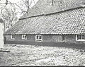
 De Harn.jpg 2,048 × 1,536; 1.84 MB
-
 Deel dwarsbalk - Ede - 20459351 - RCE.jpg 1,200 × 953; 67 KB
-
 Deel voorgevel - Ede - 20459305 - RCE.jpg 953 × 1,200; 100 KB
-
 Deel zijgevel woongedeelte - Ede - 20459288 - RCE.jpg 1,200 × 953; 105 KB
-
 Detail binnenzijde (zij)gevel - Ede - 20459314 - RCE.jpg 953 × 1,200; 77 KB
-
 Detail gevel- inscriptie - Ede - 20459294 - RCE.jpg 1,200 × 953; 63 KB
-
 Detail voorgevel - Ede - 20459286 - RCE.jpg 1,200 × 953; 100 KB
-
 Detail voorgevel - Ede - 20459293 - RCE.jpg 953 × 1,200; 105 KB
-
 Detail voorgevel - Ede - 20459309 - RCE.jpg 1,200 × 953; 92 KB
-
 Detail voorgevel - Ede - 20459310 - RCE.jpg 1,200 × 953; 116 KB
-
 Detail voorgevel - Ede - 20459311 - RCE.jpg 1,200 × 953; 116 KB
-
 Detail voorgevel - Ede - 20459313 - RCE.jpg 953 × 1,200; 111 KB
-
 Detail voorgevel - Ede - 20459332 - RCE.jpg 1,200 × 900; 259 KB
-
 Detail voorgevel - Ede - 20459333 - RCE.jpg 1,200 × 900; 223 KB
-
 Detail zijgevel - Ede - 20459289 - RCE.jpg 1,200 × 953; 105 KB
-
 Detail zijgevel - Ede - 20459303 - RCE.jpg 1,200 × 953; 78 KB
-
 Detail zijgevel woongedeelte - Ede - 20459287 - RCE.jpg 1,200 × 953; 123 KB
-
 Detail zijgevel woongedeelte - Ede - 20459291 - RCE.jpg 1,200 × 953; 109 KB
-
 Detail zijgevel woongedeelte - Ede - 20459299 - RCE.jpg 1,200 × 953; 79 KB
-
 Exterieur LINKER ZIJGEVEL - Ede - 20287655 - RCE.jpg 1,197 × 1,200; 473 KB
-
 Exterieur OVERZICHT ACHTERGEVEL - Ede - 20287656 - RCE.jpg 1,200 × 1,176; 344 KB
-
 Exterieur OVERZICHT SCHUREN - Ede - 20287657 - RCE.jpg 1,195 × 1,200; 369 KB
-
 Exterieur OVERZICHT VOORGEVEL - Ede - 20287653 - RCE.jpg 1,192 × 1,200; 436 KB
-
 Exterieur OVERZICHT VOORGEVEL - Ede - 20287654 - RCE.jpg 1,200 × 1,199; 419 KB
-
 Gebint - Ede - 20459323 - RCE.jpg 1,200 × 953; 72 KB
-
 Gebint- en kapconstructie - Ede - 20459277 - RCE.jpg 1,200 × 953; 76 KB
-
 Gebint- en kapconstructie - Ede - 20459282 - RCE.jpg 1,200 × 953; 66 KB
-
 Gebint- en kapconstructie - Ede - 20459301 - RCE.jpg 1,200 × 953; 87 KB
-
 Gebint- en kapconstructie - Ede - 20459308 - RCE.jpg 1,200 × 953; 83 KB
-
 Gebint- en kapconstructie - Ede - 20459325 - RCE.jpg 1,200 × 953; 67 KB
-
 Gebintconstructie - Ede - 20459284 - RCE.jpg 1,200 × 953; 68 KB
-
 Gebintconstructie - Ede - 20459347 - RCE.jpg 1,200 × 953; 75 KB
-
 Gebintconstructie - Ede - 20459354 - RCE.jpg 1,200 × 953; 68 KB
-
 Gebintconstructie - Ede - 20459355 - RCE.jpg 1,200 × 953; 69 KB
-
 Harnsedijk 2, aanzicht - Bennekom - 20030558 - RCE.jpg 1,200 × 810; 305 KB
-
 Harnsedijk 2, achter - Bennekom - 20030559 - RCE.jpg 1,200 × 806; 374 KB
-
 Hoek gevels met muuranker - Ede - 20459340 - RCE.jpg 1,200 × 953; 74 KB
-
 Houtconstructie achter muur - Ede - 20459338 - RCE.jpg 1,200 × 953; 73 KB
-
 Houtsnijwerk in dwarsbalk - Ede - 20459349 - RCE.jpg 1,200 × 953; 65 KB
-
 Houtsnijwerk in dwarsbalk - Ede - 20459352 - RCE.jpg 1,200 × 953; 60 KB
-
 Houtsnijwerk in dwarsbalk - Ede - 20459353 - RCE.jpg 1,200 × 953; 67 KB
-
 Inscriptie in baksteen - Ede - 20459295 - RCE.jpg 1,200 × 953; 77 KB
-
 Interieur - Ede - 20459280 - RCE.jpg 1,200 × 953; 63 KB
-
 Interieur bedrijfsgedeelte - Ede - 20459279 - RCE.jpg 1,200 × 953; 68 KB
-
 Kapconstructie en binnenzijde gevel - Ede - 20459317 - RCE.jpg 1,200 × 953; 74 KB
-
 Kapconstructie en binnenzijde gevel - Ede - 20459343 - RCE.jpg 952 × 1,200; 78 KB
-
 Kapconstructie, gevels en muuranker - Ede - 20459339 - RCE.jpg 1,200 × 953; 79 KB
-
 Kopgevel - Ede - 20459324 - RCE.jpg 1,200 × 900; 113 KB
-
 Muur (met rookkanaal ?) - Ede - 20459275 - RCE.jpg 953 × 1,200; 83 KB
-
 Muuranker - Ede - 20459345 - RCE.jpg 953 × 1,200; 67 KB
-
 Nis in muur - Ede - 20459336 - RCE.jpg 1,200 × 953; 61 KB
-
 Pilaar in kelder - Ede - 20459281 - RCE.jpg 1,200 × 953; 53 KB
-
 Put ? - Ede - 20459341 - RCE.jpg 1,200 × 953; 55 KB
-
 Raam achtergevel - Ede - 20459302 - RCE.jpg 953 × 1,200; 80 KB
-
 Raam met luikje voorgevel - Ede - 20459283 - RCE.jpg 1,200 × 953; 92 KB
-
 Raampje zijgevel - Ede - 20459370 - RCE.jpg 953 × 1,200; 83 KB
-
 Stijl in muur - Ede - 20459312 - RCE.jpg 953 × 1,200; 69 KB
-
 Tegelwand - Ede - 20459346 - RCE.jpg 1,200 × 953; 67 KB
-
 Trappetje in kelder - Ede - 20459274 - RCE.jpg 953 × 1,200; 75 KB
-
 Voor- en zijgevel - Ede - 20459315 - RCE.jpg 1,200 × 953; 80 KB
-
 Voor- en zijgevel - Ede - 20459322 - RCE.jpg 1,200 × 900; 201 KB
-
 Voor- en zijgevel - Ede - 20459334 - RCE.jpg 1,200 × 900; 196 KB
-
 Voor- en zijgevel nr. B 21-a - Ede - 20459320 - RCE.jpg 1,200 × 900; 178 KB
-
 Voorgevel - Ede - 20459330 - RCE.jpg 1,200 × 900; 122 KB
-
 Voorgevel - Ede - 20459331 - RCE.jpg 1,200 × 900; 198 KB
-
 Voorgevel 75 - Ede - 20459344 - RCE.jpg 1,200 × 900; 203 KB
-
 Zij- en achtergevel nr. 75 - Ede - 20459318 - RCE.jpg 1,200 × 900; 179 KB
-
 Zij- en achtergevel nr. B 21-b - Ede - 20459319 - RCE.jpg 1,200 × 900; 126 KB
-
 Zij- en kopgevelschuur - Ede - 20459327 - RCE.jpg 1,200 × 900; 138 KB
-
 Zij- en voorgevel woongedeelte - Ede - 20459329 - RCE.jpg 1,200 × 900; 160 KB
-
 Zijen achtergevel - Ede - 20459316 - RCE.jpg 1,200 × 900; 154 KB
-
 Zijgevel - Ede - 20459328 - RCE.jpg 1,200 × 900; 126 KB
-
 Zijgevel bedrijfsgedeelte - Ede - 20459290 - RCE.jpg 1,200 × 953; 118 KB
-
 Zijgevel bedrijfsgedeelte - Ede - 20459307 - RCE.jpg 1,200 × 953; 91 KB
-
 Zijgevel en achtergevel woongedeelte - Ede - 20459326 - RCE.jpg 1,200 × 900; 154 KB


gevel_-_Ede_-_20459314_-_RCE.jpg)


_-_Ede_-_20459275_-_RCE.jpg)


