Category:De Hoop, Hellendoorn
| Object location | | View all coordinates using: OpenStreetMap |
|---|
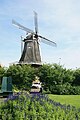
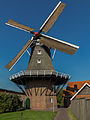
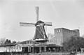
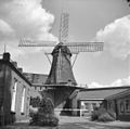
windmill in Hellendoorn, Netherlands  | |||||
| Upload media | |||||
| Instance of | |||||
|---|---|---|---|---|---|
| Location | Hellendoorn, Overijssel, Netherlands | ||||
| Street address |
| ||||
| Located on street |
| ||||
| Has use | |||||
| Heritage designation |
| ||||
| Source of energy | |||||
 | |||||
|
This is a category about rijksmonument number 21401
|
| Address |
|
Media in category "De Hoop, Hellendoorn"
The following 12 files are in this category, out of 12 total.
-
 2015 Molen Hellendoorn.JPG 3,456 × 5,184; 5.3 MB
-
 Exterieur OVERZICHT - Hellendoorn - 20299469 - RCE.jpg 1,200 × 1,200; 241 KB
-
 Hellendoorn - De Hoop.JPG 1,936 × 2,896; 2.14 MB
-
 Hellendoorn, korenmolen de Hoop RM21401 foto2 2014-10-04 12.15.jpg 3,113 × 4,151; 7.79 MB
-
 Korenmolen "De Hoop", in restauratie - Hellendoorn - 20107689 - RCE.jpg 1,200 × 1,179; 275 KB
-
 Korenmolen "De Hoop", in restauratie - Hellendoorn - 20107690 - RCE.jpg 1,200 × 1,175; 312 KB
-
 Korenmolen, aanzicht - Hellendoorn - 20107683 - RCE.jpg 1,200 × 788; 178 KB
-
 Korenmolen, aanzicht - Hellendoorn - 20107687 - RCE.jpg 1,200 × 1,181; 187 KB
-
 Korenmolen, aanzicht - Hellendoorn - 20107688 - RCE.jpg 1,200 × 1,187; 176 KB
-
 Korenmolen, zuid-zijde van het Dorp, aanzicht - Hellendoorn - 20107671 - RCE.jpg 1,200 × 1,181; 220 KB
-
 Korenmolen, zuid-zijde van het Dorp, aanzicht - Hellendoorn - 20107672 - RCE.jpg 1,200 × 1,189; 228 KB
-
 Molen, aanzicht - Hellendoorn - 20107681 - RCE.jpg 797 × 1,200; 166 KB


