Category:De Hoop, Markelo
| Object location | | View all coordinates using: OpenStreetMap |
|---|
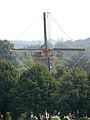
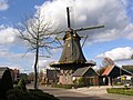
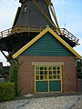
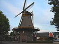
windmill in Markelo, Netherlands  | |||||
| Upload media | |||||
| Instance of | |||||
|---|---|---|---|---|---|
| Location | Markelo, Overijssel, Netherlands | ||||
| Street address |
| ||||
| Located on street |
| ||||
| Has use | |||||
| Heritage designation |
| ||||
| Source of energy | |||||
 | |||||
|
This is a category about rijksmonument number 422723
|
| Address |
|
Media in category "De Hoop, Markelo"
The following 47 files are in this category, out of 47 total.
-
 2009 Mill in Markelo.jpg 1,804 × 2,406; 3.01 MB
-
 20130821 De Hoop1 Markelo.jpg 4,687 × 3,515; 907 KB
-
 20130821 De Hoop2 Markelo.jpg 3,601 × 4,801; 976 KB
-
 20130821 De Hoop3 Markelo.jpg 3,108 × 4,144; 1.02 MB
-
 2692 Markelo.JPG 2,288 × 1,712; 2.31 MB
-
 Aanbouw bij achtkante stellingmolen - AMR Molenfoto - 20539647 - RCE.jpg 900 × 1,200; 197 KB
-

-

-
-

-

-

-
 Berg markelo.JPG 640 × 480; 27 KB
-
 De voet van achtkante stellingmolen - AMR Molenfoto - 20539648 - RCE.jpg 1,200 × 900; 178 KB
-
 Exterieur AANZICHT NIEUWE KAP - Markelo - 20315369 - RCE.jpg 1,200 × 1,197; 312 KB
-
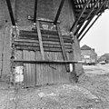
 Exterieur BIJGEBOUW - Markelo - 20315380 - RCE.jpg 1,195 × 1,200; 335 KB
-
 Exterieur DEUR - Markelo - 20315367 - RCE.jpg 1,181 × 1,200; 337 KB
-
 Exterieur KAP - Markelo - 20315368 - RCE.jpg 1,197 × 1,200; 210 KB
-
 Exterieur KRUIRAD - Markelo - 20315371 - RCE.jpg 1,197 × 1,200; 301 KB
-
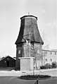
 Exterieur MOLENROMP - Markelo - 20315365 - RCE.jpg 1,200 × 1,200; 216 KB
-
 Exterieur NIEUWE GEVEL AANBOUW - Markelo - 20315381 - RCE.jpg 1,193 × 1,200; 394 KB
-
 Exterieur OVERZICHT - Markelo - 20315362 - RCE.jpg 1,199 × 1,200; 264 KB
-
 Exterieur OVERZICHT - Markelo - 20315363 - RCE.jpg 1,200 × 1,200; 296 KB
-
 Exterieur OVERZICHT - Markelo - 20315364 - RCE.jpg 1,192 × 1,200; 325 KB
-
 Exterieur OVERZICHT ACHTERZIJDE BIJGEBOUW - Markelo - 20315379 - RCE.jpg 1,192 × 1,200; 384 KB
-
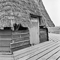
 Exterieur OVERZICHT BIJGEBOUWEN - Markelo - 20315377 - RCE.jpg 1,197 × 1,200; 319 KB
-
 Exterieur STAARTBALK - Markelo - 20315370 - RCE.jpg 1,197 × 1,200; 289 KB
-
 Exterieur STAARTBALK EN KRUIRAD - Markelo - 20315372 - RCE.jpg 1,195 × 1,200; 268 KB
-
 Exterieur STELLING EN WEEG - Markelo - 20315374 - RCE.jpg 1,188 × 1,200; 337 KB
-
 Exterieur STELLINGDEUR - Markelo - 20315376 - RCE.jpg 1,195 × 1,200; 381 KB
-
 Exterieur STICHTINGSSTEEN - Markelo - 20315375 - RCE.jpg 1,195 × 1,200; 445 KB
-
 Exterieur TOEGANGSDEUR VOORMALIGE AANBOUW - Markelo - 20315366 - RCE.jpg 1,200 × 1,197; 402 KB
-
 Exterieur VOORGEVEL EN LINKER ZIJGEVEL BIJGEBOUW - Markelo - 20315378 - RCE.jpg 1,190 × 1,200; 321 KB
-
 Exterieur WEEG EN STELLINGDEUR - Markelo - 20315373 - RCE.jpg 1,197 × 1,200; 401 KB
-
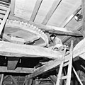
 INT. BOVENWIEL EN BONKELAAR - Markelo - 20315387 - RCE.jpg 1,200 × 1,200; 310 KB
-
 INT. BOVENWIEL EN BOVENAS - Markelo - 20315388 - RCE.jpg 1,197 × 1,200; 286 KB
-
 INT. EERSTE ZOLDER - Markelo - 20315390 - RCE.jpg 1,188 × 1,200; 331 KB
-
 INT. EERTSE ZOLDER - Markelo - 20315389 - RCE.jpg 1,200 × 1,197; 343 KB
-
 INT. LUITAFEL - Markelo - 20315385 - RCE.jpg 1,186 × 1,200; 292 KB
-
 INT. LUIWERK EN GAFFELWIEL - Markelo - 20315384 - RCE.jpg 1,195 × 1,200; 309 KB
-
 INT. LUIZOLDER - Markelo - 20315391 - RCE.jpg 1,200 × 1,197; 346 KB
-
 INT. MAALSTEEN EN VOORMALIG RIEMAANDRIJVING - Markelo - 20315382 - RCE.jpg 1,190 × 1,200; 320 KB
-
 INT. SPOORWIEL - Markelo - 20315383 - RCE.jpg 1,200 × 1,200; 266 KB
-
 INT. TAFELEMENT, ROLWAGEN EN OVERRING - Markelo - 20315386 - RCE.jpg 1,193 × 1,200; 365 KB
-
 Korenmolen, Molenstraat - Markelo - 20150844 - RCE.jpg 814 × 1,200; 172 KB
-
 Markelo, molen foto5 2010-07-18 12.24.JPG 2,592 × 3,456; 1.22 MB
-


