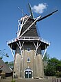
Category:De Lelie, Eenrum
| Object location | | View all coordinates using: OpenStreetMap |
|---|
windmill in Eenrum, Netherlands  | |||||
| Upload media | |||||
| Instance of | |||||
|---|---|---|---|---|---|
| Location | Eenrum, Het Hogeland, Groningen, Netherlands | ||||
| Street address |
| ||||
| Located on street |
| ||||
| Has use | |||||
| Heritage designation |
| ||||
| Source of energy | |||||
 | |||||
|
This is a category about rijksmonument number 14550
|
| Address |
|
Media in category "De Lelie, Eenrum"
The following 28 files are in this category, out of 28 total.
-
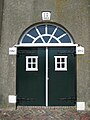 20080511 De Lelie Eenrum Groningen NL-entrance.jpg 1,500 × 2,000; 308 KB
-
 20080511 De Lelie Eenrum Groningen NL.jpg 1,485 × 2,000; 274 KB
-

-

-

-
 Boerderij naast achtkante stellingmolen - AMR Molenfoto - 20538249 - RCE.jpg 1,200 × 900; 88 KB
-
 Eenrum, windmolen de Lelie RM14550 foto1 2013-08-04 14.24.jpg 3,255 × 4,340; 10.04 MB
-
 Gebouw naast achtkante stellingmolen - AMR Molenfoto - 20538246 - RCE.jpg 1,200 × 900; 134 KB
-
 Haven met molen - Eenrum - 20067585 - RCE.jpg 1,181 × 1,200; 279 KB
-
 Haven, overzicht - Eenrum - 20067584 - RCE.jpg 1,200 × 1,195; 310 KB
-
 Havenstraat - Eenrum - 20067442 - RCE.jpg 1,200 × 1,190; 268 KB
-
 Hoofdstraat - Eenrum - 20067480 - RCE.jpg 1,200 × 1,183; 266 KB
-

-
 Koren en pelmolen - Eenrum - 20067587 - RCE.jpg 1,200 × 1,168; 226 KB
-
 Korenmolen "De Lelie", exterieur - Eenrum - 20067590 - RCE.jpg 1,200 × 1,191; 254 KB
-
 Korenmolen oost-zijde van de Molenstraat - Eenrum - 20067582 - RCE.jpg 1,200 × 1,187; 221 KB
-
 Molen COLL.S.J.BOUMA,GR.VOOR 42 - Eenrum - 20498956 - RCE.jpg 648 × 900; 89 KB
-
 Molen met dorpsgezicht vanuit het noorden - Eenrum - 20067581 - RCE.jpg 1,200 × 825; 146 KB
-
 Molenstraat - Eenrum - 20067475 - RCE.jpg 1,200 × 1,192; 254 KB
-
 Molenstraat - Eenrum - 20067476 - RCE.jpg 1,200 × 1,195; 328 KB
-

-
 Overzichten, korenmolen "De Lelie" - Eenrum - 20067588 - RCE.jpg 1,200 × 1,174; 254 KB
-
 Overzichten, korenmolen "De Lelie" - Eenrum - 20067589 - RCE.jpg 1,200 × 1,186; 222 KB
-

-
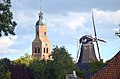
 Vergezicht met molen,kerktoren en hooimijten - Eenrum - 20364396 - RCE.jpg 1,200 × 1,196; 203 KB
-
 Voor- en zijgevel - Eenrum - 20067570 - RCE.jpg 1,200 × 806; 241 KB
-
 Zicht op Eenrum.jpg 3,648 × 2,736; 1.24 MB
-
 Zicht op Kerktoren en Molen te Eenrum.jpg 1,600 × 1,060; 779 KB


