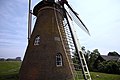
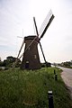
Category:De Lelie, Puttershoek
| Object location | | View all coordinates using: OpenStreetMap |
|---|
windmill in Puttershoek, Netherlands  | |||||
| Upload media | |||||
| Instance of |
| ||||
|---|---|---|---|---|---|
| Location | Puttershoek, Hoeksche Waard, South Holland, Netherlands | ||||
| Street address |
| ||||
| Located on street |
| ||||
| Has use | |||||
| Heritage designation |
| ||||
| Source of energy | |||||
 | |||||
|
This is a category about rijksmonument number 32246
|
| Address |
|
Media in category "De Lelie, Puttershoek"
The following 23 files are in this category, out of 23 total.
-
 Achtergevel - Puttershoek - 20183923 - RCE.jpg 1,188 × 1,200; 390 KB
-
 Exterieur KAP, GEDEMONTEERD - Puttershoek - 20295905 - RCE.jpg 1,200 × 1,200; 371 KB
-
 Exterieur OVERZICHT (TIJDENS RESTAURATIE) - Puttershoek - 20295904 - RCE.jpg 1,200 × 1,193; 316 KB
-
 Korenmolen "De Lelie", aanzicht - Puttershoek - 20183985 - RCE.jpg 807 × 1,200; 166 KB
-
 Korenmolen "De Lelie", een koppel maalstenen - Puttershoek - 20183990 - RCE.jpg 1,200 × 1,181; 235 KB
-
 Korenmolen "De Lelie", exterieur - Puttershoek - 20183986 - RCE.jpg 1,184 × 1,200; 237 KB
-
 Korenmolen "De Lelie", exterieur - Puttershoek - 20183987 - RCE.jpg 1,191 × 1,200; 300 KB
-
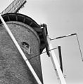 Korenmolen "De Lelie", korte spruit gebroken - Puttershoek - 20183988 - RCE.jpg 1,181 × 1,200; 273 KB
-

-

-

-
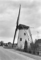
 Korenmolen De Lelie te Puttershoek, Bestanddeelnr 905-5472.jpg 3,313 × 2,516; 2.05 MB
-
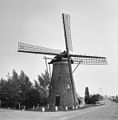
 Molen De Lelie 3-5-19 - Flickr - Bas van Oorschot.jpg 4,896 × 3,672; 5.45 MB
-
 Puttershoek - molen De Lelie tegenlicht.jpg 1,000 × 1,500; 655 KB
-
 Puttershoek - molen De Lelie.jpg 1,000 × 1,500; 987 KB
-
 Puttershoek plaatsnaambord en molen.jpg 3,000 × 4,000; 3.09 MB
-
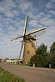
 Puttershoek, korenmolen de Lelie RM32246 foto6 2012-05-13 17.00.JPG 3,312 × 4,416; 10.19 MB
-
 Puttershoek,june 2010 (1) (8156250035).jpg 2,912 × 4,368; 2.79 MB
-
 Puttershoek,june 2010 (2) (8156243067).jpg 2,767 × 3,007; 1.94 MB
-
 Puttershoek,june 2010 (3) (8156270334).jpg 4,198 × 2,575; 2.45 MB
-
 Puttershoek,june 2010 (4) (8156263272).jpg 4,368 × 2,912; 2.87 MB
-
 Puttershoek,june 2010 (42) (8154568209).jpg 2,912 × 4,368; 2.66 MB
-
 Puttershoek,june 2010 (5) (8156223291).jpg 823 × 940; 312 KB


_-_Puttershoek_-_20295904_-_RCE.jpg)


_(8156250035).jpg)
_(8156243067).jpg)
_(8156270334).jpg)
_(8156263272).jpg)
_(8154568209).jpg)
_(8156223291).jpg)