Category:De Linde (Marum)
| Object location | | View all coordinates using: OpenStreetMap |
|---|
| Upload media | |||||
| Spoken text audio | |||||
|---|---|---|---|---|---|
| Instance of | |||||
| Location |
| ||||
 | |||||
Media in category "De Linde (Marum)"
The following 7 files are in this category, out of 7 total.
-
Nl-De Linde (Marum)-article.ogg 1 min 6 s; 660 KB
-
 Boerderij 'Corpus de Linde' II.jpg 1,632 × 918; 342 KB
-
 Boerderij 'Corpus de Linde'.jpg 1,632 × 918; 470 KB
-
 Uitsnede Kadasterkaart Marum door F.F.N. van Hulten (1832) - De Linde.jpg 1,021 × 548; 82 KB
-
 Voormalige manege op De Linde.jpg 1,632 × 918; 364 KB
-
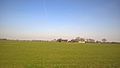
 Zicht op De Linde vanuit het noorden.jpg 1,632 × 918; 263 KB
-
 Zicht op De Linde vanuit het westen.jpg 1,632 × 918; 335 KB


_-_De_Linde.jpg)


