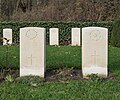
Category:De Panne Communal Cemetery, Commonwealth Plot
| Upload media | |||||
| Instance of | |||||
|---|---|---|---|---|---|
| Part of | |||||
| Location | De Panne, Arrondissement of Veurne, West Flanders, Flemish Region, Belgium | ||||
| Heritage designation | |||||
| Quantity buried |
| ||||
 | |||||
Nederlands: De Panne, Gemeentelijke begraafplaats, gedeelte van de CWGC (Engelse Gravendienst)
Media in category "De Panne Communal Cemetery, Commonwealth Plot"
The following 37 files are in this category, out of 37 total.
-
Cimetière militaire belge de La Panne (2015)-7.jpg 2,160 × 3,840; 4.08 MB
-
Cimetière militaire belge de La Panne (2015)-8.jpg 2,160 × 3,840; 4.16 MB
-
Cimetière militaire belge de La Panne (2015)-9.jpg 2,160 × 3,840; 4.89 MB
-
De Panne Communal Cemetery -2.JPG 1,811 × 1,207; 2.14 MB
-
De Panne Communal Cemetery -3.JPG 1,207 × 1,811; 1.67 MB
-
De Panne Communal Cemetery -4.JPG 1,207 × 1,811; 1.57 MB
-
De Panne Communal Cemetery a-1.JPG 1,174 × 1,811; 2.19 MB
-
De Panne Communal Cemetery a-2.JPG 1,811 × 1,207; 2.72 MB
-
De Panne Communal Cemetery a-3.JPG 1,141 × 1,811; 2.09 MB
-
De Panne Communal Cemetery-11-2.JPG 1,197 × 1,811; 2 MB
-
De Panne Communal Cemetery-12-2.JPG 1,139 × 1,811; 2.06 MB
-
De Panne Communal Cemetery-13-2.JPG 1,811 × 1,203; 2.47 MB
-
De Panne Communal Cemetery-14-2.JPG 1,811 × 1,207; 2.83 MB
-
De Panne Communal Cemetery-15-2.JPG 1,241 × 1,811; 2.22 MB
-
De Panne Communal Cemetery-17-2.JPG 1,811 × 1,207; 1.98 MB
-
De Panne Communal Cemetery-18-2.JPG 1,811 × 1,207; 2.66 MB
-
De Panne Communal Cemetery-20-2.JPG 1,811 × 1,216; 2.1 MB
-
De Panne Communal Cemetery-21-2.JPG 1,146 × 1,811; 1.97 MB
-
De Panne Communal Cemetery-22-2.JPG 1,141 × 1,811; 2 MB
-
De Panne Communal Cemetery-23-2.JPG 1,811 × 1,207; 2.96 MB
-
De Panne Communal Cemetery-24-2.JPG 1,207 × 1,811; 1.93 MB
-
De Panne Communal Cemetery-3-2.JPG 1,811 × 1,270; 2.76 MB
-
De Panne Communal Cemetery-4-2.JPG 1,811 × 1,207; 2.72 MB
-
De Panne Communal Cemetery-5-2.JPG 1,207 × 1,811; 2.84 MB
-
De Panne Communal Cemetery-6-2 (cropped).JPG 804 × 1,207; 1.38 MB
-
De Panne Communal Cemetery-6-2.JPG 1,811 × 1,207; 2.84 MB
-
De Panne Communal Cemetery-7-2.JPG 1,628 × 1,358; 2.17 MB
-
De Panne Communal Cemetery-8-2.JPG 1,811 × 1,207; 2.72 MB
-
De Panne Communal Cemetery-9-2.JPG 1,811 × 1,207; 2.27 MB
-
De Panne Communal Cemetery.JPG 2,717 × 1,811; 4.75 MB
-
De Panne, Communal Cemetery, WOI - 3015 - onroerenderfgoed.jpg 640 × 480; 95 KB


