Category:De Vlijt, Koudum
| Object location | | View all coordinates using: OpenStreetMap |
|---|
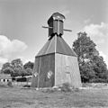
windmill in Koudum, Netherlands  | |||||
| Upload media | |||||
| Instance of | |||||
|---|---|---|---|---|---|
| Location | Koudum, Friesland, Netherlands | ||||
| Has use | |||||
| Heritage designation |
| ||||
| Inception |
| ||||
| Source of energy | |||||
 | |||||
|
This is a category about rijksmonument number 34081
|
| Address |
|
Media in category "De Vlijt, Koudum"
The following 15 files are in this category, out of 15 total.
-
 De Flyt, Koudum.jpg 1,745 × 1,163; 879 KB
-
 De Vlijt molen Koudum 03.JPG 998 × 1,500; 169 KB
-
 Exterieur IN AANBOUW - Koudum - 20295927 - RCE.jpg 1,200 × 1,193; 243 KB
-
 Exterieur OVERZICHT - Koudum - 20295926 - RCE.jpg 1,200 × 1,200; 328 KB
-

-
 Molen de Vlijt - panoramio.jpg 2,448 × 3,264; 2.7 MB
-
 Molen en vijver 12-08-2012.jpg 2,560 × 1,920; 839 KB
-
 Onderzijde van spinnenkopmolen met stelling - AMR Molenfoto - 20538895 - RCE.jpg 1,200 × 900; 265 KB
-
 Spinnenkop met stelling - AMR Molenfoto - 20538891 - RCE.jpg 1,200 × 900; 127 KB
-
 Spinnenkop met stelling - AMR Molenfoto - 20538892 - RCE.jpg 900 × 1,200; 184 KB
-
 Spinnenkop met stelling - AMR Molenfoto - 20538893 - RCE.jpg 900 × 1,200; 136 KB
-

-

-

-
 Woonhuis naast spinnenkop met stelling - AMR Molenfoto - 20538896 - RCE.jpg 1,200 × 900; 191 KB


