Category:December 2016 in the East Riding of Yorkshire
Ceremonial counties of England: Berkshire · Buckinghamshire · Cambridgeshire · Cheshire · Cornwall · Cumbria · Derbyshire · Devon · Dorset · Durham · East Riding of Yorkshire · East Sussex · Essex · Greater London · Greater Manchester · Hampshire · Herefordshire · Hertfordshire · Isle of Wight · Kent · Lancashire · Leicestershire · Lincolnshire · Merseyside · Norfolk · North Yorkshire · Northamptonshire · Northumberland · Nottinghamshire · Oxfordshire · Somerset · Suffolk · Surrey · Tyne and Wear · Warwickshire · West Midlands · West Yorkshire ·
City-counties: Bristol ·
Former historic counties:
Other former counties:
City-counties: Bristol ·
Former historic counties:
Other former counties:
Deutsch: Bilder, die im Dezember 2016 in the East Riding of Yorkshire aufgenommen worden sind. Bitte beachten Sie, dass dies weder das Datum des Uploads noch das Datum des Scannens eines Fotos ist.
English: Images/pictures taken in the East Riding of Yorkshire during December 2016. Note this is not the date of the upload, nor the date a photo was scanned.
Español: Fotografías o imágenes tomadas en the East Riding of Yorkshire durante diciembre 2016. No es la fecha de subida ni escaneo, sino la fecha en que las fotografías o imágenes se crearon.
Esperanto: Bildoj faritaj en the East Riding of Yorkshire en decembro 2016. Tio ne estas la dato, kiam la bildoj estis alŝutitaj aŭ skanitaj.
Français : Photographies ou images prises en the East Riding of Yorkshire durant décembre 2016. Ce n'est pas la date du téléchargement ou du scan.
Galego: Fotografías ou imaxes tomadas en the East Riding of Yorkshire durante decembro 2016. Non é a data de subida nin escaneamento, senón a data na que se crearon as fotografías ou imaxes.
Italiano: Fotografie o immagini scattate a the East Riding of Yorkshire nel dicembre 2016. Nota bene: la data non si riferisce né a quella di upload né a quella in cui la foto è stata digitalizzata.
Norsk bokmål: Bilder tatt i the East Riding of Yorkshire i løpet av desember 2016. Merk at dette ikke er datoen for opplasting, eller når et bilde har blitt skannet.
Norsk nynorsk: Bilete teke i the East Riding of Yorkshire i løpet av desember 2016. Merk at dette ikkje er datoen for opplasting, eller når eit bilete har vorte skanna.
Русский: Изображения, сделанные в the East Riding of Yorkshire в течение декабрь 2016 (не дата загрузки изображения).
Українська: Зображення, зроблені в the East Riding of Yorkshire протягом грудень 2016. Зауважте, що це не дата завантаження чи дата сканування фотографії.
| December 2015 | ← | December 2016 | → | December 2017 | |||||||
| Jan | Feb | Mar | Apr | May | Jun | Jul | Aug | Sep | Oct | Nov | Dec |
| 109 | 127 | 73 | 45 | 112 | 38 | 34 | 160 | 26 | 119 | 19 | 215 |
|---|---|---|---|---|---|---|---|---|---|---|---|
Subcategories
This category has the following 3 subcategories, out of 3 total.
Media in category "December 2016 in the East Riding of Yorkshire"
The following 200 files are in this category, out of 212 total.
(previous page) (next page)-
 A1079 (geograph 5386598).jpg 640 × 378; 53 KB
-
 A164 (geograph 5355889).jpg 640 × 426; 63 KB
-
 A164 towards Driffield (geograph 5253578).jpg 640 × 480; 60 KB
-
 A164 towards Driffield (geograph 5253605).jpg 640 × 480; 82 KB
-
 All Saints Church, Kilnwick 2016 (geograph 5253556).jpg 640 × 480; 78 KB
-

-
 Approaching Willerby Hill Roundabout, A164 (geograph 5355894).jpg 640 × 426; 54 KB
-
 Beach Reflection (geograph 5230616).jpg 2,696 × 3,456; 712 KB
-
 Beswick New Cut (geograph 5404045).jpg 640 × 426; 35 KB
-
 Beverley & Barmston Drain (geograph 5235653).jpg 1,200 × 799; 338 KB
-
 Beverley & Barmston Drain at Dunswell (geograph 5235661).jpg 1,200 × 799; 449 KB
-
 Beverley & Barmston Drain at Dunswell (geograph 5235694).jpg 1,200 × 799; 346 KB
-
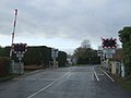
 Beverley Parks Crossing (geograph 5386521).jpg 486 × 640; 53 KB
-
 Beverley Parks Crossing (geograph 5399449).jpg 640 × 426; 57 KB
-
 Beverley Road (A164) (geograph 5253574).jpg 640 × 480; 57 KB
-
 Beverley Road (A164) (geograph 5254536).jpg 640 × 480; 67 KB
-
 Beverley Road, Dunswell (geograph 5235469).jpg 1,200 × 799; 304 KB
-
 Bird box on Skidby Carr Lane (geograph 5236344).jpg 1,200 × 799; 449 KB
-
 Black House Farm (geograph 5386454).jpg 640 × 426; 43 KB
-
 Boyes (geograph 5425533).jpg 640 × 426; 39 KB
-
 Braddon Grove (geograph 5399447).jpg 640 × 426; 60 KB
-
 Bridlington Station (geograph 5429916).jpg 640 × 426; 73 KB
-
 Bridlington Station (geograph 5429933).jpg 640 × 426; 66 KB
-
 Broadgate Bridge, A1079 (geograph 5358620).jpg 640 × 426; 66 KB
-
 Bus stop and shelter on Beverley Road (A164) (geograph 5253572).jpg 640 × 480; 54 KB
-
 Bus stop and shelter, Watton (geograph 5253598).jpg 640 × 480; 63 KB
-
 Businesses on Dunswell Road (geograph 5236710).jpg 1,200 × 799; 305 KB
-
 Businesses on Dunswell Road (geograph 5236714).jpg 1,200 × 799; 287 KB
-
 Car sales on Beverley Road (A164), Cranswick (geograph 5254539).jpg 640 × 480; 41 KB
-
 China Red Restaurant (geograph 5235488).jpg 1,200 × 799; 265 KB
-
 China Red Restaurant (geograph 5235527).jpg 1,200 × 799; 325 KB
-
 China Red Restaurant (geograph 5235532).jpg 731 × 1,200; 254 KB
-
 Church Lane (geograph 5379019).jpg 640 × 426; 46 KB
-
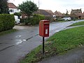
 Close up, Elizabeth II postbox on Beverley Road. Kilnwick Lodges (geograph 5249503).jpg 1,291 × 2,543; 728 KB
-
 Close up, Elizabeth II postbox on Carr Lane (geograph 5250169).jpg 900 × 1,733; 291 KB
-
 Close up, Elizabeth II postbox on School Lane, Kilnwick (geograph 5249473).jpg 1,282 × 2,398; 716 KB
-
 Cottage on Church Lane, Watton (geograph 5253593).jpg 640 × 480; 69 KB
-
 Coverdale Strip (geograph 5253563).jpg 640 × 480; 78 KB
-
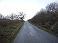
 Crabtree Lane (geograph 5253552).jpg 640 × 480; 57 KB
-
 Drain beside the road to Kilnwick (geograph 5253550).jpg 640 × 480; 66 KB
-
 Dunswell Lane goes under the A1079 (geograph 5236392).jpg 1,200 × 799; 299 KB
-
 Dunswell Lane towards Dunswell Road (geograph 5236399).jpg 1,200 × 799; 318 KB
-
 Dunswell Lane, Dunswell (geograph 5235537).jpg 1,200 × 799; 244 KB
-
 Dunswell Road north of Cottingham (geograph 5236662).jpg 1,200 × 799; 323 KB
-
 Dunswell Road towards Cottingham (geograph 5236405).jpg 1,200 × 799; 330 KB
-
 Dunswell Road towards Cottingham (geograph 5236447).jpg 1,200 × 799; 541 KB
-
 Dunswell Road towards Cottingham (geograph 5236450).jpg 1,200 × 799; 547 KB
-
 Dunswell War Memorial (geograph 5235358).jpg 766 × 1,200; 467 KB
-
 Dunswell War Memorial (geograph 5235361).jpg 891 × 1,200; 589 KB
-
 Dunswell War Memorial (geograph 5235362).jpg 806 × 1,200; 512 KB
-

-
 Elizabeth II postbox on Beverley Road. Kilnwick Lodges, (geograph 5249500).jpg 2,136 × 2,848; 1.44 MB
-
 Elizabeth II postbox on Carr Lane (geograph 5250168).jpg 640 × 456; 83 KB
-
 Elizabeth II postbox on Main Street, Watton (geograph 5249478).jpg 1,169 × 2,204; 527 KB
-
 Elizabeth II postbox on School Lane, Kilnwick (geograph 5249472).jpg 2,848 × 2,136; 1.22 MB
-
 Embankment, A1079 (geograph 5399441).jpg 640 × 426; 58 KB
-
 Embankment, A164 (geograph 5386469).jpg 640 × 426; 56 KB
-
 England Spring Crossing (geograph 5386423).jpg 640 × 426; 93 KB
-
 Entering Hutton Cranswick (geograph 5254538).jpg 640 × 480; 58 KB
-
 Entering Kilnwick (geograph 5253555).jpg 640 × 480; 68 KB
-
 Extec Conveyor Machine (geograph 5236461).jpg 1,200 × 799; 340 KB
-
 Farm track (footpath) beside Kilnwick New Cut (geograph 5253576).jpg 640 × 480; 85 KB
-
 Farmland (geograph 5404054).jpg 640 × 426; 31 KB
-
 Farmland between A164 and railway line (geograph 5401765).jpg 640 × 357; 35 KB
-
 Farmland off Beverley Road (A164) (geograph 5253573).jpg 640 × 480; 60 KB
-
 Farmland south of Beverley (geograph 5386432).jpg 640 × 403; 45 KB
-
 Farmland south of Beverley (geograph 5401767).jpg 640 × 328; 34 KB
-
 Fence (geograph 5386486).jpg 640 × 426; 59 KB
-
 Field and hedge (geograph 5401766).jpg 640 × 350; 33 KB
-
 Field boundary east of Kilnwick (geograph 5253561).jpg 640 × 480; 61 KB
-
 Field by Long Lane (geograph 5386482).jpg 640 × 368; 40 KB
-
 Field entrance off Little Lane, Watton (geograph 5253601).jpg 640 × 480; 57 KB
-
 Field entrance off the A164 (geograph 5254533).jpg 640 × 433; 52 KB
-
 Field, Watton (geograph 5378981).jpg 640 × 426; 47 KB
-
 Fields off Little Lane, Watton (geograph 5253599).jpg 640 × 480; 56 KB
-
 Fingerpost on junction near Kilnwick (geograph 5253554).jpg 640 × 480; 42 KB
-
 Flat farmland (geograph 5378550).jpg 640 × 426; 36 KB
-
 Flat farmland (geograph 5386589).jpg 640 × 426; 45 KB
-
 Flat farmland (geograph 5404060).jpg 640 × 426; 42 KB
-
 Flat Field (geograph 5378912).jpg 640 × 426; 45 KB
-
 Flat scenery (geograph 5404065).jpg 640 × 426; 39 KB
-
 Flat! (geograph 5404057).jpg 640 × 426; 38 KB
-
 Footbridge over the A1079 (geograph 5358619).jpg 640 × 426; 36 KB
-
 Footpath along hedge (geograph 5378555).jpg 640 × 426; 68 KB
-
 Glasshouses, Holycroft Farm (geograph 5386500).jpg 640 × 426; 58 KB
-
 Grassland, Gengs (geograph 5392224).jpg 640 × 426; 61 KB
-
 Grazing near Kilnwick (geograph 5253553).jpg 640 × 480; 72 KB
-
 Hall Ings (geograph 5386614).jpg 640 × 426; 38 KB
-
 Heading east from Kilnwick (geograph 5253565).jpg 640 × 480; 60 KB
-
 Heading south east towards Kilnwick (geograph 5253547).jpg 640 × 480; 51 KB
-
 Hedgeline (geograph 5378552).jpg 640 × 426; 53 KB
-
 Holderness (geograph 5404072).jpg 640 × 426; 39 KB
-
 Holderness farmland (geograph 5378549).jpg 640 × 426; 51 KB
-
 Holderness farmland (geograph 5404063).jpg 640 × 426; 35 KB
-
 Holderness Scenery (geograph 5379029).jpg 640 × 426; 45 KB
-
 Holderness scenery (geograph 5404055).jpg 640 × 426; 32 KB
-
 Holycroft Farm (geograph 5386490).jpg 640 × 426; 58 KB
-
 Holycroft Farm (geograph 5386495).jpg 640 × 426; 60 KB
-
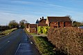
 House by Carr Lane (geograph 5404051).jpg 640 × 426; 45 KB
-
 Houses on Church Lane, Watton (geograph 5253582).jpg 640 × 480; 66 KB
-
 Houses on Main Street, Watton (geograph 5249480).jpg 640 × 480; 49 KB
-
 Houses, Dent Road (geograph 5399388).jpg 640 × 426; 44 KB
-
 Houses, Minster Avenue (geograph 5386314).jpg 640 × 426; 59 KB
-
 Houses, Minster Avenue (geograph 5386410).jpg 640 × 426; 58 KB
-
 Hull Paragon Station-geograph-5395617.jpg 640 × 426; 57 KB
-
 Isolated tree (geograph 5399445).jpg 640 × 426; 33 KB
-
 Kilnwick New Cut (geograph 5379034).jpg 640 × 426; 46 KB
-
 Kilnwick village hall (geograph 5253560).jpg 640 × 480; 120 KB
-
 Lay-by on Beverley Road (A164) (geograph 5254537).jpg 640 × 480; 58 KB
-
 Level crossing on Carr Lane (geograph 5250170).jpg 2,848 × 2,136; 1.37 MB
-
 Level crossing on Church Lane, Watton (geograph 5253592).jpg 640 × 480; 48 KB
-
 Little Lane, Watton (geograph 5253603).jpg 640 × 480; 49 KB
-
 LKAB Mineral Works (geograph 5251995).jpg 640 × 480; 56 KB
-
 Low tension pylons (geograph 5401763).jpg 640 × 426; 31 KB
-
 Main Street, Kilnwick (geograph 5253557).jpg 640 × 480; 61 KB
-
 Main Street, Watton (geograph 5253594).jpg 640 × 480; 60 KB
-
 Many motorhomes (geograph 5399437).jpg 640 × 426; 44 KB
-
 Marshy pond (geograph 5404050).jpg 640 × 426; 45 KB
-
 Minor road junction west of Kilnwick (geograph 5253549).jpg 640 × 480; 52 KB
-
 Minor road towards Kilnwick (geograph 5253544).jpg 640 × 480; 68 KB
-
 Minster Avenue (geograph 5386315).jpg 640 × 426; 55 KB
-
 Minster Avenue (geograph 5386418).jpg 640 × 426; 59 KB
-
 National Cycle Route 1 (Bracken Lane) (geograph 5254530).jpg 640 × 480; 69 KB
-
 Near County Farm (geograph 5399446).jpg 640 × 426; 23 KB
-
 Near Ivy House Farm (geograph 5399463).jpg 640 × 426; 37 KB
-
 Near Ivy House Farm (geograph 5399464).jpg 640 × 347; 26 KB
-
 New plantings by the A164 (geograph 5401764).jpg 640 × 426; 43 KB
-
 North Farm on Dunswell Road (geograph 5236409).jpg 1,200 × 799; 363 KB
-
 North Farm on Dunswell Road (geograph 5236444).jpg 1,200 × 799; 343 KB
-
 North of Watton Abbey Farm (geograph 5378918).jpg 640 × 426; 35 KB
-
 Old bus shelter, Watton (geograph 5253596).jpg 640 × 480; 65 KB
-
 Old Rope (geograph 5230609).jpg 4,608 × 3,456; 4.37 MB
-
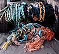 Old Ropes and Nets (geograph 5230611).jpg 3,548 × 3,235; 3.52 MB
-
 Old Rush (geograph 5404401).jpg 640 × 381; 31 KB
-
 Park Grange Farm (geograph 5399466).jpg 640 × 426; 38 KB
-
 Path beside the A164 (geograph 5254534).jpg 640 × 480; 52 KB
-
 Path leading to Skidby Carr Lane (geograph 5235668).jpg 1,200 × 799; 396 KB
-
 Path leading to Skidby Carr Lane (geograph 5235674).jpg 1,200 × 799; 531 KB
-
 Poplar House on Dunswell Road (geograph 5237171).jpg 1,200 × 799; 376 KB
-
 Poplar Nursery on Dunswell Road (geograph 5237180).jpg 1,200 × 799; 390 KB
-
 Priest Ings (geograph 5404073).jpg 640 × 372; 42 KB
-
 Publican Farm (geograph 5253571).jpg 640 × 448; 49 KB
-
 Pylon (geograph 5386508).jpg 640 × 445; 48 KB
-
 Pylon (geograph 5386532).jpg 620 × 640; 68 KB
-
 Pylon (geograph 5399435).jpg 640 × 426; 32 KB
-
 Pylon and farmland (geograph 5386594).jpg 640 × 426; 33 KB
-
 Pylon and woodland (geograph 5386580).jpg 640 × 426; 46 KB
-
 Pylon, Hall Ings (geograph 5386612).jpg 640 × 426; 33 KB
-
 Railway towards Beverley (geograph 5253589).jpg 640 × 480; 74 KB
-
 Railway towards Driffield (geograph 5253587).jpg 640 × 480; 80 KB
-
 Red Roofs (house) on Dunswell Road (geograph 5237132).jpg 1,200 × 799; 382 KB
-
 Rough grasses (geograph 5392226).jpg 640 × 426; 61 KB
-
 Rough grassland (geograph 5399440).jpg 640 × 426; 50 KB
-
 Rough pasture (geograph 5401768).jpg 640 × 426; 45 KB
-
 School House (geograph 5235460).jpg 1,200 × 799; 371 KB
-
 School Lane, Kilnwick (geograph 5249475).jpg 2,848 × 2,136; 1.4 MB
-
 Scurf Dike (geograph 5404066).jpg 640 × 426; 46 KB
-
 Semi-detached house, Beech View (geograph 5378548).jpg 640 × 426; 55 KB
-
 Shed, Black House Farm (geograph 5386462).jpg 640 × 426; 36 KB
-

-
 Skidby Carr Bridge on Skidby Carr Lane (geograph 5235682).jpg 1,200 × 799; 404 KB
-
 Skidby Carr Farm (geograph 5236361).jpg 1,200 × 799; 319 KB
-
 Skidby Carr Farm off Dunswell Lane (geograph 5236378).jpg 1,200 × 799; 322 KB
-
 Skidby Carr Farmhouse (geograph 5236369).jpg 1,200 × 799; 262 KB
-
 Skidby Carr Lane (geograph 5235707).jpg 1,200 × 799; 664 KB
-
 Skidby Carr Lane (geograph 5235841).jpg 1,200 × 799; 518 KB
-
 Skidby Carr Lane (geograph 5235848).jpg 1,200 × 799; 490 KB
-
 Skidby Carr Lane (geograph 5235857).jpg 1,200 × 799; 529 KB
-
 Skidby Carr Lane (geograph 5235863).jpg 1,200 × 799; 331 KB
-
 Skidby Carr Lane (geograph 5236328).jpg 1,200 × 799; 462 KB
-
 Skidby Carr Lane (geograph 5236331).jpg 1,200 × 799; 408 KB
-
 Skidby Carr Lane (geograph 5236336).jpg 1,200 × 799; 415 KB
-
 Skidby Carr Lane (geograph 5236339).jpg 1,200 × 799; 270 KB
-
 Skidby Carr Lane (geograph 5236347).jpg 1,200 × 799; 406 KB
-
 Small pond (geograph 5399391).jpg 640 × 426; 35 KB
-
 South of Thistledown Farm (geograph 5379027).jpg 640 × 426; 41 KB
-
 St Mary's Church, Watton 2016 (geograph 5253580).jpg 640 × 480; 100 KB
-
 Straight track (geograph 5404061).jpg 640 × 425; 43 KB
-
 Telephone box on Main Street, Kilnwick (geograph 5253559).jpg 640 × 480; 74 KB
-

-
 Terrace, Hanley Road (geograph 5392230).jpg 640 × 426; 57 KB
-
 Terrace, Hanley Road (geograph 5392231).jpg 640 × 425; 52 KB
-
 The Nuns (geograph 5379008).jpg 640 × 426; 33 KB
-
 The Nuns (geograph 5379015).jpg 640 × 426; 41 KB
-
 The Old Post Office (geograph 5235541).jpg 1,200 × 799; 241 KB
-
 The southern edge of Hutton Cranswick (geograph 5378546).jpg 640 × 426; 41 KB
-
 Track leading towards Dunswell Lane (geograph 5236374).jpg 1,200 × 799; 487 KB
-
 Track to Park Grange Farm (geograph 5399467).jpg 640 × 426; 31 KB
-
 Track to Sharry Grange (geograph 5392127).jpg 640 × 426; 56 KB
-
 Track to Watton Abbey Farm (geograph 5378971).jpg 640 × 426; 46 KB
-
 Trackside woodland (geograph 5386560).jpg 640 × 426; 67 KB
-
 Tudor Springs on Dunswell Road (geograph 5236464).jpg 1,200 × 799; 297 KB
-
 Tudor Springs on Dunswell Road (geograph 5236466).jpg 1,200 × 722; 275 KB
-
 View to Old Rush (geograph 5404041).jpg 640 × 426; 35 KB
-
 Wanlass Farm Sub Station (geograph 5386619).jpg 640 × 330; 55 KB
-
 Wanlass Farm Sub Station (geograph 5386622).jpg 640 × 426; 64 KB
-
 Watton Abbey Farm (geograph 5378927).jpg 640 × 426; 43 KB
-
 Watton Abbey Farm (geograph 5378951).jpg 640 × 426; 45 KB
-
 Wilfholme Road (geograph 5253568).jpg 640 × 480; 53 KB
-
 Wind turbine, Watton Abbey Farm (geograph 5378922).jpg 640 × 426; 28 KB
.jpg)
.jpg)
.jpg)
.jpg)
.jpg)
.jpg)
.jpg)
.jpg)
.jpg)
.jpg)
.jpg)
.jpg)
.jpg)
.jpg)
_(geograph_5253574).jpg)
_(geograph_5254536).jpg)
.jpg)
.jpg)
.jpg)
.jpg)
.jpg)
.jpg)
.jpg)
.jpg)
_(geograph_5253572).jpg)
.jpg)
.jpg)
.jpg)
,_Cranswick_(geograph_5254539).jpg)
.jpg)
.jpg)
.jpg)
.jpg)
.jpg)
.jpg)
.jpg)
.jpg)
.jpg)
.jpg)
.jpg)
.jpg)
.jpg)
.jpg)
.jpg)
.jpg)
.jpg)
.jpg)
.jpg)
.jpg)
.jpg)
.jpg)
.jpg)
.jpg)
.jpg)
.jpg)
.jpg)
.jpg)
.jpg)
.jpg)
.jpg)
.jpg)
_beside_Kilnwick_New_Cut_(geograph_5253576).jpg)
.jpg)
.jpg)
_(geograph_5253573).jpg)
.jpg)
.jpg)
.jpg)
.jpg)
.jpg)
.jpg)
.jpg)
.jpg)
.jpg)
.jpg)
.jpg)
.jpg)
.jpg)
.jpg)
.jpg)
.jpg)
.jpg)
.jpg)
.jpg)
.jpg)
.jpg)
.jpg)
.jpg)
.jpg)
.jpg)
.jpg)
.jpg)
.jpg)
.jpg)
.jpg)
.jpg)
.jpg)
.jpg)
.jpg)
.jpg)
.jpg)
.jpg)
.jpg)
.jpg)

.jpg)
.jpg)
.jpg)
_(geograph_5254537).jpg)
.jpg)
.jpg)
.jpg)
.jpg)
.jpg)
.jpg)
.jpg)
.jpg)
.jpg)
.jpg)
.jpg)
.jpg)
.jpg)
_(geograph_5254530).jpg)
.jpg)
.jpg)
.jpg)
.jpg)
.jpg)
.jpg)
.jpg)
.jpg)
.jpg)
.jpg)
.jpg)
.jpg)
.jpg)
.jpg)
.jpg)
.jpg)
.jpg)
.jpg)
.jpg)
.jpg)
.jpg)
.jpg)
.jpg)
.jpg)
.jpg)
.jpg)
.jpg)
_on_Dunswell_Road_(geograph_5237132).jpg)
.jpg)
.jpg)
.jpg)
.jpg)
.jpg)
.jpg)
.jpg)
.jpg)

.jpg)
.jpg)
.jpg)
.jpg)
.jpg)
.jpg)
.jpg)
.jpg)
.jpg)
.jpg)
.jpg)
.jpg)
.jpg)
.jpg)
.jpg)
.jpg)
.jpg)
.jpg)
.jpg)
.jpg)
.jpg)
.jpg)
.jpg)
.jpg)
.jpg)
.jpg)
.jpg)
.jpg)
.jpg)
.jpg)
.jpg)
.jpg)
.jpg)
.jpg)
.jpg)
.jpg)
.jpg)
.jpg)
.jpg)
.jpg)