Category:December 2019 in York
Deutsch: Bilder, die im Dezember 2019 in York aufgenommen worden sind. Bitte beachten Sie, dass dies weder das Datum des Uploads noch das Datum des Scannens eines Fotos ist.
English: Images/pictures taken in York during December 2019. Note this is not the date of the upload, nor the date a photo was scanned.
Español: Fotografías o imágenes tomadas en York durante diciembre 2019. No es la fecha de subida ni escaneo, sino la fecha en que las fotografías o imágenes se crearon.
Esperanto: Bildoj faritaj en York en decembro 2019. Tio ne estas la dato, kiam la bildoj estis alŝutitaj aŭ skanitaj.
Français : Photographies ou images prises en York durant décembre 2019. Ce n'est pas la date du téléchargement ou du scan.
Galego: Fotografías ou imaxes tomadas en York durante decembro 2019. Non é a data de subida nin escaneamento, senón a data na que se crearon as fotografías ou imaxes.
Italiano: Fotografie o immagini scattate a York nel dicembre 2019. Nota bene: la data non si riferisce né a quella di upload né a quella in cui la foto è stata digitalizzata.
Norsk bokmål: Bilder tatt i York i løpet av desember 2019. Merk at dette ikke er datoen for opplasting, eller når et bilde har blitt skannet.
Norsk nynorsk: Bilete teke i York i løpet av desember 2019. Merk at dette ikkje er datoen for opplasting, eller når eit bilete har vorte skanna.
Русский: Изображения, сделанные в York в течение декабрь 2019 (не дата загрузки изображения).
Українська: Зображення, зроблені в York протягом грудень 2019. Зауважте, що це не дата завантаження чи дата сканування фотографії.
| December 2018 | ← | December 2019 | → | December 2020 | |||||||
| Jan | Feb | Mar | Apr | May | Jun | Jul | Aug | Sep | Oct | Nov | Dec |
| 78 | 46 | 71 | 129 | 59 | 103 | 80 | 288 | 106 | 87 | 124 | 152 |
|---|---|---|---|---|---|---|---|---|---|---|---|
Subcategories
This category has only the following subcategory.
2
Media in category "December 2019 in York"
The following 151 files are in this category, out of 151 total.
-
 51 Bootham, York (Bootham School) - geograph.org.uk - 6343061.jpg 1,280 × 963; 337 KB
-
 A glimpse of High Petergate - geograph.org.uk - 6343057.jpg 903 × 1,280; 371 KB
-
 A silver chopper - geograph.org.uk - 6345189.jpg 640 × 480; 94 KB
-
 Alcuin Way - geograph.org.uk - 6336584.jpg 768 × 1,024; 132 KB
-
 Along Hull Road - geograph.org.uk - 6346441.jpg 1,024 × 768; 501 KB
-
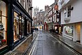
 Along Stonegate - geograph.org.uk - 6346440.jpg 768 × 1,024; 519 KB
-
 An enigmatic signpost - geograph.org.uk - 6345173.jpg 480 × 640; 62 KB
-

-
 Auditorium during U.K. snooker championship 2019.jpg 2,448 × 2,448; 827 KB
-
 Back of the Science Park - geograph.org.uk - 6336581.jpg 1,024 × 768; 225 KB
-
 Bales beside York Road - geograph.org.uk - 6379727.jpg 1,024 × 639; 429 KB
-
 Barker Tower - geograph.org.uk - 6343186.jpg 480 × 640; 88 KB
-
 Beehives in the Minster Close - geograph.org.uk - 6343795.jpg 480 × 640; 122 KB
-
 Bootham House (no.61) and 59 Bootham, York - geograph.org.uk - 6343062.jpg 1,280 × 911; 314 KB
-
 Bootham Park Hospital - geograph.org.uk - 6343064.jpg 1,280 × 960; 293 KB
-
 Bootham, York - geograph.org.uk - 6343069.jpg 1,280 × 960; 443 KB
-

-

-
 Church of All Saints, North Street, York - geograph.org.uk - 6343510.jpg 1,280 × 1,280; 504 KB
-
 Church of All Saints, Pavement, York - geograph.org.uk - 6343513.jpg 960 × 1,280; 197 KB
-
 Church of Holy Trinity, Goodramgate - geograph.org.uk - 6343522.jpg 1,280 × 1,032; 340 KB
-
 Church of St Olave, York - geograph.org.uk - 6343076.jpg 1,280 × 890; 326 KB
-
 Church of St. John the Baptist - geograph.org.uk - 6342840.jpg 2,000 × 1,295; 2.58 MB
-
 Class 91 in Platform 9 - geograph.org.uk - 6349163.jpg 1,024 × 768; 230 KB
-
 Cycle racks on the Esplanade - geograph.org.uk - 6344955.jpg 640 × 480; 95 KB
-
 Cyclists on York Millennium Bridge - geograph.org.uk - 6343326.jpg 640 × 480; 64 KB
-
 Davygate by night - geograph.org.uk - 6343542.jpg 640 × 480; 58 KB
-
 December late afternoon sun on the Minster - geograph.org.uk - 5999386.jpg 1,280 × 1,280; 381 KB
-
 Ebor Hall, York - geograph.org.uk - 6343511.jpg 1,280 × 960; 311 KB
-
 Field with emerging crop... and standing water - geograph.org.uk - 6342868.jpg 2,000 × 1,500; 2.36 MB
-
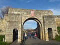 Fishergate Bar - geograph.org.uk - 6343591.jpg 640 × 480; 84 KB
-

-
 Foss View - geograph.org.uk - 6343791.jpg 640 × 480; 97 KB
-
 Frost covered playing field - geograph.org.uk - 6336580.jpg 1,024 × 768; 276 KB
-
 Frosty playing fields - geograph.org.uk - 6336576.jpg 1,024 × 768; 375 KB
-
 Gate and lodge to Bootham Park Hospital - geograph.org.uk - 6343063.jpg 1,280 × 960; 478 KB
-
 High Petergate, York - geograph.org.uk - 6343058.jpg 1,280 × 1,280; 501 KB
-
 Hungate footbridge - geograph.org.uk - 6343610.jpg 640 × 480; 79 KB
-

-
 Hungate footbridge - the deck - geograph.org.uk - 6343597.jpg 640 × 480; 96 KB
-
 Hungate footbridge - the mast - geograph.org.uk - 6343595.jpg 480 × 640; 81 KB
-
 Hungate footbridge and Leetham House - geograph.org.uk - 6343608.jpg 640 × 480; 89 KB
-
 Innovation Way roundabout - geograph.org.uk - 6336583.jpg 1,024 × 768; 217 KB
-
 La Vecchia Scuola, Low Petergate, York - geograph.org.uk - 6343056.jpg 1,280 × 958; 363 KB
-
 Lake at Derwent - geograph.org.uk - 6346443.jpg 1,024 × 768; 557 KB
-
 Lendal Bridge - geograph.org.uk - 6345166.jpg 640 × 480; 84 KB
-
 Lendal Tower - geograph.org.uk - 6343317.jpg 480 × 640; 97 KB
-
 Living sculpture cyclist - geograph.org.uk - 6343563.jpg 640 × 480; 64 KB
-
 Lock gate at the mouth of the River Foss - geograph.org.uk - 6343576.jpg 640 × 480; 102 KB
-
 Logs by the riverside - geograph.org.uk - 6343051.jpg 1,280 × 960; 537 KB
-
 Low Petergate to north-west - geograph.org.uk - 6354768.jpg 2,000 × 1,333; 2.07 MB
-
 Maker's name plate, Naburn Lock - geograph.org.uk - 6343055.jpg 1,280 × 960; 228 KB
-
 Mansion House by night - geograph.org.uk - 6343538.jpg 640 × 480; 70 KB
-
 Marygate, York, at dusk - geograph.org.uk - 6343073.jpg 1,280 × 1,280; 454 KB
-
 Menstrual product dispensers.jpg 2,988 × 5,312; 1.74 MB
-
 Merchant Taylors' Hall - geograph.org.uk - 6343821.jpg 640 × 480; 75 KB
-
 Monk Bar - geograph.org.uk - 6343816.jpg 480 × 640; 82 KB
-
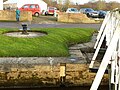
 Naburn Lock - capstan - geograph.org.uk - 6342415.jpg 1,280 × 960; 553 KB
-
 Naburn Lock - capstan - geograph.org.uk - 6342434.jpg 1,280 × 960; 476 KB
-
 Naburn Lock - footbridge - geograph.org.uk - 6342431.jpg 1,280 × 858; 275 KB
-
 Naburn Lock - geograph.org.uk - 6342413.jpg 1,280 × 960; 336 KB
-
 Naburn Lock - geograph.org.uk - 6342420.jpg 1,280 × 960; 305 KB
-
 Naburn Lock - geograph.org.uk - 6342430.jpg 960 × 1,280; 387 KB
-
 Naburn Lock - Old Lock - geograph.org.uk - 6342411.jpg 1,280 × 960; 357 KB
-
 Naburn Lock - The Banqueting House - geograph.org.uk - 6342414.jpg 1,280 × 960; 325 KB
-
 Naburn Lock - the island - geograph.org.uk - 6342412.jpg 1,280 × 960; 311 KB
-
 Naburn Lock - windlass - geograph.org.uk - 6342432.jpg 1,280 × 960; 462 KB
-
 Naburn Lock – crane and cottages - geograph.org.uk - 6342429.jpg 1,077 × 1,280; 331 KB
-
 Naburn Lock – foundation stone - geograph.org.uk - 6342437.jpg 1,280 × 960; 497 KB
-
 Naburn Lock – mill sculpture - geograph.org.uk - 6342421.jpg 960 × 1,280; 556 KB
-
 Naburn Lock, Canal and Rivers Trust premises - geograph.org.uk - 6342427.jpg 1,280 × 960; 310 KB
-
 Naburn Weir - geograph.org.uk - 6342416.jpg 1,280 × 960; 612 KB
-
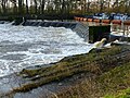 Naburn Weir - geograph.org.uk - 6342417.jpg 1,280 × 960; 566 KB
-
 North Eastern Railway War Memorial - geograph.org.uk - 6343183.jpg 640 × 480; 43 KB
-
 Old lamp and sign.jpg 3,024 × 4,032; 3.86 MB
-
 Old pavilion - geograph.org.uk - 6336572.jpg 1,024 × 768; 367 KB
-

-
 Pink sky over York - geograph.org.uk - 6379207.jpg 1,024 × 768; 573 KB
-
 Pipe bridge over the River Foss - geograph.org.uk - 6343684.jpg 640 × 480; 91 KB
-
 Platform 2, York Station - geograph.org.uk - 6343088.jpg 1,280 × 960; 284 KB
-
 Platforms 10 and 11 - geograph.org.uk - 6349161.jpg 1,024 × 768; 192 KB
-
 Playing field covered in frost - geograph.org.uk - 6336579.jpg 1,024 × 768; 209 KB
-
 Playing fields in the mist - geograph.org.uk - 6346442.jpg 1,024 × 768; 404 KB
-
 Purey Cust Chambers York.jpg 4,141 × 3,106; 2.92 MB
-
 Railway signs and nameplates - geograph.org.uk - 6345180.jpg 640 × 480; 64 KB
-

-
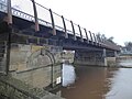
 Scarborough Bridge, York - geograph.org.uk - 6343083.jpg 1,280 × 912; 230 KB
-
 Scarborough Bridge, York - geograph.org.uk - 6343084.jpg 1,280 × 960; 177 KB
-
 Scarborough Bridge, York - geograph.org.uk - 6343086.jpg 1,280 × 936; 187 KB
-
 Scarborough Bridge, York - geograph.org.uk - 6344952.jpg 640 × 480; 67 KB
-
 Scarborough Bridge, York - geograph.org.uk - 6344953.jpg 640 × 480; 77 KB
-
 Scarborough footbridge - geograph.org.uk - 6344950.jpg 640 × 480; 65 KB
-
 Shield of the City of York - geograph.org.uk - 6343053.jpg 1,280 × 960; 297 KB
-

-
 St Anthony's Hall, Peasholme Green - geograph.org.uk - 5999399.jpg 1,280 × 1,280; 563 KB
-
 St Mary's Abbey gateway - geograph.org.uk - 6343078.jpg 1,280 × 926; 320 KB
-
 St Mary's Abbey gateway and south lodge - geograph.org.uk - 6343074.jpg 1,280 × 905; 308 KB
-
 St Mary's Abbey, York, at twilight - geograph.org.uk - 6343079.jpg 1,280 × 900; 295 KB
-
 St Mary's Tower - geograph.org.uk - 6343070.jpg 1,280 × 873; 308 KB
-
 St Mary's, York - geograph.org.uk - 6343067.jpg 1,280 × 960; 355 KB
-
 Station car park, York - geograph.org.uk - 6343087.jpg 1,280 × 960; 259 KB
-
 Station Road - geograph.org.uk - 6379208.jpg 1,024 × 768; 503 KB
-
 Stonegate, York - geograph.org.uk - 6343516.jpg 1,280 × 960; 333 KB
-
 Sun rising over Windmill Lane - geograph.org.uk - 6336586.jpg 1,024 × 768; 234 KB
-
 Take note^ - geograph.org.uk - 6345175.jpg 640 × 480; 80 KB
-
 The "Morgenster" - geograph.org.uk - 6343571.jpg 640 × 480; 88 KB
-
 The approach to Naburn Lock - geograph.org.uk - 6343048.jpg 1,280 × 943; 482 KB
-
 The Blacksmiths Arms, Naburn - geograph.org.uk - 6342410.jpg 1,280 × 960; 288 KB
-
 The Mansion House, York - geograph.org.uk - 6343514.jpg 1,280 × 960; 290 KB
-
 The Minster Inn, Marygate, York - geograph.org.uk - 6343071.jpg 1,280 × 1,280; 370 KB
-
 The Ouse at Naburn - geograph.org.uk - 6342408.jpg 1,280 × 960; 335 KB
-
 The Postern Gate - geograph.org.uk - 6343587.jpg 640 × 480; 77 KB
-
 The Red Tower - geograph.org.uk - 6343827.jpg 640 × 480; 112 KB
-
 The River Foss - geograph.org.uk - 6343599.jpg 640 × 480; 71 KB
-
 The River Ouse in York at night - geograph.org.uk - 6343081.jpg 1,280 × 862; 208 KB
-
 The York Shambles.jpg 4,000 × 2,415; 7.9 MB
-
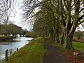 Towpath at Naburn - geograph.org.uk - 6343047.jpg 1,280 × 960; 548 KB
-

-
 Upside down design, 27 Bootham - geograph.org.uk - 6343059.jpg 1,280 × 944; 382 KB
-
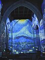
 Van Gogh - The Immersive Experience - geograph.org.uk - 6344591.jpg 480 × 640; 62 KB
-
 Van Gogh - The Immersive Experience - geograph.org.uk - 6344594.jpg 480 × 640; 62 KB
-
 Van Gogh - The Immersive Experience - geograph.org.uk - 6344598.jpg 480 × 640; 71 KB
-
 Van Gogh - The Immersive Experience - geograph.org.uk - 6344599.jpg 480 × 640; 60 KB
-
 Van Gogh - The Immersive Experience - geograph.org.uk - 6344601.jpg 480 × 640; 70 KB
-
 Van Gogh - The Immersive Experience - geograph.org.uk - 6345197.jpg 480 × 640; 55 KB
-
 Van Gogh - The Immersive Experience - geograph.org.uk - 6345201.jpg 480 × 640; 72 KB
-
 Van Gogh - The Immersive Experience - geograph.org.uk - 6345202.jpg 480 × 640; 61 KB
-
 Van Gogh - The Immersive Experience - geograph.org.uk - 6345203.jpg 480 × 640; 64 KB
-
 Van Gogh's bedroom - geograph.org.uk - 6345192.jpg 640 × 480; 54 KB
-
 View by night from Lendal Bridge - geograph.org.uk - 6343523.jpg 640 × 480; 56 KB
-
 Walmgate Bar - geograph.org.uk - 6343836.jpg 480 × 640; 74 KB
-
 Water Tower, St Mary's Abbey, York - geograph.org.uk - 6343080.jpg 1,280 × 960; 418 KB
-
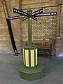
 Weighing Machine, York railway station - Flcikr 2020.jpg 2,517 × 3,402; 5.51 MB
-
 Welcome to Naburn Lock - geograph.org.uk - 6342424.jpg 1,280 × 960; 524 KB
-
 WW2 bunker at Naburn Lock - geograph.org.uk - 6343052.jpg 1,280 × 960; 357 KB
-
 York City Wall - geograph.org.uk - 6343830.jpg 480 × 640; 105 KB
-
 York City Walls - geograph.org.uk - 6343180.jpg 480 × 640; 86 KB
-
 York City Walls at night - geograph.org.uk - 6343095.jpg 1,280 × 850; 194 KB
-
 York Millennium Bridge - geograph.org.uk - 6343324.jpg 640 × 480; 74 KB
-
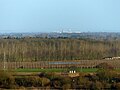 York Minster seen from Hambleton Hough - geograph.org.uk - 6343553.jpg 1,280 × 960; 300 KB
-
 York St John University - geograph.org.uk - 6343807.jpg 640 × 480; 124 KB
-
 York Station - 49248577668.jpg 4,620 × 3,312; 10.68 MB
-
 York Station - Flickr 2020.jpg 4,549 × 3,465; 10.75 MB
-
 York Station at night - geograph.org.uk - 6343089.jpg 1,280 × 960; 322 KB
-
 York Station at night - geograph.org.uk - 6343090.jpg 1,280 × 960; 345 KB
-
 York Station at night - geograph.org.uk - 6343092.jpg 1,280 × 960; 378 KB
-
 York Station at night - geograph.org.uk - 6343093.jpg 960 × 1,280; 279 KB
-
 York Station at night - geograph.org.uk - 6343094.jpg 1,280 × 1,280; 357 KB
-
 York Station Flickr 18th December 2019.jpg 3,336 × 4,340; 8.13 MB
-
 Yorkshire Museum York 01.jpg 4,608 × 3,456; 3.65 MB
-
 Yorkshire Museum York 02.jpg 4,608 × 3,456; 4.02 MB
_-_geograph.org.uk_-_6343061.jpg)


_and_59_Bootham,_York_-_geograph.org.uk_-_6343062.jpg)


