Category:Delridge, Seattle, Washington
district in Seattle, Washington  | |||||
| Upload media | |||||
| Instance of | |||||
|---|---|---|---|---|---|
| Location | Washington, Pacific Northwest, Washington, Pacific States Region | ||||
 | |||||
Subcategories
This category has the following 7 subcategories, out of 7 total.
F
- Frank B. Cooper School (7 F)
K
- Kenyon Hall (3 F)
P
R
W
- West Seattle Golf Course (11 F)
- West Seattle Stadium (9 F)
Media in category "Delridge, Seattle, Washington"
The following 20 files are in this category, out of 20 total.
-
 16th Ave SW, ca 1920 (SEATTLE 233).jpg 768 × 537; 85 KB
-
 CM Herbold on Delridge Walking Tour (32195303804).jpg 5,184 × 3,456; 909 KB
-
 CM Herbold on Delridge Walking Tour (32914317201).jpg 5,184 × 3,456; 857 KB
-
 CM Herbold on Delridge Walking Tour (32914317371).jpg 5,184 × 3,456; 956 KB
-

-
 Seattle - 23rd Avenue SW, 1914 (50676767371).jpg 1,200 × 925; 793 KB
-
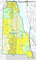 Seattle - Delridge map.jpg 1,340 × 2,200; 510 KB
-
 Seattle - High Point map.jpg 777 × 1,263; 154 KB
-
 Seattle - Highland Park map.jpg 771 × 1,068; 137 KB
-
 Seattle - Kenyon Hall 01.jpg 4,288 × 2,848; 6.3 MB
-
 Seattle - Kenyon Hall 02.jpg 4,288 × 2,848; 6.14 MB
-
 Seattle - Kenyon Hall 03.jpg 4,288 × 2,848; 6.15 MB
-
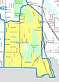
 Seattle - North Delridge map.jpg 720 × 784; 109 KB
-
 Seattle - Riverview map.jpg 835 × 1,419; 166 KB
-
 Seattle - Roxhill map.jpg 609 × 1,248; 123 KB
-
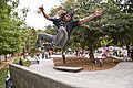 Seattle - Skateboarder at Delridge Skate Park, 2011 (53595707726).jpg 4,256 × 2,832; 2.38 MB
-
 Seattle - South Delridge map.jpg 683 × 1,335; 136 KB
-
 Seattle City Council District 1 neighborhoods.png 3,639 × 3,641; 4.59 MB
-
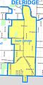
 Seattle Map - Delridge.png 394 × 698; 13 KB
-
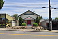
 Youngstown business district, West Seattle (CURTIS 905).jpeg 768 × 623; 68 KB
.jpg)
.jpg)
.jpg)
.jpg)
.jpg)
.jpg)


.jpg)


.jpeg)