Category:Denstroude
English: Denstroude is a hamlet located to the west of the A290 road north of Canterbury in Kent, England. It is a collection of houses and farms, one of which takes its name from the hamlet; the other being Parsonage Farm, although there is no church nearby.
village in Kent, United Kingdom  | |||||
| Upload media | |||||
| Instance of | |||||
|---|---|---|---|---|---|
| Location | Blean, Canterbury, Kent, South East England, England | ||||
 | |||||
Media in category "Denstroude"
The following 42 files are in this category, out of 42 total.
-
 A290 near Red Lion House - geograph.org.uk - 423023.jpg 640 × 368; 48 KB
-
 Corner of Tong Wood - geograph.org.uk - 413323.jpg 640 × 480; 127 KB
-
-
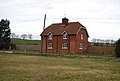
 Denstroude Farm, Denstroude Lane (2) - geograph.org.uk - 1209841.jpg 640 × 430; 62 KB
-
 Denstroude Farm, Denstroude Lane - geograph.org.uk - 1209835.jpg 640 × 430; 60 KB
-
 Denstroude Lane - geograph.org.uk - 1209842.jpg 640 × 430; 61 KB
-
 Disused ROC monitoring post - geograph.org.uk - 1198225.jpg 640 × 480; 84 KB
-

-

-
 Horse in a paddock, Denstroude Lane - geograph.org.uk - 1209827.jpg 640 × 430; 90 KB
-
 Inquisitive sheep and lambs - geograph.org.uk - 759767.jpg 640 × 480; 208 KB
-

-
 Looking NE along Denstroude Lane - geograph.org.uk - 765277.jpg 640 × 480; 207 KB
-
 Looking NNE along Denstroude Lane - geograph.org.uk - 765234.jpg 640 × 480; 177 KB
-
-
 Looking SSW along Denstroude Lane - geograph.org.uk - 765227.jpg 640 × 480; 193 KB
-
 Looking W along Denstroude Lane - geograph.org.uk - 763666.jpg 640 × 480; 216 KB
-
 Meeting of the ways^ - geograph.org.uk - 765264.jpg 640 × 480; 182 KB
-
 Old corrugated shed on Courtenay Road - geograph.org.uk - 766750.jpg 640 × 480; 249 KB
-
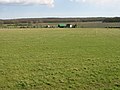
 Parkland to the SE of Courtenay Road - geograph.org.uk - 766757.jpg 640 × 480; 239 KB
-
 Parsonage Farm from Denstroude Lane - geograph.org.uk - 765244.jpg 640 × 480; 190 KB
-
 Prunus spinosa - geograph.org.uk - 761498.jpg 640 × 480; 246 KB
-
 Road to Brook Farm from Denstroude Lane - geograph.org.uk - 765266.jpg 640 × 480; 228 KB
-
 Sharp left in Denstroude Lane - geograph.org.uk - 763694.jpg 640 × 480; 176 KB
-

-
 Take your wellies^ - geograph.org.uk - 763700.jpg 640 × 480; 281 KB
-
 View across fields from Denstroude Lane - geograph.org.uk - 761490.jpg 640 × 480; 196 KB
-
 View across the fields near Denstroude - geograph.org.uk - 759759.jpg 640 × 480; 243 KB
-
 View along Denstroude Lane - geograph.org.uk - 761504.jpg 640 × 480; 202 KB
-

-
 Wooden Barn off Denstroude Lane - geograph.org.uk - 1210533.jpg 640 × 430; 68 KB
-
 Denstroude Farm - geograph.org.uk - 413322.jpg 640 × 480; 73 KB
-
 Denstroude Farm on Denstroude Lane - geograph.org.uk - 765349.jpg 640 × 444; 209 KB
-
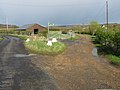
 Denstroude Farm on Denstroude Lane - geograph.org.uk - 766182.jpg 640 × 480; 161 KB
-
-
 Farm buildings on Denstroude Farm - geograph.org.uk - 766176.jpg 640 × 480; 174 KB
-
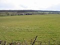
 Farmland view from Denstroude Lane - geograph.org.uk - 759776.jpg 640 × 480; 220 KB
-
 Field edge to the S of Denstroude Lane - geograph.org.uk - 763687.jpg 640 × 480; 232 KB
-
 Field entrance off Denstroude Lane - geograph.org.uk - 761502.jpg 640 × 480; 265 KB
-
 Footpath to North Bishopden Wood - geograph.org.uk - 766173.jpg 640 × 441; 261 KB
-

-


_-_geograph.org.uk_-_1209841.jpg)


