Category:Derelict buildings in Devon
Ceremonial counties of England: Bedfordshire · Berkshire · Buckinghamshire · Cambridgeshire · Cheshire · Cornwall · Cumbria · Derbyshire · Devon · Dorset · Durham · East Riding of Yorkshire · East Sussex · Essex · Gloucestershire · Greater London · Greater Manchester · Hampshire · Herefordshire · Hertfordshire · Kent · Lancashire · Leicestershire · Lincolnshire · Merseyside · Norfolk · North Yorkshire · Northamptonshire · Northumberland · Nottinghamshire · Oxfordshire · Rutland · Shropshire · Somerset · South Yorkshire · Staffordshire · Suffolk · Surrey · Tyne and Wear · Warwickshire · West Midlands · West Sussex · West Yorkshire · Wiltshire · Worcestershire
City-counties: Bristol · City of London
Former historic counties:
Other former counties:
City-counties: Bristol · City of London
Former historic counties:
Other former counties:
Subcategories
This category has the following 5 subcategories, out of 5 total.
G
- Galmpton Windmill (8 F)
L
- Lord Churston's Bathhouse (4 F)
S
- Stoke Canon Signal Box (5 F)
T
- Tillhouse Farmhouse (5 F)
Media in category "Derelict buildings in Devon"
The following 94 files are in this category, out of 94 total.
-
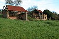
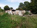
 Barn above Newbarn Wood - geograph.org.uk - 731380.jpg 640 × 426; 122 KB
-
 Barn at Medland - geograph.org.uk - 575012.jpg 640 × 480; 111 KB
-
 Barn at Medland - geograph.org.uk - 576343.jpg 640 × 480; 142 KB
-
 Barn at Medland - geograph.org.uk - 576348.jpg 640 × 480; 133 KB
-
 Bigadon House in 1962 - geograph.org.uk - 216756.jpg 1,839 × 1,197; 326 KB
-
 Bigadon House in 1962 - geograph.org.uk - 216758.jpg 1,861 × 1,198; 396 KB
-
 Bigadon House in 1973 - geograph.org.uk - 216759.jpg 1,800 × 1,209; 421 KB
-
 Bishops Nympton - decayed barn - geograph.org.uk - 406373.jpg 640 × 427; 226 KB
-
 Bodley's Farm - geograph.org.uk - 636905.jpg 640 × 480; 85 KB
-
 Broomage - geograph.org.uk - 311864.jpg 640 × 480; 118 KB
-
 Broomage - geograph.org.uk - 313137.jpg 479 × 640; 77 KB
-
 Broomage - geograph.org.uk - 315261.jpg 640 × 480; 94 KB
-
 Broomage - geograph.org.uk - 315263.jpg 640 × 480; 115 KB
-
 Building at the Octagon, Union Street - geograph.org.uk - 359327.jpg 411 × 640; 54 KB
-
 Bulkworthy, dilapilated barn - geograph.org.uk - 590966.jpg 640 × 427; 247 KB
-
 C18? ceramic bath used as cattle trough near Spriddlestone Devon.JPG 2,816 × 1,584; 1.98 MB
-
 Charles, derelict barn - geograph.org.uk - 520007.jpg 640 × 427; 390 KB
-
-
 Clennon's Linhay - geograph.org.uk - 965416.jpg 640 × 427; 90 KB
-
 Clennon's Linhay - geograph.org.uk - 965432.jpg 640 × 427; 148 KB
-

-
 Cornwalls Gate - Plymouth - geograph.org.uk - 1761281.jpg 1,200 × 797; 832 KB
-
 Cottage at East Ash - geograph.org.uk - 689525.jpg 640 × 480; 67 KB
-
 Dairy Farm? near Spriddlestone Devon.JPG 2,816 × 1,584; 2.02 MB
-
 Damaged Greenhouses, Potting Shed Nursery.jpg 5,152 × 3,864; 11.46 MB
-
 DeerShelterStevenstoneDevon.JPG 3,648 × 2,736; 2.15 MB
-
 Derelict area by Millbank Docks - geograph.org.uk - 1516473.jpg 640 × 480; 181 KB
-
 Derelict Barn - geograph.org.uk - 1768891.jpg 1,024 × 682; 211 KB
-
 Derelict barn - geograph.org.uk - 235165.jpg 480 × 640; 119 KB
-
 Derelict barn at Spriddlestone - geograph.org.uk - 279341.jpg 640 × 480; 143 KB
-
 Derelict building below Ingsdon Manor - geograph.org.uk - 1723399.jpg 640 × 480; 151 KB
-
 Derelict building in Rushmoor Wood - geograph.org.uk - 163086.jpg 640 × 480; 111 KB
-
 Derelict building near Lee Quarry - geograph.org.uk - 431367.jpg 462 × 640; 126 KB
-
 Derelict Building, Bath Place, Plymouth - geograph.org.uk - 372150.jpg 640 × 591; 120 KB
-
 Derelict building, Rock Road, Torquay - geograph.org.uk - 1298901.jpg 480 × 640; 108 KB
-

-
 Derelict building, Weston - geograph.org.uk - 195522.jpg 640 × 427; 274 KB
-
 Derelict buildings near Coldridge - geograph.org.uk - 79368.jpg 640 × 426; 142 KB
-
 Derelict buildings on Risdon Farm - geograph.org.uk - 968320.jpg 640 × 480; 80 KB
-

-

-
 Derelict cottage in the Sterridge Valley - geograph.org.uk - 738450.jpg 640 × 480; 157 KB
-
 Derelict cottage on Beaford Moor - geograph.org.uk - 555533.jpg 640 × 472; 135 KB
-
 Derelict cottage, Sorley - geograph.org.uk - 1354286.jpg 480 × 640; 107 KB
-
 Derelict dairy farm near Spriddlestone, Devon.JPG 1,584 × 2,816; 1.99 MB
-

-

-
 Derelict petrol station, on the A380, near Kenn - geograph.org.uk - 1716320.jpg 1,024 × 768; 169 KB
-
 Derelict pig farm near Fosterville - geograph.org.uk - 1751871.jpg 640 × 427; 447 KB
-
 Derelict Pub, Union Street, Plymouth.jpg 640 × 581; 110 KB
-
 Derelict shed near Butterleigh - geograph.org.uk - 1621893.jpg 640 × 480; 152 KB
-
 Derelict shop in Heavitree Road, Exeter - geograph.org.uk - 1638678.jpg 640 × 480; 115 KB
-
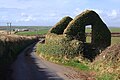
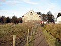
 Derelict Windmill, Churston Common - geograph.org.uk - 370970.jpg 480 × 640; 87 KB
-
 Dewerstone Cottage.jpg 3,648 × 2,608; 4.52 MB
-
 Disused Barn - geograph.org.uk - 1448182.jpg 640 × 426; 96 KB
-
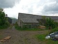
 Disused barn - geograph.org.uk - 887381.jpg 640 × 466; 61 KB
-
-
 Disused building, Clennon Valley - geograph.org.uk - 1084021.jpg 640 × 429; 87 KB
-
 Disused building, Clovelly - geograph.org.uk - 1361162.jpg 640 × 480; 109 KB
-
-
 Disused Grandstand, Dean Prior, Devon - geograph.org.uk - 88335.jpg 640 × 427; 172 KB
-
 Disused holiday camp (1), Seaton - geograph.org.uk - 815686.jpg 640 × 427; 310 KB
-
 Disused holiday camp (2), Seaton - geograph.org.uk - 815687.jpg 640 × 427; 211 KB
-
 Disused holiday camp (3), Seaton - geograph.org.uk - 815688.jpg 640 × 427; 221 KB
-
 Disused holiday camp (4), Seaton - geograph.org.uk - 815689.jpg 640 × 427; 229 KB
-
 Fenacre Farm - geograph.org.uk - 1780005.jpg 640 × 480; 128 KB
-
 Fludda - geograph.org.uk - 151518.jpg 640 × 480; 85 KB
-
-

-
 Further collapse imminent - geograph.org.uk - 247893.jpg 640 × 480; 144 KB
-
 Greenbank Prison courthouse - geograph.org.uk - 945551.jpg 640 × 480; 39 KB
-

-
 Hulk of a house - geograph.org.uk - 1302701.jpg 640 × 480; 65 KB
-
-
 Linney, Stokeley - geograph.org.uk - 1358939.jpg 640 × 480; 111 KB
-

-
 Newland Mill, North Tawton, Devon - geograph.org.uk - 448400.jpg 640 × 480; 124 KB
-
 Not such a grand stand and jump - Buckfastleigh - geograph.org.uk - 1720469.jpg 1,200 × 785; 803 KB
-
 Old stables - geograph.org.uk - 747249.jpg 640 × 480; 120 KB
-
 Old storage buildings - geograph.org.uk - 599822.jpg 600 × 450; 165 KB
-
 Old Windmill, Churston Common - geograph.org.uk - 370963.jpg 640 × 480; 73 KB
-
 Old workshop beside the road - geograph.org.uk - 1734837.jpg 640 × 427; 100 KB
-
 Pontin's Holiday Camp, St Mary's Bay - geograph.org.uk - 50295.jpg 640 × 480; 114 KB
-
 Pontin's Holiday Camp. St. Mary's Bay - geograph.org.uk - 50297.jpg 640 × 480; 145 KB
-
 Redundant buildings - geograph.org.uk - 716211.jpg 640 × 377; 75 KB
-
 Redundant cart shed - geograph.org.uk - 878098.jpg 640 × 427; 95 KB
-
 Remains of engine shed. - geograph.org.uk - 1181257.jpg 640 × 427; 87 KB
-
 Roofless barn, Slapton - geograph.org.uk - 1363020.jpg 640 × 480; 86 KB
-
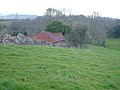
 Ruined farmhouse on Saunton Down - geograph.org.uk - 82305.jpg 640 × 480; 84 KB
-

-
 The Woodpecker Inn - geograph.org.uk - 896713.jpg 640 × 427; 67 KB
-
 Through the windmill, Churston Common - geograph.org.uk - 370974.jpg 480 × 640; 129 KB
-
 Tiverton , Abandoned House - geograph.org.uk - 1216887.jpg 640 × 480; 73 KB
-
 Tiverton , Abandoned House - geograph.org.uk - 1216893.jpg 640 × 512; 52 KB


,_Seaton_-_geograph.org.uk_-_815686.jpg)
,_Seaton_-_geograph.org.uk_-_815687.jpg)
,_Seaton_-_geograph.org.uk_-_815688.jpg)
,_Seaton_-_geograph.org.uk_-_815689.jpg)


_Portland_Street,_Ilfracombe._-_geograph.org.uk_-_1275944.jpg)


