Category:Derelict buildings in the City of Bradford
Media in category "Derelict buildings in the City of Bradford"
The following 29 files are in this category, out of 29 total.
-
 "Doctor, I feel like a ton of bricks has fallen on me" (2814765422).jpg 1,709 × 2,440; 3.77 MB
-
 56 Harris Street, Bradford - geograph.org.uk - 4018263.jpg 640 × 494; 144 KB
-

-
 Damaged Building - geograph.org.uk - 2961583.jpg 1,024 × 682; 204 KB
-
 Derelict Building - Fagley Lane - geograph.org.uk - 2194350.jpg 640 × 480; 80 KB
-

-
 Derelict Building, Grattan Road - geograph.org.uk - 2098418.jpg 2,592 × 1,944; 1.48 MB
-
 Derelict building, Milner Field - geograph.org.uk - 1356321.jpg 640 × 480; 158 KB
-
 Derelict building, Victoria Park, Oakenshaw - geograph.org.uk - 5621283.jpg 1,024 × 768; 211 KB
-

-

-
 Derelict Former Cafe, Valley Road - geograph.org.uk - 4312175.jpg 1,600 × 1,200; 317 KB
-
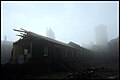
 Derelict mill (2248528065).jpg 2,336 × 1,920; 2.59 MB
-
 Derelict Mill - Hollings Road - geograph.org.uk - 2170190.jpg 640 × 480; 61 KB
-
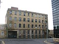
 Derelict mill buildings for sale, Bradford - geograph.org.uk - 3516392.jpg 1,000 × 667; 184 KB
-
 Derelict Mill Site - Smith Street - geograph.org.uk - 2169350.jpg 640 × 480; 70 KB
-
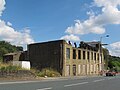
 Derelict Mill, Harris Street - geograph.org.uk - 4289920.jpg 1,600 × 1,200; 321 KB
-
 Disused Barn - Halifax Road - geograph.org.uk - 600228.jpg 640 × 480; 37 KB
-
-
 High Royds - geograph.org.uk - 1047053.jpg 640 × 428; 32 KB
-
 Ingleroyd mansion - geograph.org.uk - 2682793.jpg 640 × 429; 155 KB
-

-
 Odsal Police Station - Odsal Top - geograph.org.uk - 397316.jpg 638 × 303; 41 KB
-

-
 Smith Street, Bradford - geograph.org.uk - 4012376.jpg 640 × 411; 117 KB
-
 Suit DIY enthusiast (1569865865).jpg 3,505 × 2,177; 2.01 MB
-
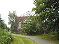
 Upper Shibden Hall Lodge (8402098801).jpg 2,329 × 1,698; 2.51 MB
-
 Wool warehouse (10553779695).jpg 2,048 × 1,536; 1.09 MB
-
 Derelict property in Soho Street - geograph.org.uk - 406055.jpg 640 × 554; 102 KB
.jpg)


.jpg)


.jpg)
.jpg)
.jpg)
