Category:Derryhale
English: Derryhale is a small village and townland (of 834 acres) in County Armagh, Northern Ireland.
village and townland in Northern Ireland  | |||||
| Upload media | |||||
| Instance of | |||||
|---|---|---|---|---|---|
| Location | Northern Ireland | ||||
 | |||||
Media in category "Derryhale"
The following 17 files are in this category, out of 17 total.
-
 Ballintaggart Road - geograph.org.uk - 5091314.jpg 4,608 × 3,456; 3.69 MB
-

-
 Derryhale Controlled Primary School - geograph.org.uk - 511188.jpg 640 × 480; 77 KB
-
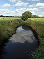
 Derryhale Road - geograph.org.uk - 5091415.jpg 4,608 × 3,456; 2.94 MB
-
 Derryhale Road - geograph.org.uk - 5091416.jpg 4,608 × 3,456; 2.98 MB
-
 Derryhale Road - geograph.org.uk - 5091419.jpg 4,608 × 3,456; 3.06 MB
-
 Glenbank Road - geograph.org.uk - 5091428.jpg 4,608 × 3,456; 2.95 MB
-
 Glenbank Road - geograph.org.uk - 5091430.jpg 4,608 × 3,456; 3.09 MB
-
 Houses on Vicarage Road, Portadown - geograph.org.uk - 5304157.jpg 3,733 × 1,906; 1.02 MB
-
 Mulladry Road - geograph.org.uk - 5091417.jpg 3,456 × 4,608; 2.78 MB
-
 Mulladry Road - geograph.org.uk - 5091418.jpg 4,608 × 3,456; 3.38 MB
-
 Near Portadown - geograph.org.uk - 5091423.jpg 4,608 × 3,456; 3.03 MB
-
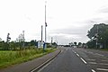 Scene along A3 Road - geograph.org.uk - 2569589.jpg 777 × 521; 104 KB
-
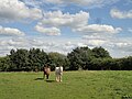
 Seen better days - geograph.org.uk - 5091429.jpg 4,608 × 3,456; 2.94 MB
-
 UlsterMuseumPrehistorybr (3).JPG 4,000 × 3,000; 1.56 MB
-
 UlsterMuseumPrehistorybr (4).JPG 4,000 × 3,000; 1.55 MB
-
 Under scrutiny - geograph.org.uk - 5091426.jpg 4,608 × 3,456; 2.96 MB


.JPG)
.JPG)
