Category:Details of 20th-century maps of the United Kingdom
Media in category "Details of 20th-century maps of the United Kingdom"
The following 153 files are in this category, out of 153 total.
-
 Herculaneum Dock context.jpg 754 × 724; 443 KB
-
 Herculaneum Dock detail.jpg 755 × 719; 370 KB
-
 Map of Allesley, Coventry (1900-1910).jpg 1,014 × 460; 287 KB
-

-
 Llancillo Bartholomew's Hereford Sheet 23, Half-inch to Mile 1902.jpg 1,695 × 903; 1.52 MB
-
 Cemmaes Road map 1900.png 2,866 × 1,430; 4.16 MB
-
 Great and Little Wolford, Warwickshire 1903 map.jpg 743 × 743; 729 KB
-
 S East Geology.jpg 547 × 649; 92 KB
-
 Laysters in Ordnance Survey Second Edition 1905 Sheet XIII. N.W.jpg 1,327 × 1,030; 462 KB
-
 Moonzie map 1908.jpg 1,050 × 1,028; 751 KB
-
 1908 OS Map of St. Helens GCR Station Area.jpg 2,625 × 3,617; 1.39 MB
-
 Central CLC Tunnel map.jpg 744 × 706; 434 KB
-
 Penwortham 1888.png 4,493 × 3,178; 19.95 MB
-
 Scots Watling Street.png 1,000 × 882; 562 KB
-
 Watling Street route.jpg 762 × 517; 300 KB
-
 Welsh Watling Street.png 350 × 501; 110 KB
-
 1910 cheshire odinance survey map showing Edgley Park.jpg 2,959 × 4,096; 3.14 MB
-
 1910 Cheshire ordnance survey map showing Edgeley Park (cropped).jpg 2,282 × 2,782; 1.53 MB
-
 East Barnet 1910s Ordnance Survey map.jpg 9,450 × 5,850; 6.85 MB
-
 1911Watling Street.png 2,016 × 1,314; 169 KB
-
 Map BWHA Railway.jpg 2,054 × 1,664; 915 KB
-
 Watford Cassiobury map 1920.png 2,998 × 1,438; 4.43 MB
-
 Cole Park on a 1920s Ordnance Survey map.png 9,450 × 5,870; 2.87 MB
-
 Becclesmap 1921.jpg 2,544 × 3,504; 1.37 MB
-
 Four-shire-stone-map.png 1,154 × 1,027; 2.53 MB
-
 Uttoxeter 1921.JPG 622 × 416; 56 KB
-
 Erlestoke map 1922.jpg 897 × 525; 208 KB
-
 South East Hampshire Gunther.jpg 790 × 811; 228 KB
-
 Hemel hempsted midland map1924.png 1,862 × 1,495; 1.88 MB
-
 Belle Isle1925.jpg 286 × 258; 59 KB
-
 St Edwards Hospital 1925 map.png 1,042 × 613; 811 KB
-
 Two viaducts OS 1928.jpg 446 × 554; 250 KB
-
 Bromyard Downs Herefordshire OS map SO65NE – Pre1930 to 1954, Pub 1955.jpg 1,663 × 883; 1.08 MB
-

-
 Fair oak park map.png 782 × 465; 767 KB
-

-
 Moor Hall estate plan (1930) - 2023-06-18 - Andy Mabbett - 02.jpg 4,000 × 3,000; 3.06 MB
-
-
 Crawley1932OS.png 620 × 719; 991 KB
-
 West & East Channel, Gloucester.jpg 655 × 759; 78 KB
-
 Chanctonbury Ring OS map 1934.jpg 699 × 430; 134 KB
-
 Bassett and Bassett Green locations.png 639 × 328; 424 KB
-
 Before Stansted Airport aa.jpg 1,424 × 935; 265 KB
-
 General Roys Baseline.jpg 909 × 742; 325 KB
-
 Musgrave railway station 1935 map.jpg 1,400 × 958; 1.46 MB
-
 Chemlesfordmap 1936.jpg 3,504 × 2,544; 1.45 MB
-
 Southend1936map.jpg 3,504 × 2,544; 1.52 MB
-
 Porlock map 1937.jpg 478 × 484; 204 KB
-
 Barnstablemap 1937.jpg 2,544 × 3,504; 1.67 MB
-
 Barnstablemap.jpg 506 × 288; 52 KB
-
 Bidefordmap 1937.jpg 758 × 702; 929 KB
-
 Dorchestermap 1937 (1).jpg 1,126 × 839; 1,023 KB
-
 Dorchestermap 1937.jpg 3,504 × 2,544; 1.51 MB
-
 Great torrington map1937.jpg 579 × 229; 129 KB
-
 Minehead map 1937.jpg 467 × 469; 54 KB
-
 Mineheadmap 1937.jpg 3,504 × 2,544; 2.71 MB
-
 New Brighton Pier Map c1937.jpg 1,923 × 1,165; 848 KB
-
 New Brighton Tower Map c1937.jpg 1,805 × 1,300; 1.06 MB
-
 Ringwoodmap 1937.jpg 3,504 × 2,544; 1.68 MB
-
 Swanagemap 1937.jpg 2,976 × 2,451; 6.52 MB
-
 Warehammap 1937.jpg 5,072 × 6,992; 4.85 MB
-
 Area surrounding Tingrith Civil Parish, Central Bedfordshire.png 1,101 × 565; 1.52 MB
-
 20th Century Little Torrington Map.PNG 451 × 421; 523 KB
-
 20th Century Map of Beetley.png 871 × 553; 1.02 MB
-
 20th Century map of Carlton.PNG 395 × 310; 352 KB
-
 20th Century map of Ringshall, Suffolk.png 651 × 326; 411 KB
-
 Clacton on seamap1940.jpg 3,504 × 2,544; 1.55 MB
-
 Colchestermap1940.jpg 3,504 × 2,544; 1.68 MB
-
 Filixstowmap1940.jpg 2,544 × 3,504; 1.58 MB
-
 Map of the Parish of Nurstead, Kent.png 1,255 × 585; 1.22 MB
-
 Mersea island.jpg 3,504 × 2,544; 1.59 MB
-
 RAF airfield map.jpg 450 × 405; 107 KB
-
 West Parley Historical Map Excerpt.PNG 541 × 425; 562 KB
-
 Woodlands Histroical Map.png 1,055 × 629; 1.43 MB
-
 Historical map showing Deeping Gate.PNG 581 × 380; 455 KB
-
 Wyke and Norwood Green station from OS map 1945.png 682 × 312; 458 KB
-
 20th Century Boyton Map.PNG 538 × 459; 475 KB
-
 20th Century map of Friston.png 609 × 379; 572 KB
-
 A 20th Century map of Lower Hardres.png 473 × 683; 724 KB
-
 Canterbury Orchards 1945 OS Map 171 detail.jpg 2,890 × 1,996; 2.7 MB
-
 Chichestermap1945.jpg 2,544 × 3,504; 1.59 MB
-
 Cliffe and Cliffe Woods area historical map.png 349 × 466; 306 KB
-
 Dartfordmap1945.jpg 3,504 × 2,544; 1.92 MB
-
 Haile 20th Century Historical Map.PNG 586 × 440; 629 KB
-
 Historical Map of Peldon.png 558 × 457; 161 KB
-
 Horsea island map 1945.jpg 455 × 359; 148 KB
-
 Langstone map 1945.jpg 492 × 330; 138 KB
-
 Map excerpt for West Parley.png 527 × 535; 485 KB
-
 Map image of Nether Langwith.PNG 276 × 205; 128 KB
-
 Map of Acton Turville Parish.PNG 526 × 393; 417 KB
-
 Map Of Hawkchurch.png 716 × 582; 1.01 MB
-
 Nork 1945 OSmap.jpg 380 × 430; 111 KB
-
 OS MAP OF TIBENHAM.png 431 × 323; 261 KB
-
 OS Rye 1945.png 777 × 450; 735 KB
-
 Peldon, Essex.png 426 × 423; 440 KB
-
 St Andrew, Ilketshall.png 384 × 414; 392 KB
-
 Stanley park map.jpg 299 × 188; 17 KB
-
 Stirlingmap1945.png 1,734 × 1,308; 5.88 MB
-

-
 Toseland 20th Century Map.PNG 907 × 563; 945 KB
-
 Woodlands Historical Map.jpg 447 × 303; 84 KB
-
 Worth 20th Century Map.JPG 708 × 599; 106 KB
-
 Map of Holton St Mary, OS 1946.png 261 × 163; 80 KB
-
 Belstead Map 1946.png 573 × 443; 464 KB
-
 Burnham marketmap 1946.png 1,029 × 1,037; 2.6 MB
-
 East Grinsteadmap1946.jpg 2,048 × 1,504; 1.92 MB
-
 Gravesendmap 1946.jpg 2,669 × 1,625; 936 KB
-
 Grays Thurrockmap 1946.jpg 1,568 × 1,408; 313 KB
-
 Halwill Junctionmap 1946.png 960 × 1,667; 2.99 MB
-
 Halwillmap 1946.png 720 × 804; 749 KB
-
 Littlehamptonmap 1946.jpg 1,104 × 1,248; 164 KB
-
 Map of Little Wenham, OS 1946.png 238 × 132; 54 KB
-
 North Tawtonmap 1946.png 1,178 × 1,115; 2.42 MB
-
 Okehamptonmap 1946.png 1,242 × 1,102; 2.33 MB
-
 Ordnance Survey One-Inch Sheet 123 Spalding, Published 1946.jpg 10,924 × 12,746; 14.15 MB
-
 Ordnance Survey One-Inch Sheet 134 Huntingdon & Peterborough, Published 1946.jpg 10,967 × 12,765; 14.72 MB
-
 Ordnance Survey One-Inch Sheet 149 Colchester, Published 1946 Marks Hall.jpg 1,195 × 1,564; 496 KB
-
 OS Daventry 1946 map.jpg 1,117 × 1,105; 1.19 MB
-
 Royal Tunbridge Wellsmap 1946.jpg 1,677 × 1,141; 1.33 MB
-
 Steyningmap 1946.png 1,007 × 939; 2 MB
-
 Tonbridgemap 1946.jpg 1,691 × 1,181; 1.21 MB
-
 Wolfhampcote Parish, 1946.jpg 1,344 × 912; 756 KB
-
 Worthingmap 1946.png 2,420 × 1,909; 6.04 MB
-
 Bognor regis crop.jpg 646 × 456; 48 KB
-
 20th Century Map of Clifford.PNG 414 × 237; 254 KB
-
 Ascot Racecoursemap 1947.png 1,210 × 918; 2.46 MB
-
 CLIFFORD.jpg 256 × 256; 19 KB
-
 Longmoor campmap 1947.png 1,930 × 1,437; 5.14 MB
-
 Map of Adforton from the 20th Century..PNG 719 × 477; 892 KB
-

-
 Puffin islandmap1947.png 1,041 × 765; 1.18 MB
-

-
 Sutton, Herefordshire, OS 1 to 25,000 map of Great Britain, 1950.jpg 1,539 × 898; 1.39 MB
-
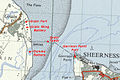
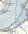 Cliffe - Coalhouse - Shornmead Forts map.jpg 347 × 425; 72 KB
-
 Llancillo Ordnance Survey Herefordshire Sheet 32, 1 to 25,000 1951.jpg 1,468 × 904; 1.63 MB
-
 Grain-Garrison Point forts OS 7th Series map.jpg 685 × 458; 157 KB
-
 Norton Herefordshire OS map SO65NE – Pre1930 to 1954, Pub 1955.jpg 894 × 868; 708 KB
-

-
 Foxley Herefordshire SO44 - OS 125,000 Provisional Series Map 1956.jpg 1,654 × 1,050; 1.33 MB
-
 Laysters in Ordnance Survey SO56 - OS 125,000 map 1956.jpg 1,244 × 903; 1.8 MB
-
 Wroughton OS Map published 1959.jpg 1,836 × 866; 1.1 MB
-
 Castle Frome, Herefordshire OS Map Gloucester and Malvern. 1960.jpg 1,703 × 905; 2.09 MB
-
 Dewsall in Ordnance Survey Sheet 142 - Hereford - A Edition 1960.jpg 1,826 × 1,055; 2.55 MB
-
 Hatfield and Newhampton OS New Popular Edition, Sheet 129 - Ludlow.jpg 634 × 476; 575 KB
-
 New Tavern Fort OS Nat Grid map 1963.jpg 490 × 588; 137 KB
-
 Windsor street gasworks 1967.png 486 × 404; 488 KB
-
 Great Britain 20th Century Map - Long Newnton.png 424 × 273; 297 KB
-
 Adforton.PNG 1,023 × 805; 2.09 MB
-
 Tugby and Keythorpe ordnance survey 20th century.PNG 853 × 536; 1.19 MB
-
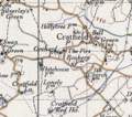 Cratfield 20th century map.PNG 318 × 281; 212 KB
-
 New Tavern and Tilbury Forts OS map.jpg 444 × 385; 98 KB
-
 Bangormap1947.png 1,143 × 1,146; 2.31 MB
-
 Wentworth 20th century map.png 534 × 530; 510 KB


.jpg)


.jpg)


_-_2023-06-18_-_Andy_Mabbett_-_02.jpg)


.jpg)


_Eye,_Published_1947_cropped_to_show_Brome_and_Brome_Hall.png)


