Category:Details of old maps of Belgium
Countries of Europe: Austria · Belarus · Belgium · Czech Republic · France‡ · Germany · Italy · Netherlands‡ · Poland · Russia‡ · Ukraine · United Kingdom
‡: partly located in Europe
‡: partly located in Europe
Subcategories
This category has the following 2 subcategories, out of 2 total.
D
- Details of Ferraris maps of Belgium (241 F)
L
Media in category "Details of old maps of Belgium"
The following 6 files are in this category, out of 6 total.
-
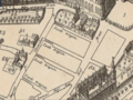 Joode strappen map 1695.png 907 × 679; 923 KB
-
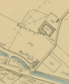
 Uittreksel Villaret-kaart (1745-1748).png 297 × 363; 309 KB
-
 Kaartboek goederen Clarysssen 1750.gif 271 × 473; 44 KB
-
 Josephinakarte Opalfene forest, Ternat, Belgium 1767-1774.gif 435 × 498; 96 KB
-
 Le village de Chapelle-Lez-Herlaimont en 1770.png 878 × 710; 1.05 MB
-
 Uittreksel Popp-kaart (1842 - 1850).png 296 × 360; 195 KB

.png)


.png)