Category:Diagrams of route markers of Guernsey County, Ohio
Media in category "Diagrams of route markers of Guernsey County, Ohio"
The following 13 files are in this category, out of 13 total.
-
 Guernsey County 35 OH.svg 600 × 600; 19 KB
-
 Guernsey County 416 OH.svg 600 × 600; 18 KB
-
 Guernsey County 430 OH.svg 600 × 600; 20 KB
-
 Guernsey County 670 OH.svg 600 × 600; 20 KB
-
 Guernsey County 690 OH.svg 600 × 600; 20 KB
-
 Guernsey County 71 OH.svg 600 × 600; 16 KB
-
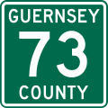 Guernsey County 73 OH.svg 600 × 600; 18 KB
-
 Guernsey County 75 OH.svg 600 × 600; 18 KB
-
 Guernsey County 82 OH.svg 600 × 600; 19 KB
-
 Guernsey County 831 OH.svg 600 × 600; 20 KB
-
 Guernsey County 967 OH.svg 600 × 600; 19 KB
-
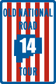 Old National Road Tour 14.svg 600 × 900; 23 KB
-
 Old National Road Tour 15A.svg 600 × 900; 24 KB


