Category:Diemitz lock
| Object location | | View all coordinates using: OpenStreetMap |
|---|
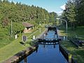
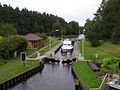
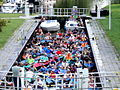
Deutsch: Die Schleuse Diemitz ist Teil der Müritz-Havel-Wasserstraße und verbindet den Labussee mit dem Großen Peetschsee.
  | |||||
| Upload media | |||||
| Instance of | |||||
|---|---|---|---|---|---|
| Location | Diemitz, Mirow, Mecklenburgische Seenplatte District, Mecklenburg-Western Pomerania, Germany | ||||
| Located in or next to body of water | |||||
 | |||||
Media in category "Diemitz lock"
The following 12 files are in this category, out of 12 total.
-
 2015-09-28 Schleuse Diemitz 053.jpg 1,024 × 768; 715 KB
-
 Achter Diemitz.JPG 1,400 × 1,050; 1.75 MB
-
 Diemitz Schleuse.jpg 1,600 × 1,200; 1.12 MB
-
 Hausboottour (222) Schleuse Diemitz (21130962132).jpg 6,466 × 4,250; 11.78 MB
-
 Hausboottour (223) Schleuse Diemitz (21114991816).jpg 6,467 × 4,311; 8.63 MB
-
 Mecklenb-seenplatte-schleuse-diemitz-b.jpg 3,200 × 2,133; 1.77 MB
-
 Mecklenb-seenplatte-schleuse-diemitz.jpg 3,200 × 2,133; 2.33 MB
-
 Mueritz-Havel-Wasserstrasse-Diemitz-11-IV-2007-355.jpg 1,024 × 768; 686 KB
-
 Schleuse Diemitz und die umliegenden Seen – 360° Panorama aus der Luft – Juli 2021.jpg 27,328 × 13,664; 22.42 MB
-
 Schleuse Diemitz.JPG 1,400 × 1,050; 1.67 MB
-
 Unterwasserpfahlwand.jpg 5,184 × 3,456; 5.91 MB
-
 Zufahrt Schleuse Diemitz.jpg 5,184 × 3,456; 6.76 MB


_Schleuse_Diemitz_(21130962132).jpg)
_Schleuse_Diemitz_(21114991816).jpg)


