Category:Dirleton (civil parish)
Scottish parish in East Lothian, Scotland, UK | |||||
| Upload media | |||||
| Instance of | |||||
|---|---|---|---|---|---|
| Part of |
| ||||
| Named after | |||||
| Location |
| ||||
| Population |
| ||||
| Area |
| ||||
 | |||||
Subcategories
This category has the following 4 subcategories, out of 4 total.
Media in category "Dirleton (civil parish)"
The following 200 files are in this category, out of 1,462 total.
(previous page) (next page)-
 2017 Scottish Orienteering Championships - geograph.org.uk - 5397738.jpg 1,024 × 683; 377 KB
-
 6th tee, Gullane No. 1 - geograph.org.uk - 5989342.jpg 1,024 × 768; 361 KB
-
 6th tee, Gullane No. 1 - geograph.org.uk - 5989359.jpg 1,024 × 768; 324 KB
-
 9th tee, Gullane No.1 Course - geograph.org.uk - 5989319.jpg 1,024 × 768; 255 KB
-
 A brambly clearing, Yellowcraig Plantation - geograph.org.uk - 6777609.jpg 1,024 × 768; 562 KB
-

-
 A sandy track, Gullane - geograph.org.uk - 2088879.jpg 640 × 480; 82 KB
-
 A wet corner of Yellowcraig Plantation - geograph.org.uk - 6777631.jpg 1,024 × 576; 376 KB
-
 A198 at Gullane - geograph.org.uk - 5806111.jpg 800 × 505; 127 KB
-
 A198, Gullane Links - geograph.org.uk - 6461765.jpg 1,024 × 768; 235 KB
-
 A198, Luffness - geograph.org.uk - 4215075.jpg 800 × 450; 377 KB
-
 Abbotsford road - geograph.org.uk - 4307213.jpg 800 × 600; 459 KB
-
 Aberlady Bay and Nature Reserve - geograph.org.uk - 3213553.jpg 800 × 600; 76 KB
-
 Aberlady Bay at sunset - geograph.org.uk - 6771623.jpg 1,024 × 576; 96 KB
-

-

-

-

-

-
 Aberlady, Gullane and North Berwick Railway - geograph.org.uk - 5376775.jpg 1,024 × 684; 433 KB
-
 Across the potato field - geograph.org.uk - 3598001.jpg 640 × 480; 64 KB
-
 Advertising, Scottish Ladies Open - geograph.org.uk - 5963095.jpg 1,024 × 768; 347 KB
-
 After the potato harvest, Kingston - geograph.org.uk - 6628460.jpg 1,024 × 768; 196 KB
-

-
 Anti tank blocks near Gullane Head - geograph.org.uk - 6559056.jpg 1,024 × 678; 332 KB
-
 Anti-tank blocks at Gullane Links - geograph.org.uk - 5762774.jpg 800 × 474; 108 KB
-
 Anti-tank blocks at Gullane Links - geograph.org.uk - 5802164.jpg 800 × 551; 137 KB
-
 Anti-tank blocks at Gullane Links - geograph.org.uk - 5803008.jpg 800 × 600; 166 KB
-
 Anti-tank blocks at Gullane Links - geograph.org.uk - 5803013.jpg 800 × 580; 126 KB
-
 Anti-tank blocks, Gullane Links, East Lothian - geograph.org.uk - 6398069.jpg 2,189 × 1,232; 526 KB
-
 Anti-tank blocks, Gullane Links, East Lothian - geograph.org.uk - 6398073.jpg 2,189 × 1,232; 483 KB
-

-
 Approach to Kingston - geograph.org.uk - 6522807.jpg 1,024 × 768; 279 KB
-
 Approaching Newhouse Farm - geograph.org.uk - 4880291.jpg 640 × 480; 314 KB
-
 Arable land near Gullane - geograph.org.uk - 3627465.jpg 640 × 360; 203 KB
-
 Arable land near Saltcoats Castle - geograph.org.uk - 3784990.jpg 640 × 360; 206 KB
-
 Arable land south of Gullane - geograph.org.uk - 6460237.jpg 1,024 × 768; 359 KB
-
 Arable land, Newhouse - geograph.org.uk - 3876218.jpg 640 × 480; 245 KB
-
 Arable land, Park Hills - geograph.org.uk - 2779765.jpg 640 × 360; 201 KB
-
 Arable land, Park Hills - geograph.org.uk - 2779768.jpg 640 × 360; 199 KB
-
 Archerfield - geograph.org.uk - 5220972.jpg 1,024 × 683; 285 KB
-
 Archerfield - geograph.org.uk - 5484604.jpg 1,024 × 576; 307 KB
-
 Archerfield - geograph.org.uk - 5484607.jpg 1,024 × 576; 253 KB
-
 Archerfield from West Links - geograph.org.uk - 5484601.jpg 1,024 × 576; 339 KB
-
 Archerfield golf course - geograph.org.uk - 3531088.jpg 1,024 × 768; 177 KB
-
 Archerfield Golf Course - geograph.org.uk - 6487536.jpg 539 × 209; 50 KB
-
 Archerfield House - geograph.org.uk - 1954742.jpg 1,600 × 1,200; 240 KB
-
 Archerfield House - geograph.org.uk - 4833331.jpg 3,264 × 2,448; 3.91 MB
-
 Archerfield House and golf course - geograph.org.uk - 1821388.jpg 800 × 600; 108 KB
-
 Archerfield House near Dirleton - geograph.org.uk - 6062449.jpg 2,048 × 1,536; 1.05 MB
-
 Archerfield Walled Garden - geograph.org.uk - 4833250.jpg 3,264 × 2,448; 3.81 MB
-
 Archerfield Walled Garden - geograph.org.uk - 6295675.jpg 640 × 429; 357 KB
-
 Auld Reekie - geograph.org.uk - 6677534.jpg 3,146 × 2,326; 1.14 MB
-
 Aye right^ - geograph.org.uk - 6777664.jpg 1,024 × 576; 227 KB
-
 B1345 at Dirleton - geograph.org.uk - 5806024.jpg 800 × 600; 141 KB
-

-
 B1345 lay-by - geograph.org.uk - 4717961.jpg 640 × 480; 49 KB
-
 B1347 - geograph.org.uk - 4364801.jpg 800 × 450; 326 KB
-
 B1347 approaching North Berwick - geograph.org.uk - 6080721.jpg 1,024 × 768; 262 KB
-
 B1347 heading north - geograph.org.uk - 3665508.jpg 640 × 480; 73 KB
-
 B1347 towards Kingston - geograph.org.uk - 2953084.jpg 640 × 480; 48 KB
-
 B1347 towards Kingston - geograph.org.uk - 2953130.jpg 640 × 480; 42 KB
-
 B1347 towards North Berwick - geograph.org.uk - 2953161.jpg 640 × 480; 56 KB
-
 Baked Bean Trail - geograph.org.uk - 5878743.jpg 1,024 × 1,024; 689 KB
-
 Bandit, Gullane - geograph.org.uk - 5006649.jpg 640 × 427; 95 KB
-
 Barley and The Law - geograph.org.uk - 6198654.jpg 3,648 × 2,736; 4.72 MB
-
 Barley at Dirleton - geograph.org.uk - 2445594.jpg 2,592 × 1,944; 2.49 MB
-
 Barley near Kingston - geograph.org.uk - 4098459.jpg 640 × 360; 209 KB
-
 Barley near Yellow Craig - geograph.org.uk - 3532768.jpg 640 × 426; 229 KB
-
 Barley near Yellow Craig - geograph.org.uk - 3532772.jpg 640 × 426; 267 KB
-
 Barley, Dirleton - geograph.org.uk - 3786498.jpg 640 × 426; 241 KB
-
 Barley, Fenton - geograph.org.uk - 3627470.jpg 640 × 360; 219 KB
-
 Barley, Fenton Barns - geograph.org.uk - 4055170.jpg 640 × 360; 212 KB
-
 Barley, Fenton Barns - geograph.org.uk - 4666447.jpg 800 × 534; 397 KB
-
 Barley, Newhouse - geograph.org.uk - 3627487.jpg 640 × 360; 197 KB
-
 Barley, Newhouse - geograph.org.uk - 3627498.jpg 640 × 360; 185 KB
-
 Beach along the East Lothian coast - geograph.org.uk - 5803438.jpg 800 × 580; 150 KB
-
 Beach among the Black Rocks - geograph.org.uk - 1638982.jpg 640 × 474; 88 KB
-
 Beach and Black Rocks, Gullane - geograph.org.uk - 5006748.jpg 640 × 360; 105 KB
-
 Beach at Black Rocks - geograph.org.uk - 6140405.jpg 640 × 480; 228 KB
-
 Beach at Longskelly - geograph.org.uk - 6295570.jpg 640 × 443; 236 KB
-
 Beach at Longskelly - geograph.org.uk - 6295577.jpg 640 × 404; 220 KB
-
 Beach at West Links - geograph.org.uk - 5803498.jpg 800 × 600; 139 KB
-
 Beach at West Links - geograph.org.uk - 5803534.jpg 800 × 600; 139 KB
-
 Beach by Archerfield - geograph.org.uk - 5878833.jpg 1,024 × 576; 334 KB
-
 Beach by Gullane Head - geograph.org.uk - 6537955.jpg 1,024 × 768; 284 KB
-
 Beach cricket, Gullane - geograph.org.uk - 5484569.jpg 1,024 × 576; 327 KB
-
 Beach near Archerfield - geograph.org.uk - 5651026.jpg 1,024 × 576; 177 KB
-
 Beach near Eyeboughty - geograph.org.uk - 5878812.jpg 1,024 × 1,024; 499 KB
-
 Beach near Gullane Point - geograph.org.uk - 5718146.jpg 1,600 × 1,066; 392 KB
-
 Beach near Gullane Point - geograph.org.uk - 6724767.jpg 1,024 × 768; 184 KB
-
 Beach north of Gullane - geograph.org.uk - 5484587.jpg 1,024 × 576; 324 KB
-
 Beach north of Gullane - geograph.org.uk - 5484590.jpg 1,024 × 576; 357 KB
-
 Beach west of Longskelly Rocks - geograph.org.uk - 5547026.jpg 1,024 × 768; 238 KB
-
 Beach west of Yellow Craig - geograph.org.uk - 5537933.jpg 1,024 × 576; 222 KB
-
 Beach west of Yellowcraig - geograph.org.uk - 6777649.jpg 1,024 × 576; 145 KB
-
 Beach, Gullane - geograph.org.uk - 1998651.jpg 640 × 359; 93 KB
-
 Beach, Gullane - geograph.org.uk - 2698493.jpg 640 × 360; 192 KB
-
 Beach, Gullane - geograph.org.uk - 2702839.jpg 640 × 360; 191 KB
-
 Beach, Gullane - geograph.org.uk - 2965701.jpg 640 × 359; 224 KB
-
 Beach, Gullane - geograph.org.uk - 4091355.jpg 800 × 435; 338 KB
-
 Beach, Gullane - geograph.org.uk - 4773428.jpg 800 × 450; 126 KB
-
 Beach, Gullane - geograph.org.uk - 5006737.jpg 640 × 360; 66 KB
-
 Beach, Gullane - geograph.org.uk - 5255416.jpg 800 × 531; 273 KB
-
 Beach, Gullane - geograph.org.uk - 5824032.jpg 1,024 × 683; 263 KB
-
 Beach, Gullane - geograph.org.uk - 6389919.jpg 1,024 × 683; 287 KB
-
 Beach, Gullane - geograph.org.uk - 6724771.jpg 1,024 × 768; 179 KB
-
 Beach, Gullane - geograph.org.uk - 6724782.jpg 1,024 × 768; 94 KB
-
 Beach, Gullane Point - geograph.org.uk - 1998634.jpg 640 × 480; 105 KB
-
 Beach, Gullane Point - geograph.org.uk - 2097867.jpg 640 × 359; 72 KB
-
 Beach, Gullane Point - geograph.org.uk - 6257015.jpg 1,024 × 768; 381 KB
-
 Beach, near Eyebroughy - geograph.org.uk - 940544.jpg 640 × 346; 52 KB
-
 Beach, West Links - geograph.org.uk - 5257757.jpg 1,024 × 680; 261 KB
-
 Beach, West Links - geograph.org.uk - 5257759.jpg 1,024 × 680; 261 KB
-
 Beach, West Links - geograph.org.uk - 938381.jpg 640 × 359; 59 KB
-
 Beach, West Links - geograph.org.uk - 938382.jpg 640 × 359; 50 KB
-
 Beach, West Links - geograph.org.uk - 940525.jpg 640 × 359; 62 KB
-
 Beach, west of North Berwick - geograph.org.uk - 5879684.jpg 1,024 × 576; 376 KB
-
 Beach, Yellowcraig - geograph.org.uk - 5234220.jpg 1,024 × 576; 350 KB
-
 Beach, Yellowcraig - geograph.org.uk - 944518.jpg 640 × 359; 61 KB
-
 Bell, Luffness New Golf Club - geograph.org.uk - 6769911.jpg 1,024 × 1,024; 207 KB
-
 Bench on the beach at West Links - geograph.org.uk - 6140782.jpg 640 × 480; 321 KB
-
 Bench on the beach at West Links - geograph.org.uk - 6140783.jpg 640 × 480; 360 KB
-
 Bench on the beach at West Links - geograph.org.uk - 6140785.jpg 640 × 480; 348 KB
-
 Bend in the B1347 - geograph.org.uk - 5949434.jpg 1,024 × 683; 354 KB
-
 Berwick Law from Fenton Banks - geograph.org.uk - 5512172.jpg 1,024 × 682; 146 KB
-
 Bike shop, Archerfield - geograph.org.uk - 5808427.jpg 1,024 × 683; 333 KB
-
 Bindweed - geograph.org.uk - 6295663.jpg 640 × 545; 273 KB
-
 Black Rocks - geograph.org.uk - 2702830.jpg 640 × 360; 234 KB
-
 Black Rocks - geograph.org.uk - 5547225.jpg 1,024 × 768; 256 KB
-
 Black Rocks - geograph.org.uk - 5547283.jpg 1,024 × 768; 247 KB
-
 Black Rocks and Gullane Bay - geograph.org.uk - 3530839.jpg 1,024 × 768; 205 KB
-
 Black Rocks, Gullane - geograph.org.uk - 1638969.jpg 640 × 478; 118 KB
-
 Blackthorn removal, Gullane - geograph.org.uk - 2969878.jpg 640 × 359; 242 KB
-
 Board at Renaissance Club Golf Course at Archerfield Estate - geograph.org.uk - 6062472.jpg 2,048 × 1,536; 1.29 MB
-
 Bonfire, Kingston - geograph.org.uk - 2668925.jpg 640 × 360; 70 KB
-
 Boulder, Halfmoon Plantation - geograph.org.uk - 5397655.jpg 1,024 × 683; 357 KB
-
 Boulders, Gullane Links - geograph.org.uk - 6771606.jpg 1,024 × 576; 152 KB
-
 Boundary Wall, Dirleton Castle - geograph.org.uk - 5537605.jpg 640 × 480; 86 KB
-
 Brambles, Gullane - geograph.org.uk - 2088873.jpg 640 × 480; 126 KB
-
 Broad beans on Station Road - geograph.org.uk - 2446474.jpg 2,592 × 1,944; 3 MB
-
 Broad Sands - geograph.org.uk - 2216742.jpg 640 × 480; 252 KB
-
 Broad Sands - geograph.org.uk - 2290278.jpg 640 × 427; 166 KB
-
 Broad Sands at Yellow Craig - geograph.org.uk - 1880525.jpg 1,024 × 768; 157 KB
-
 Broad Sands at Yellowcraig - geograph.org.uk - 1880497.jpg 1,024 × 768; 134 KB
-
 Broad Sands towards North Berwick - geograph.org.uk - 5547562.jpg 1,024 × 768; 119 KB
-
 Buckthorn clearance - geograph.org.uk - 4554190.jpg 800 × 533; 412 KB
-
 Buckthorn clearance - geograph.org.uk - 5220980.jpg 1,024 × 683; 314 KB
-
 Buckthorn clearance, Gullane - geograph.org.uk - 6256940.jpg 1,024 × 768; 479 KB
-
 Buckthorn clearance, Gullane Bents - geograph.org.uk - 2691757.jpg 640 × 360; 238 KB
-
 Buckthorn infestation, Jamie's Neuk - geograph.org.uk - 5220642.jpg 1,024 × 683; 318 KB
-
 Buckthorn removal - geograph.org.uk - 1998645.jpg 640 × 480; 112 KB
-
 Buckthorn removal - geograph.org.uk - 2097846.jpg 640 × 480; 133 KB
-
 Buckthorn removal - geograph.org.uk - 6389321.jpg 1,024 × 768; 343 KB
-
 Buckthorn trimming - geograph.org.uk - 5320798.jpg 1,024 × 683; 327 KB
-
 Buckthorn, Gullane - geograph.org.uk - 5878739.jpg 1,024 × 683; 424 KB
-
 Buckthorn, Gullane - geograph.org.uk - 6389925.jpg 1,024 × 683; 342 KB
-
 Buckthorn, Gullane Bents - geograph.org.uk - 5256265.jpg 800 × 531; 244 KB
-
 Buckthorn, Gullane Bents - geograph.org.uk - 6735989.jpg 1,024 × 768; 259 KB
-
 Buckthorn, West Links - geograph.org.uk - 5484595.jpg 1,024 × 576; 376 KB
-
 Buckthorn, Yellow Craig - geograph.org.uk - 2216736.jpg 640 × 480; 262 KB
-
 Bug Hotels - geograph.org.uk - 6295672.jpg 640 × 447; 529 KB
-
 Building site, Gullane - geograph.org.uk - 5949486.jpg 1,024 × 683; 267 KB
-
 Building site, Gullane - geograph.org.uk - 5949487.jpg 1,024 × 683; 352 KB
-
 Cabbage harvest, Muirton - geograph.org.uk - 6627962.jpg 1,024 × 768; 195 KB
-
 Cable reels on an electric fence - geograph.org.uk - 4687032.jpg 800 × 600; 123 KB
-
 Cairn, West Links - geograph.org.uk - 6777653.jpg 1,024 × 576; 198 KB
-
 Canada geese in flight - geograph.org.uk - 3748522.jpg 640 × 500; 31 KB
-
 Canada geese in flight - geograph.org.uk - 3748524.jpg 640 × 480; 34 KB
-
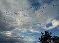 Canada geese in flight - geograph.org.uk - 3748526.jpg 640 × 469; 42 KB
-

-
 Car park at Yellowcraig, Dirleton - geograph.org.uk - 1034437.jpg 640 × 480; 83 KB
-
 Car park, Yellow Craig - geograph.org.uk - 2331978.jpg 800 × 530; 144 KB
-
 Car wash on Dirleton Road - geograph.org.uk - 3332122.jpg 3,264 × 2,448; 3.33 MB
-
 Caravan site and anchor at North Berwick - geograph.org.uk - 3332308.jpg 3,264 × 2,448; 4.08 MB
-
 Carlekemp House - geograph.org.uk - 6141118.jpg 640 × 480; 290 KB
-
 Castle Inn, Dirleton - geograph.org.uk - 2883749.jpg 800 × 532; 150 KB
-
 Castle Mains, Dirleton Castle - geograph.org.uk - 2903858.jpg 640 × 480; 99 KB
-
 Castle Tarbet - geograph.org.uk - 1368006.jpg 640 × 351; 82 KB
-
 Cave, Gullane - geograph.org.uk - 6724778.jpg 1,024 × 768; 215 KB
-
 Cereals, West Fenton - geograph.org.uk - 3785499.jpg 640 × 360; 243 KB
-
 Channel wrack (Pelvetia canaliculata) - geograph.org.uk - 1247944.jpg 640 × 480; 148 KB
-
 Children's course, Gullane - geograph.org.uk - 2180925.jpg 640 × 359; 66 KB
-
 Chimney stalk at Kingston steading - geograph.org.uk - 3756956.jpg 1,024 × 683; 105 KB
-
 Christmas Morning in Yellowcraig Plantation - geograph.org.uk - 6351324.jpg 1,024 × 576; 311 KB
-
 Cleaning the beach at Gullane - geograph.org.uk - 2535842.jpg 2,592 × 1,944; 2.05 MB
-
 Clearance of sea buckthorn - geograph.org.uk - 2235649.jpg 800 × 530; 145 KB
-
 Cleared buckthorn, Yellowcraig - geograph.org.uk - 6747516.jpg 1,024 × 683; 295 KB
-
 Cleared snow - geograph.org.uk - 2180948.jpg 640 × 359; 71 KB
-
 Clearing buckthorn - geograph.org.uk - 5221263.jpg 1,024 × 683; 299 KB
-
 Clearing buckthorn, West Links - geograph.org.uk - 5221279.jpg 1,024 × 683; 245 KB
-
 Clearing, Gullane Bents - geograph.org.uk - 5220624.jpg 1,024 × 683; 286 KB
-
 Clearing, Jamie's Neuk - geograph.org.uk - 5397723.jpg 1,024 × 683; 399 KB
-
 Club house on Luffness Links - geograph.org.uk - 5236419.jpg 1,024 × 682; 117 KB
-
 Clubhouse on Luffness Links - geograph.org.uk - 5235424.jpg 1,024 × 682; 148 KB
-
 Clubhouse renovation, Gullane - geograph.org.uk - 4360749.jpg 800 × 600; 404 KB
-
 Coast near Weaklaw Rocks - geograph.org.uk - 1821403.jpg 800 × 600; 89 KB
-
 Coast near West Links - geograph.org.uk - 1639006.jpg 640 × 473; 72 KB
-
 Coast opposite Fidra - geograph.org.uk - 5878858.jpg 1,024 × 576; 232 KB
-
 Coast path, West Links - geograph.org.uk - 940534.jpg 640 × 359; 66 KB


_-_geograph.org.uk_-_1247944.jpg)


&filefrom=Coastal+defences%2C+Aberlady+Bay+-+geograph.org.uk+-+2096464.jpg#mw-category-media)