Category:Dirt roads in Conwy County Borough
Media in category "Dirt roads in Conwy County Borough"
The following 72 files are in this category, out of 72 total.
-
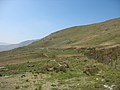
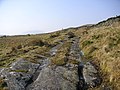
 A quad-bike track towards the mountain - geograph.org.uk - 398081.jpg 640 × 480; 111 KB
-
 A ruined sheepfold by the trackway - geograph.org.uk - 410656.jpg 640 × 394; 57 KB
-
 An Easter Walk in the Conwy Valley - 5 - geograph.org.uk - 406849.jpg 640 × 360; 105 KB
-

-

-
-
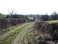
 Bends in the farm road - geograph.org.uk - 566957.jpg 640 × 480; 104 KB
-
 Bridleway to Llangwstenin - geograph.org.uk - 1013832.jpg 640 × 480; 99 KB
-
 Cefn Cyfarwydd - geograph.org.uk - 1830546.jpg 640 × 480; 79 KB
-
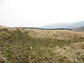
 Cwm Eigiau to Melynllyn Track - geograph.org.uk - 223840.jpg 640 × 427; 81 KB
-
 Diwedd y ffordd. End of the track - geograph.org.uk - 379213.jpg 640 × 448; 137 KB
-
 Farm road above Bryn Gefeilia' - geograph.org.uk - 403530.jpg 640 × 480; 133 KB
-
-
 Farm track and wall - geograph.org.uk - 1099572.jpg 640 × 480; 89 KB
-
 Farm Track at Rowlyn Uchaf - geograph.org.uk - 261734.jpg 600 × 435; 113 KB
-
 Farm track leading down to Gorddinan - geograph.org.uk - 617913.jpg 640 × 480; 114 KB
-
 Farm track near Dolwen - geograph.org.uk - 29889.jpg 512 × 384; 59 KB
-

-
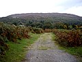
 Forest crossroads - geograph.org.uk - 558178.jpg 640 × 480; 68 KB
-

-
 Forest road east of the track junction - geograph.org.uk - 409036.jpg 640 × 476; 118 KB
-
 Forestry road east of Blaen Glasgwm - geograph.org.uk - 557694.jpg 640 × 480; 132 KB
-
 Forestry road on Llechweddhafod - geograph.org.uk - 554631.jpg 640 × 501; 119 KB
-
 Forestry track above Penmachno - geograph.org.uk - 172945.jpg 640 × 480; 105 KB
-
 Forestry track above Ty Mawr - geograph.org.uk - 172916.jpg 640 × 480; 103 KB
-
 Forestry track approaching Llyn Bychan - geograph.org.uk - 2446940.jpg 4,000 × 3,000; 3.37 MB
-

-
-
 Lakeside track at Llyn Crafnant - geograph.org.uk - 1437082.jpg 640 × 433; 71 KB
-
 Leat service track from the A5 - geograph.org.uk - 424884.jpg 640 × 480; 83 KB
-
 Llwybr ceffyl. Bridleway. - geograph.org.uk - 417361.jpg 640 × 480; 104 KB
-
 Llyn Crafnant - geograph.org.uk - 1816966.jpg 480 × 640; 88 KB
-
 Moel Eilio Track near Llyn Coedty - geograph.org.uk - 220279.jpg 640 × 427; 120 KB
-
 Rough track to Ty Isa Gell - geograph.org.uk - 345215.jpg 640 × 480; 144 KB
-

-
 The path beyond the ford - geograph.org.uk - 701432.jpg 480 × 640; 77 KB
-
 The path, portal and sheepfold - geograph.org.uk - 717748.jpg 640 × 480; 125 KB
-

-
 The track towards Clogwynyreryr - geograph.org.uk - 717465.jpg 640 × 480; 90 KB
-

-
 Trac. Track - geograph.org.uk - 423885.jpg 640 × 480; 131 KB
-
 Track off Moel Seisiog - geograph.org.uk - 638716.jpg 640 × 480; 71 KB
-
 Track to Pen-y-garnedd - geograph.org.uk - 340676.jpg 640 × 480; 79 KB
-
 Track to Tal y Braich Uchaf - geograph.org.uk - 222579.jpg 640 × 427; 101 KB
-

-
 Alwen tracks - geograph.org.uk - 117704.jpg 640 × 480; 54 KB
-

-
 Farm track - geograph.org.uk - 125445.jpg 640 × 480; 71 KB
-
 Footpath near Nant-y-cerrig farm - geograph.org.uk - 201893.jpg 640 × 427; 95 KB
-
 Footpath to Capel Garmon - geograph.org.uk - 165744.jpg 640 × 480; 175 KB
-
 Forestry barrier at road junction - geograph.org.uk - 197109.jpg 640 × 427; 103 KB
-
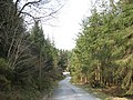 Forestry road west of Hafod-las - geograph.org.uk - 402518.jpg 640 × 480; 134 KB
-
 Forestry track - geograph.org.uk - 117698.jpg 640 × 480; 87 KB
-

-
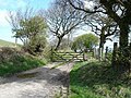
 Gated road - geograph.org.uk - 157479.jpg 640 × 480; 61 KB
-
 Gated track - geograph.org.uk - 181765.jpg 640 × 480; 132 KB
-
 Hen ffordd - geograph.org.uk - 379335.jpg 640 × 480; 153 KB
-
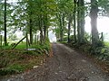
 Lane to Ty-nant-y-llwyn - geograph.org.uk - 181920.jpg 640 × 480; 79 KB
-
 Little used lane - geograph.org.uk - 124532.jpg 640 × 480; 111 KB
-
 Llwybr. Path - geograph.org.uk - 410336.jpg 640 × 480; 105 KB
-
 Lôn y fferm. Farm Lane. - geograph.org.uk - 410369.jpg 640 × 480; 127 KB
-
 Menter Coedwigaeth - geograph.org.uk - 152765.jpg 640 × 480; 116 KB
-
 Road Junction at Hafodunos Farm - geograph.org.uk - 218450.jpg 640 × 427; 74 KB
-
 Road junction near Bryniau Gleision - geograph.org.uk - 209656.jpg 640 × 427; 109 KB
-
 Road Junction near Pen Gallt y Foel - geograph.org.uk - 222131.jpg 640 × 427; 119 KB
-
 Road junction near Rhyd Loyw farm - geograph.org.uk - 201892.jpg 640 × 427; 100 KB
-
 The parting of the ways - geograph.org.uk - 410632.jpg 640 × 480; 83 KB
-

-
 Track across the field to Ty Gwyn - geograph.org.uk - 218473.jpg 640 × 427; 63 KB
-
-
 Track with gate - geograph.org.uk - 439051.jpg 640 × 360; 96 KB
-
 Tyddyn Eli - geograph.org.uk - 260679.jpg 640 × 480; 143 KB


