Category:Disused railway lines in Lancashire
Subcategories
This category has the following 8 subcategories, out of 8 total.
F
G
I
P
S
W
Media in category "Disused railway lines in Lancashire"
The following 14 files are in this category, out of 14 total.
-
 "Dismantled Railway", Whittingham Hospital Railway - geograph.org.uk - 3304491.jpg 2,560 × 1,920; 3.02 MB
-
 Abandoned railway - geograph.org.uk - 3920844.jpg 1,800 × 1,197; 1.01 MB
-

-
 Bridge 104 - panoramio.jpg 3,072 × 1,728; 1.98 MB
-
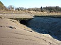 Burrow Beck almost at the Lune - geograph.org.uk - 1704682.jpg 640 × 480; 101 KB
-
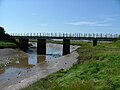 Conder Viaduct, Glasson Dock - geograph.org.uk - 47792.jpg 640 × 480; 95 KB
-
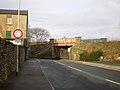
 Dark Lane railway bridge - geograph.org.uk - 1226409.jpg 640 × 480; 146 KB
-
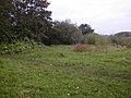 Disused Rail line - geograph.org.uk - 68937.jpg 640 × 480; 110 KB
-
 Greetby Hill railway bridge.JPG 2,848 × 2,136; 1.49 MB
-
 Railway bridge over Green Lane - geograph.org.uk - 1607343.jpg 640 × 480; 57 KB
-
 Site of old Coal Mine - geograph.org.uk - 1544411.jpg 640 × 480; 96 KB
-
 The Railway Tavern, Blaguegate - geograph.org.uk - 66803.jpg 640 × 480; 60 KB
-
-
 Railway Crossing Lane, Lancaster - geograph.org.uk - 57158.jpg 640 × 480; 166 KB


