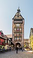
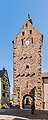
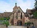
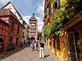
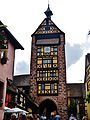
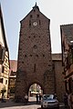
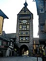
Category:Dolder, Riquewihr
| Object location | | View all coordinates using: OpenStreetMap |
|---|
tower  | |||||
| Upload media | |||||
| Instance of | |||||
|---|---|---|---|---|---|
| Part of | |||||
| Location | Riquewihr, canton of Kaysersberg | ||||
| Occupant | |||||
| Inception |
| ||||
 | |||||
Media in category "Dolder, Riquewihr"
The following 44 files are in this category, out of 44 total.
-
 2009 02 28 Riquewihr.jpg 1,536 × 2,048; 1.02 MB
-
 2015-12 Dolder sign 01.jpg 5,332 × 3,555; 8.55 MB
-
 68340 Riquewihr, France - panoramio (3).jpg 2,816 × 2,112; 1.89 MB
-
 Alsace Riquewihr Dolder - panoramio.jpg 1,458 × 1,944; 667 KB
-
 Alsace Riquewihr Dolder 041990 - panoramio.jpg 1,516 × 2,364; 1.1 MB
-
 Dolder a Riquewihr.jpg 6,240 × 3,995; 3.64 MB
-
 Dolder in Riquewihr (1).jpg 2,413 × 4,166; 5.85 MB
-
 Dolder in Riquewihr (2).jpg 1,790 × 4,492; 6.62 MB
-
 Dolder Riquewihr Christmas Market.jpg 5,776 × 3,862; 1.28 MB
-
 F Haut-Rhin Sainte-Marie-aux-Mines Riquewihr 11.jpg 3,022 × 3,022; 5.59 MB
-
 F Haut-Rhin Sainte-Marie-aux-Mines Riquewihr 12.jpg 2,113 × 3,110; 3.34 MB
-
 Passage du Dolder Riquewihr.jpg 6,240 × 3,995; 4.14 MB
-
 PM 049896 F Riquewihr.jpg 400 × 600; 217 KB
-
 Porte sous le Dolder.jpg 2,592 × 3,872; 1.1 MB
-
 Riquewhirdolder.jpg 288 × 384; 23 KB
-
 Riquewihr - Le Dolder.jpg 4,344 × 6,646; 9.33 MB
-
 Riquewihr - panoramio (3).jpg 2,048 × 1,536; 643 KB
-
 Riquewihr 001.jpg 1,024 × 768; 442 KB
-
 Riquewihr 013.jpg 1,024 × 768; 423 KB
-
 Riquewihr Dolder 01.JPG 3,648 × 2,736; 2.99 MB
-
 Riquewihr Dolder 04.JPG 2,612 × 3,641; 1.48 MB
-
 Riquewihr Dolder 05.JPG 3,593 × 2,736; 2.03 MB
-
 Riquewihr Dolder Feldseite.jpg 3,440 × 4,586; 5.89 MB
-
 Riquewihr Dolder Stadtseite 1.jpg 3,332 × 4,301; 4.19 MB
-
 Riquewihr Dolder Stadtseite 2.jpg 3,448 × 4,592; 4.89 MB
-
 Riquewihr Dolder.JPG 1,224 × 1,632; 799 KB
-
 Riquewihr Dolder.jpg 1,280 × 960; 443 KB
-
 Riquewihr MG 4491.JPG 2,848 × 4,272; 1.2 MB
-
 Riquewihr MG 4495.JPG 2,848 × 4,272; 1.64 MB
-
 Riquewihr Porte Haute.JPG 1,632 × 1,224; 900 KB
-
 Riquewihr PorteHaute.JPG 2,736 × 3,648; 2.74 MB
-
 Riquewihr rue principale.JPG 1,600 × 1,200; 395 KB
-
 Riquewihr September 2023.jpg 1,536 × 2,048; 2.76 MB
-
 Riquewihr, Alsace (6710666625).jpg 2,741 × 4,127; 9.02 MB
-
 Riquewihr-004.jpg 1,952 × 2,576; 1 MB
-
 Riquewihr-0060.jpg 2,674 × 4,011; 4.02 MB
-
 Riquewihr-apr 2005.jpg 1,320 × 1,160; 538 KB
-
 Riquewihr-FR-68-vers 1935-Dolder.jpg 1,044 × 1,650; 821 KB
-
 Riquewihr-PM 49901.jpg 473 × 709; 250 KB
-
 Riquewihr-PM 49903.jpg 473 × 709; 266 KB
-
 Roofs of Riquewihr.jpg 4,097 × 2,721; 1.63 MB
-
 Village (Riquewihr) (3).jpg 2,592 × 1,944; 535 KB
-
 Риквир, Франция - panoramio (26).jpg 2,448 × 3,264; 1.47 MB
-
 Риквир, Франция - panoramio (7).jpg 2,448 × 3,264; 1.97 MB


.jpg)


.jpg)


.jpg)


.jpg)


_(3).jpg)
.jpg)
.jpg)
.jpg)