Category:Domaine Micheli (Landecy)
| Object location | | View all coordinates using: OpenStreetMap |
|---|
 | |||||
| Upload media | |||||
| Instance of | |||||
|---|---|---|---|---|---|
| Part of | |||||
| Location |
| ||||
| Street address |
| ||||
| Heritage designation | |||||
 | |||||
Media in category "Domaine Micheli (Landecy)"
The following 10 files are in this category, out of 10 total.
-
 Archive Micheli.JPG 4,928 × 3,264; 4.46 MB
-
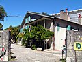
 Bardonnex Domaine Micheli 2011-08-28 12 45 49 PICT4203.jpg 2,272 × 1,404; 2.35 MB
-
 Bardonnex Domaine Micheli 2011-08-28 12 46 12 PICT4204.jpg 2,272 × 1,704; 2.3 MB
-
 Bardonnex Domaine Micheli 2011-08-28 12 47 20 PICT4205.jpg 2,272 × 1,704; 2.49 MB
-
 Bardonnex domaine Micheli 2011-08-28 12 47 29 PICT4206.JPG 2,272 × 1,704; 2.35 MB
-
 Bardonnex domaine Micheli 2011-08-28 12 47 46 PICT4207.JPG 2,272 × 1,704; 2.29 MB
-
 Bardonnex domaine Micheli 2011-08-28 12 47 55 PICT4208.JPG 2,272 × 1,704; 2.73 MB
-
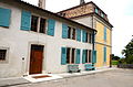
 Landecy 1.jpg 2,417 × 1,861; 1.91 MB
-
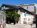
 Landecy 2.jpg 2,175 × 1,488; 2.03 MB
-
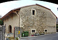
 Manoir DomaineMicheli-LandecyBardonnexGeneve RomanDeckert18052021.jpg 3,949 × 2,976; 8.89 MB


