Category:Domaine de Rubelles (Rubelles)
| Object location | | View all coordinates using: OpenStreetMap |
|---|
 | |||||
| Upload media | |||||
| Instance of | |||||
|---|---|---|---|---|---|
| Location | Rubelles, Seine-et-Marne, Île-de-France, Metropolitan France, France | ||||
| Street address |
| ||||
| Heritage designation |
| ||||
 | |||||
Media in category "Domaine de Rubelles (Rubelles)"
The following 2 files are in this category, out of 2 total.
-
 Chatrubellesfacad.jpg 677 × 440; 169 KB
-
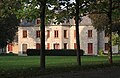
 Rubelles château.jpg 2,592 × 1,944; 3.45 MB
