Category:Donatsfriedhof Freiberg
| Object location | | View all coordinates using: OpenStreetMap |
|---|
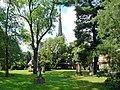
cemetery in Freiberg, Germany  | |||||
| Upload media | |||||
| Instance of | |||||
|---|---|---|---|---|---|
| Location | Freiberg, Mittelsachsen, Saxony, Germany | ||||
| Street address |
| ||||
| Heritage designation | |||||
| Inception |
| ||||
 | |||||
| (Wikidata) |
Subcategories
This category has only the following subcategory.
K
Media in category "Donatsfriedhof Freiberg"
The following 41 files are in this category, out of 41 total.
-
 20150723150DR Freiberg Jakobikirche mit Silbermannorgel.jpg 2,104 × 2,884; 3.63 MB
-
 20150723155MDR Freiberg Jakobikirche.jpg 3,223 × 3,742; 7.22 MB
-
 20150723160DR Freiberg Jakobikirche.jpg 3,095 × 2,312; 4.74 MB
-
 Albin Weisbach Grab Freiberg.JPG 3,456 × 2,592; 3.86 MB
-
 Anton Lissner Grab Freiberg.JPG 3,456 × 2,592; 4.04 MB
-
 August Ferdinand Anacker Grab Freiberg.JPG 3,456 × 2,592; 3.91 MB
-
 Bernhard von Cotta Grab Freiberg.JPG 3,456 × 2,592; 3.95 MB
-
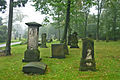
 Donatsfriedhof Freiberg 1.JPG 3,232 × 3,232; 4.21 MB
-
 Donatsfriedhof Freiberg 2.JPG 3,232 × 3,232; 4.07 MB
-
 Donatsfriedhof1.jpg 1,954 × 1,303; 1.02 MB
-
 Donatsfriedhof2.jpg 1,942 × 1,295; 1.15 MB
-
 Donatsfriedhof3.jpg 1,965 × 1,310; 1.1 MB
-
 Donatsfriedhof4.jpg 1,536 × 2,048; 1.01 MB
-
 Donatsfriedhof5.jpg 1,536 × 2,048; 1.12 MB
-
 Donatsfriedhof6.jpg 2,015 × 1,343; 1.1 MB
-
 Donatsfriedhof7.jpg 2,046 × 1,364; 1.3 MB
-
 Donatsfriedhof8.jpg 1,935 × 1,290; 1.14 MB
-
 Eduard Heuchler Grab Freiberg.JPG 3,456 × 2,592; 3.94 MB
-
 Erichrammlersgrab.jpg 3,733 × 2,800; 5.56 MB
-
 Esthervonkirchbachsgrab.jpg 2,356 × 3,534; 4.19 MB
-
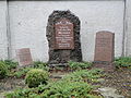
 Freiberg Bombenopfer 1944 Gräberfeld Denkmale.JPG 2,560 × 1,920; 2.14 MB
-
 Freiberg Bombenopfer 1944 Mutter Matthes.JPG 2,560 × 1,920; 2.04 MB
-
 Freiberg Friedhof.jpg 3,083 × 2,055; 3.68 MB
-
 Freiberg Gedenkstein Friedhof Bombenopfer 1944.JPG 1,920 × 2,560; 2.13 MB
-
 Friedrich Wilhelm Schwamkrug Grab Freiberg.JPG 3,456 × 2,592; 3.93 MB
-
 Georg Spackeler Grab Freiberg.JPG 3,456 × 2,592; 3.82 MB
-
 Hans Matschak Grab Freiberg.JPG 3,456 × 2,592; 3.95 MB
-
 Hieronymus Theodor Richter Grab Freiberg.JPG 3,456 × 2,592; 3.94 MB
-
 Johann Carl Freiesleben Grab Freiberg.JPG 3,377 × 2,371; 5.76 MB
-
 Johannes Galli Grab Freiberg.JPG 3,456 × 2,592; 3.88 MB
-
 Julius Weisbach Grab Freiberg.JPG 3,456 × 2,592; 3.85 MB
-
 Karl A. Jurasky Donatsfriedhof Freiberg.JPG 3,456 × 2,592; 3.89 MB
-
 Karl Kegel Grab Freiberg.JPG 3,456 × 2,592; 3.84 MB
-
 Karl-Friedrich Lüdemann Grab Freiberg.JPG 3,456 × 2,592; 3.91 MB
-
 Manfred Wolf Grab Freiberg.JPG 3,456 × 2,592; 3.97 MB
-
 Otto Emicke Grab Freiberg.JPG 3,456 × 2,592; 3.92 MB
-
 Otto Fritzsche Grab Freiberg.JPG 3,456 × 2,592; 3.84 MB
-
 Ottostutzersgrab.jpg 4,752 × 3,168; 6.53 MB
-
 Schwamkrugsgrab.jpg 4,752 × 3,168; 6.63 MB
-
 Theodorrichtersgrab.jpg 3,776 × 2,832; 4.32 MB
-
 Wilhelm August Lampadius Grab Freiberg.JPG 3,456 × 2,592; 3.98 MB


