Category:Donisthorpe
English: Donisthorpe is a village in the East Midlands of England, administered as part of the Leicestershire district of North West Leicestershire.
village in United Kingdom  | |||||
| Upload media | |||||
| Instance of | |||||
|---|---|---|---|---|---|
| Location | Oakthorpe and Donisthorpe, North West Leicestershire, Leicestershire, East Midlands, England | ||||
| Different from | |||||
 | |||||
Subcategories
This category has the following 3 subcategories, out of 3 total.
D
- Donisthorpe railway station (3 F)
M
- Macpherson (bus company) (1 F)
Media in category "Donisthorpe"
The following 62 files are in this category, out of 62 total.
-
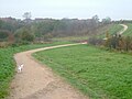
 20190518AshbyWoulds Trail.jpg 2,592 × 4,608; 5.47 MB
-
 20190518ParkInfoBoard.jpg 4,608 × 2,592; 4.96 MB
-
 Ashby Canal, Donisthorpe - geograph.org.uk - 60335.jpg 640 × 480; 80 KB
-
 Autumn Dawn - geograph.org.uk - 283163.jpg 640 × 480; 65 KB
-
 Barley crop at Hicks Lodge - geograph.org.uk - 1503385.jpg 640 × 480; 128 KB
-
 Birch trees at Donisthorpe, Leicestershire.jpg 640 × 480; 168 KB
-
 Blossom Donisthorpe Park.jpg 6,016 × 4,016; 8.88 MB
-
 Bramborough Brook - geograph.org.uk - 663686.jpg 640 × 480; 133 KB
-
 Bridge over Bramborough brook - geograph.org.uk - 663668.jpg 640 × 480; 96 KB
-
 Bridge over Bramborough Brook - geograph.org.uk - 663681.jpg 640 × 480; 125 KB
-
 Bridge over Bramborough Brook, Donisthorpe, Leicestershire.jpg 640 × 480; 135 KB
-
 Bridge over previous railway line at Donisthorpe, Leicestershire.jpg 640 × 480; 106 KB
-
 Chimney of disused brickworks, Donisthorpe, Leicestershire.jpg 640 × 480; 89 KB
-
 Church Street, Donisthorpe - geograph.org.uk - 797655.jpg 640 × 433; 73 KB
-
 Church Street, Donisthorpe - geograph.org.uk - 797841.jpg 640 × 488; 73 KB
-
 Church Street, Donisthorpe, Leicestershire.jpg 640 × 480; 79 KB
-
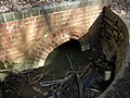 Culvert - geograph.org.uk - 933627.jpg 640 × 480; 97 KB
-
 Culvert under disused railway, Donisthorpe, Leicestershire.jpg 640 × 481; 92 KB
-
 Dog waste bin at Donisthorpe, Leicestershire.jpg 640 × 480; 57 KB
-

-
 Donisthorpe Colliery steam winder - geograph.org.uk - 702102.jpg 640 × 419; 91 KB
-
 Donisthorpe Colliery winding wheel - geograph.org.uk - 797671.jpg 640 × 536; 109 KB
-
 Donisthorpe Colliery winding wheel, Donisthorpe, Leicestershire.jpg 640 × 480; 67 KB
-
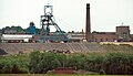 Donisthorpe Colliery, 1990.jpg 3,102 × 1,779; 3.54 MB
-
 Donisthorpe Engine Inn (geograph 2847027).jpg 640 × 480; 98 KB
-
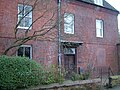
 Donisthorpe Hall, Donisthorpe, Leicestershire 01.jpg 640 × 480; 115 KB
-
 Donisthorpe Hall, Donisthorpe, Leicestershire 02.jpg 640 × 480; 153 KB
-
 Donisthorpe Masons Arms - geograph.org.uk - 2847033.jpg 640 × 480; 134 KB
-
 Donisthorpe woodland park 005.jpg 295 × 194; 19 KB
-

-
 Donisthorpe, Leicestershire - geograph.org.uk - 797694.jpg 640 × 564; 67 KB
-
 Fallen ash tree at Donisthorpe, Leicestershire.jpg 640 × 480; 163 KB
-
 Farm bridge at Donisthorpe, Leicestershire.jpg 640 × 480; 153 KB
-
 Footpath through Donisthorpe Country Park, Leicestershire.jpg 640 × 480; 78 KB
-
 Hall Lane, Donisthorpe, Leicestershire.jpg 640 × 480; 83 KB
-
 Hill Street in Donisthorpe - geograph.org.uk - 797847.jpg 640 × 448; 75 KB
-
 Mason's Arms Donisthorpe - geograph.org.uk - 3810500.jpg 1,600 × 1,069; 337 KB
-
 Moira Road in Donisthorpe - geograph.org.uk - 797651.jpg 640 × 423; 65 KB
-
 Narrow Lane in Donisthorpe, Leicestershire.jpg 640 × 480; 141 KB
-
 Orchard next to Talbot Place, Donisthorpe, Leicestershire.jpg 640 × 480; 107 KB
-
 Pheasant breeding pens at Donisthorpe, Leicestershire.jpg 640 × 480; 48 KB
-
 Road to sewerage works at Donisthorpe, Leicestershire.jpg 640 × 480; 88 KB
-
 Rooftops in Donisthorpe, Leicestershire.jpg 640 × 480; 88 KB
-
 Roundabout, Church Street, Donisthorpe - geograph.org.uk - 2471040.jpg 640 × 538; 119 KB
-
 Seals Road, Donisthorpe, Leicestershire.jpg 640 × 480; 106 KB
-
 Sheet63Zoom Donisthorpe.jpg 710 × 746; 295 KB
-
 Snowman in Donisthorpe, Leicestershire.jpg 640 × 480; 78 KB
-
 St John the Evangelist - geograph.org.uk - 4455303.jpg 4,320 × 3,240; 5.58 MB
-
 St John's on Church Street - geograph.org.uk - 3810257.jpg 1,600 × 1,070; 457 KB
-
 St John's Vicarage at Donisthorpe, Leicestershire.jpg 640 × 480; 122 KB
-
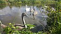 Swans Ashby Canal.jpg 5,312 × 2,988; 4.24 MB
-
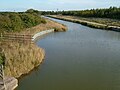 The Ashby Canal at Donisthorpe, Leicestershire.jpg 640 × 480; 88 KB
-
 The Engine Inn, Donisthorpe, Leicstershire.jpg 640 × 480; 84 KB
-
 The Grange on Church Street, Donisthorpe, Leicestershire.jpg 640 × 480; 128 KB
-
 The Masons Arms, Donisthorpe, Leicestershire.jpg 640 × 480; 67 KB
-
 The Peterleas - geograph.org.uk - 337347.jpg 640 × 480; 95 KB
-
 The Turks Head public house, Donisthorpe, Leicestershire.jpg 640 × 480; 127 KB
-
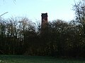
 Tower of St John's Church at Donisthorpe, Leicestershire.jpg 640 × 480; 151 KB
-
 View towards Donisthorpe - geograph.org.uk - 790140.jpg 640 × 482; 54 KB
-
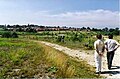
 Waste tip near Bramborough Pool - geograph.org.uk - 1502610.jpg 640 × 480; 148 KB
-
 Wheelie bins on New Street, Donisthorpe, Leicestershire.jpg 640 × 480; 100 KB
-
 Wooden Footbridge Ashby Canal.jpg 6,016 × 4,016; 8.65 MB


.jpg)


