Category:Dorfkirche (Bralitz)
| Object location | | View all coordinates using: OpenStreetMap |
|---|
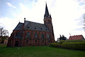
listed hall church in Bralitz, Bad Freienwalde (Oder), Brandenburg state of Germany  Dorfkirche Bralitz  Westportal der Dorfkirche Bralitz | |||||
| Upload media | |||||
| Instance of | |||||
|---|---|---|---|---|---|
| Made from material | |||||
| Location | Bralitz, Bad Freienwalde, Märkisch-Oderland District, Brandenburg, Germany | ||||
| Street address |
| ||||
| Architectural style | |||||
| Owned by | |||||
| Occupant | |||||
| Heritage designation | |||||
| Inception |
| ||||
| Significant event |
| ||||
| Religion or worldview | |||||
 | |||||
English: Pictures of the church in Bralitz , Bad Freienwalde municipality, Märkisch-Oderland district, Brandenburg state, Germany
Deutsch: Bilder der Dorfkirche Bralitz , Stadt Bad Freienwalde, Landkreis Märkisch-Oderland, Land Brandenburg, Deutschland.
Français : Photos de l'église à Bralitz , ville de Bad Freienwalde, arrondissement de Märkisch-Oderland, état fédéral de Brandebourg, Allemagne
This is the category of the Brandenburger Baudenkmal (cultural heritage monument) with the ID 09180374 (Wikidata)
|
Media in category "Dorfkirche (Bralitz)"
The following 13 files are in this category, out of 13 total.
-
 Bralitz Dorfkirche 18.04.2011 AP-01.jpg 2,000 × 3,008; 2.97 MB
-
 Bralitz Dorfkirche 18.04.2011 AP-02.jpg 3,008 × 2,000; 2.94 MB
-
 Bralitz Dorfkirche 18.04.2011 AP-03.jpg 3,008 × 2,000; 3.42 MB
-
 Bralitz Dorfkirche 18.04.2011 AP-04.jpg 3,008 × 2,000; 2.96 MB
-
 Bralitz Dorfkirche 18.04.2011 AP-06.jpg 3,008 × 2,000; 2.66 MB
-
 Bralitz Dorfkirche 18.04.2011 AP-07.jpg 3,008 × 2,000; 1.92 MB
-
 Dorfkirche Bralitz 2018 NE.jpg 4,044 × 4,735; 5.74 MB
-
 Dorfkirche Bralitz 2018 NNW.jpg 3,538 × 4,782; 6.29 MB
-
 Dorfkirche Bralitz 2018 Portal W.jpg 3,638 × 4,856; 8.14 MB
-
 Dorfkirche Bralitz 2018 SE.jpg 4,917 × 4,898; 8.24 MB
-
 Dorfkirche Bralitz 2018 SSW.jpg 3,446 × 4,718; 6.68 MB
-
 Dorfkirche Bralitz 2018 Turmhelm.jpg 3,648 × 4,864; 3.95 MB
-
 Kirche Bralitz Bad Freienwalde.jpg 2,190 × 3,342; 5.45 MB


