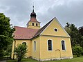
Category:Dorfkirche Grünefeld (Havelland)
| Object location | | View all coordinates using: OpenStreetMap |
|---|
church building in Brandenburg state, Germany  | |||||
| Upload media | |||||
| Instance of | |||||
|---|---|---|---|---|---|
| Location | Grünefeld, Schönwalde-Glien, Havelland District, Brandenburg, Germany | ||||
| Heritage designation | |||||
 | |||||
This is the category of the Brandenburger Baudenkmal (cultural heritage monument) with the ID 09150689 (Wikidata)
|
English: Church in Grünefeld, Schönwalde-Glien municipality, Havelland district, Brandenburg state, Germany
Deutsch: Dorfkirche in Grünefeld, Gemeinde Schönwalde-Glien, Landkreis Havelland, Land Brandenburg, Deutschland.
Français : Église de Grünefeld, commune de Schönwalde-Glien, arrondissement Pays de la Havel, état fédéral de Brandebourg, Allemagne
Media in category "Dorfkirche Grünefeld (Havelland)"
The following 24 files are in this category, out of 24 total.
-
 A 10 Ziethener Luch 05.jpg 705 × 567; 70 KB
-
 Dorfkirche Grünefeld 2019 Infotafel.jpg 4,864 × 3,648; 4.34 MB
-
 Dorfkirche Grünefeld 2019 NNE.jpg 4,010 × 3,870; 5.29 MB
-
 Dorfkirche Grünefeld 2019 NNW.jpg 3,424 × 3,507; 3.67 MB
-
 Dorfkirche Grünefeld 2019 Portal.jpg 3,648 × 4,864; 6.16 MB
-
 Dorfkirche Grünefeld 2019 S.jpg 4,864 × 3,648; 6.64 MB
-
 Dorfkirche Grünefeld 2019 SE.jpg 4,842 × 3,620; 6.1 MB
-
 Dorfkirche Grünefeld 2019 SW.jpg 3,648 × 4,864; 5.33 MB
-
 Dorfkirche Grünefeld 2019 Turmhaube S.jpg 3,648 × 4,864; 5.31 MB
-
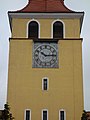 Dorfkirche Grünefeld 2019 Turmuhr.jpg 3,648 × 4,864; 4.07 MB
-
 Dorfkirche Grünefeld Chor Ostansicht.jpg 3,024 × 4,032; 3.61 MB
-
 Dorfkirche Grünefeld Denkmal Weltkriege.jpg 4,032 × 3,024; 5.55 MB
-
 Dorfkirche Grünefeld Nordostansicht.jpg 4,032 × 3,024; 2.66 MB
-
 Dorfkirche Grünefeld Nordwestansicht.jpg 4,032 × 3,024; 2.71 MB
-
 Dorfkirche Grünefeld Orgel (FoP-Germany).jpg 927 × 1,421; 407 KB
-
 Dorfkirche Grünefeld Ostansicht.jpg 3,024 × 4,032; 2.44 MB
-
 Dorfkirche Grünefeld Südansicht.jpg 4,032 × 3,024; 2.94 MB
-
 Dorfkirche Grünefeld Südturm Südostansicht.jpg 3,024 × 4,032; 1.96 MB
-
 Dorfkirche Grünefeld Südturm Westansicht.jpg 3,024 × 4,032; 3.2 MB
-
 Dorfkirche Grünefeld Westansicht.jpg 3,024 × 4,032; 3 MB
-
 Dorfkirche Grünefeld westlicher Kreuzarm Westansicht.jpg 3,024 × 4,032; 3.4 MB
-
 Dorfkirche Grünefeld östlicher Kreuzarm Nordostansicht.jpg 3,024 × 4,032; 2.49 MB
-
 Dorfkirche Grünefeld östlicher Kreuzarm Südostansicht.jpg 3,024 × 4,032; 3.14 MB
-
 Kirche Grünefeld.jpg 3,156 × 4,168; 3.04 MB


.jpg)


