Category:Dorpsstraat 1, Havelte
| Object location | | View all coordinates using: OpenStreetMap |
|---|
 | |||||
| Upload media | |||||
| Instance of |
| ||||
|---|---|---|---|---|---|
| Location | Havelte, Drenthe, Netherlands | ||||
| Located on street |
| ||||
| Heritage designation |
| ||||
 | |||||
|
This is a category about rijksmonument number 21013
|
| Address |
|
Media in category "Dorpsstraat 1, Havelte"
The following 19 files are in this category, out of 19 total.
-
 Achter- en zijgevel nr. F 141-8 - Havelte - 20452100 - RCE.jpg 1,200 × 900; 128 KB
-
 Achter- en zijgevel nr. F 268-1 - Havelte - 20452096 - RCE.jpg 1,200 × 900; 147 KB
-
 Deel zijgevel nr. F 38-30 - Havelte - 20452097 - RCE.jpg 1,200 × 953; 86 KB
-
 Detail zijbaander nr. F 43-23 - Havelte - 20452087 - RCE.jpg 1,200 × 900; 126 KB
-
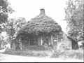
 Havelte 21013.jpg 3,888 × 2,592; 5.56 MB
-
 Interieur nr. F 268-4 - Havelte - 20452093 - RCE.jpg 1,200 × 900; 143 KB
-
 Interieur nr. F 268-5 - Havelte - 20452092 - RCE.jpg 1,200 × 900; 149 KB
-
 Interieur nr. F 268-6 - Havelte - 20452091 - RCE.jpg 1,200 × 900; 154 KB
-
 Interieur nr. F 268-7 - Havelte - 20452090 - RCE.jpg 1,200 × 900; 81 KB
-
 Interieur nr. F 268-8 - Havelte - 20452089 - RCE.jpg 1,200 × 900; 134 KB
-
 Interieur woonged. nr. F 268-3 - Havelte - 20452094 - RCE.jpg 1,200 × 900; 73 KB
-
 Voorgevel nr. F 141-10 - Havelte - 20452098 - RCE.jpg 1,200 × 900; 134 KB
-
 Voorgevel nr. F 38-29 - Havelte - 20452102 - RCE.jpg 1,200 × 900; 154 KB
-
 Voorgevel nr. HV5-A - Havelte - 20452103 - RCE.jpg 1,200 × 900; 141 KB
-
 Zij- en achtergevel nr. F 141-11 - Havelte - 20452086 - RCE.jpg 1,200 × 900; 161 KB
-
 Zij- en voorgevel nr. F 141-9 - Havelte - 20452099 - RCE.jpg 1,200 × 900; 178 KB
-
 Zijgevel nr. F 268-2 - Havelte - 20452095 - RCE.jpg 1,200 × 900; 181 KB
-
 Zijgevel nr. F 37-24 - Havelte - 20452088 - RCE.jpg 1,200 × 900; 138 KB
-
 Zijgevel nr. F 38-31 - Havelte - 20452101 - RCE.jpg 1,200 × 900; 175 KB


