Category:Dorpsstraat 14, Baambrugge
| Object location | | View all coordinates using: OpenStreetMap |
|---|
building in De Ronde Venen, Netherlands  | |||||
| Upload media | |||||
| Instance of | |||||
|---|---|---|---|---|---|
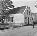
| Location | Baambrugge, Utrecht, Netherlands | ||||
| Street address |
| ||||
| Located on street |
| ||||
| Heritage designation |
| ||||
 | |||||
|
This is a category about rijksmonument number 7005
|
| Address |
|
Media in category "Dorpsstraat 14, Baambrugge"
The following 2 files are in this category, out of 2 total.
-
 Baambrugge - Dorpsstraat 14 RM7005.JPG 4,203 × 3,363; 766 KB
-
 Voor-en zijgevel - Baambrugge - 20026667 - RCE.jpg 1,200 × 1,191; 342 KB
