Category:Dorpsstraat 39, Baambrugge
| Object location | | View all coordinates using: OpenStreetMap |
|---|
house in De Ronde Venen, Netherlands  | |||||
| Upload media | |||||
| Instance of | |||||
|---|---|---|---|---|---|
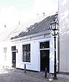
| Location | Baambrugge, Utrecht, Netherlands | ||||
| Street address |
| ||||
| Located on street |
| ||||
| Heritage designation |
| ||||
 | |||||
|
This is a category about rijksmonument number 6999
|
| Address |
|
Media in category "Dorpsstraat 39, Baambrugge"
The following 2 files are in this category, out of 2 total.
-
 Baambrugge - Dorpsstraat 39 RM6999.JPG 3,291 × 3,930; 908 KB
-
 Voorgevels - Baambrugge - 20026676 - RCE.jpg 1,200 × 1,198; 333 KB
