Category:Downside, Elmbridge
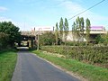
English: Downside is a village in the English county of Surrey. It is a small rural community in the River Mole valley between Cobham to the north and the M25 motorway to the south. Immediately to the north is Cobham Park, an old country house that has been converted to apartments by a recent redevelopment.
village in the English county of Surrey  | |||||
| Upload media | |||||
| Instance of | |||||
|---|---|---|---|---|---|
| Location | Elmbridge, Surrey, South East England, England | ||||
 | |||||
Subcategories
This category has the following 3 subcategories, out of 3 total.
Media in category "Downside, Elmbridge"
The following 28 files are in this category, out of 28 total.
-
 Downside Sports and Social Club, Downside Common Road, Downside, near Cobham (June 2015).JPG 4,200 × 2,600; 2.53 MB
-
 Downside Village Hall, Downside Common Road, Downside, near Cobham (June 2015).JPG 3,800 × 2,800; 2.24 MB
-
 Halfpenny Cross - geograph.org.uk - 933621.jpg 640 × 480; 104 KB
-
-
 Poynters Riding Centre - geograph.org.uk - 933631.jpg 640 × 480; 105 KB
-
 Railway Cottages, Effingham Junction - geograph.org.uk - 446261.jpg 640 × 390; 75 KB
-
 The Common, Downside - geograph.org.uk - 791060.jpg 640 × 480; 143 KB
-
 Tinmans Row, Downside - geograph.org.uk - 779170.jpg 640 × 427; 185 KB
-
 View across Downside Common, Downside, near Cobham (June 2015) (1).JPG 4,600 × 3,400; 3.74 MB
-
 View across Downside Common, Downside, near Cobham (June 2015) (2).JPG 4,600 × 3,400; 3.54 MB
-
 View across Downside Common, Downside, near Cobham (June 2015) (3).JPG 4,600 × 3,400; 3.3 MB
-
 View across Downside Common, Downside, near Cobham (June 2015) (4).JPG 3,400 × 4,600; 3.44 MB
-
 Bookham Road - geograph.org.uk - 779234.jpg 640 × 480; 184 KB
-
 Bookham Road from Hundred Pound Wood - geograph.org.uk - 779254.jpg 640 × 480; 186 KB
-
 Bridleway to Downside - geograph.org.uk - 778513.jpg 640 × 427; 206 KB
-
 Clamp Rough - geograph.org.uk - 446256.jpg 640 × 404; 130 KB
-
 Elm Tree Cottage, Downside - geograph.org.uk - 779197.jpg 640 × 479; 218 KB
-
 Entrance to Seymours Garden Centre - geograph.org.uk - 61528.jpg 640 × 480; 110 KB
-

-
 Gallows Grove, Effingham Junction - geograph.org.uk - 453558.jpg 640 × 410; 117 KB
-
 Gallows Grove, Effingham Junction - geograph.org.uk - 453560.jpg 640 × 410; 117 KB
-
 Horsley Road, Downside - geograph.org.uk - 51338.jpg 640 × 480; 119 KB
-

-
 New March House - geograph.org.uk - 51343.jpg 640 × 480; 136 KB
-
 Old Lane. Effingham Junction - geograph.org.uk - 457885.jpg 640 × 416; 99 KB
-
 Poynters - geograph.org.uk - 2789.jpg 640 × 395; 38 KB
-
 Semaphore Tower - geograph.org.uk - 357807.jpg 428 × 572; 109 KB
-

.JPG)
.JPG)


_(1).JPG)
_(2).JPG)
_(3).JPG)
_(4).JPG)


_and_Downside_Road_-_geograph.org.uk_-_51332.jpg)


