Category:Drainage basins of Georgia (U.S. state)
States of the United States: Alabama · Alaska · Arizona · Arkansas · California · Colorado · Connecticut · Delaware · Florida · Georgia · Idaho · Illinois · Iowa · Kansas · Kentucky · Louisiana · Maryland · Massachusetts · Minnesota · Mississippi · Missouri · Montana · Nebraska · Nevada · New Jersey · New Mexico · New York · North Carolina · Ohio · Oklahoma · Oregon · Pennsylvania · South Dakota · Tennessee · Texas · Utah · Vermont · Virginia · Washington · West Virginia · Wisconsin · Wyoming
Puerto Rico
Puerto Rico
Media in category "Drainage basins of Georgia (U.S. state)"
The following 17 files are in this category, out of 17 total.
-
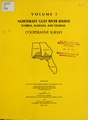 Northeast Gulf river basins - Florida, Alabama and Georgia cooperative survey (IA CAT31059288).pdf 1,377 × 1,877, 634 pages; 37.52 MB
-
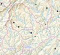
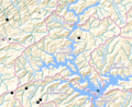
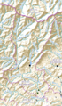 HUC 031300010102 - Smith Creek-Chattahoochee River.PNG 336 × 571; 441 KB
-
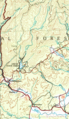 HUC 031300010102 topographic map.tiff 692 × 1,192; 1.99 MB
-
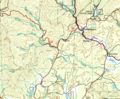
 HUC 031300010103 - Dukes Creek.PNG 517 × 421; 507 KB
-
 HUC 031300010103 topographic map.tiff 1,146 × 950; 2.56 MB
-
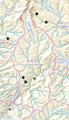
 HUC 031300010104 - Chickamauga Creek.PNG 473 × 528; 581 KB
-
 HUC 031300010104 topographic map.tiff 1,006 × 1,096; 2.45 MB
-
 HUC 031300010105 - Amys Creek-Chattahoochee River.PNG 385 × 364; 320 KB
-
 HUC 031300010105 topographic map.tiff 940 × 870; 1.65 MB
-
 HUC 031300010204 - Beaverdam Creek-Middle Soque River.PNG 441 × 401; 395 KB
-
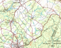
 HUC 031300010204 topographical map.PNG 542 × 562; 557 KB
-
 HUC 031300010205 - Hazel Creek.PNG 547 × 420; 521 KB
-
 HUC 031300010205 topographical map.PNG 801 × 627; 994 KB
-
 HUC 031300010206 - Yellowbank Creek-Lower Soque River.PNG 258 × 450; 262 KB
-
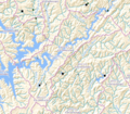 HUC 031300010305 - Limestone Creek-Chattahoochee River.tiff 1,176 × 1,032; 2.62 MB
-
 HUC 031300010702 - Thompson Creek-Chestatee River.tiff 934 × 764; 1.49 MB
-
 HUC 031300010703 - Latham Creek-Chestatee River.tiff 608 × 598; 758 KB


