Category:Drayton, Norfolk
English: Drayton, Norfolk, is a suburban village in the county of Norfolk and district of Broadland north west of Norwich. It is situated on the A1067 road between Hellesdon and Taverham.
village and civil parish in Broadland, Norfolk, United Kingdom  | |||||
| Upload media | |||||
| Instance of | |||||
|---|---|---|---|---|---|
| Location | Broadland, Norfolk, East of England, England | ||||
| Area |
| ||||
| Said to be the same as | Drayton (Wikimedia duplicated page, civil parish) | ||||
 | |||||
Subcategories
This category has the following 8 subcategories, out of 8 total.
Media in category "Drayton, Norfolk"
The following 115 files are in this category, out of 115 total.
-
 A glimpse of the River Wensum - geograph.org.uk - 3885970.jpg 640 × 480; 238 KB
-

-
 A1067 past Drayton Wood - geograph.org.uk - 3841864.jpg 1,024 × 682; 206 KB
-
 Approaching the Reepham Road roundabout - geograph.org.uk - 5234895.jpg 640 × 360; 256 KB
-
 Bin day in Station Road - geograph.org.uk - 3885899.jpg 640 × 480; 137 KB
-
 Boardwalk alongside the River Wensum - geograph.org.uk - 3885943.jpg 640 × 430; 211 KB
-
 Boardwalk beside the River Wensum - geograph.org.uk - 3885938.jpg 640 × 480; 259 KB
-
 Boardwalk over ditch - geograph.org.uk - 3885949.jpg 640 × 622; 325 KB
-
 Brambles on Bloods Dale - geograph.org.uk - 3886062.jpg 640 × 480; 199 KB
-
 Brickyard Farm Drayton - geograph.org.uk - 6079922.jpg 3,264 × 2,448; 1.76 MB
-
 Bus stop on Drayton High Road - geograph.org.uk - 5541993.jpg 640 × 480; 69 KB
-
 Carter Academy, Drayton - geograph.org.uk - 5995849.jpg 1,600 × 1,126; 240 KB
-
 Children's playground in Drayton - geograph.org.uk - 2055009.jpg 640 × 480; 228 KB
-
 Collecting rubbish on Low Road - geograph.org.uk - 3885733.jpg 640 × 480; 186 KB
-
 Conifer, Drayton - geograph.org.uk - 5300570.jpg 640 × 574; 222 KB
-
 Construction of a new road junction - geograph.org.uk - 5048245.jpg 640 × 528; 406 KB
-
 Cycle Park at Tesco's - geograph.org.uk - 3459612.jpg 640 × 440; 76 KB
-
 Digger parked beside Reepham Road - geograph.org.uk - 5048273.jpg 640 × 536; 358 KB
-
 Drayton (Norfolk) geograph-3419773-by-Ben-Brooksbank.jpg 2,395 × 1,470; 4.45 MB
-
 Drayton Green Lanes footpath - geograph.org.uk - 3885932.jpg 640 × 480; 242 KB
-
 Drayton High Road - geograph.org.uk - 5541997.jpg 640 × 480; 107 KB
-
 Drayton Lane, Drayton - geograph.org.uk - 3677769.jpg 3,072 × 2,304; 1.06 MB
-
 Drayton Lane, Drayton - geograph.org.uk - 3678905.jpg 3,072 × 2,304; 1.27 MB
-
 Drayton Lane, Drayton - geograph.org.uk - 3678949.jpg 3,057 × 2,305; 1.01 MB
-
 Drayton Lane, Drayton - geograph.org.uk - 3679240.jpg 2,872 × 2,157; 1.34 MB
-
 Drayton Lane, Drayton - geograph.org.uk - 3679253.jpg 2,788 × 2,094; 1.12 MB
-
 Drayton Lane, Drayton - geograph.org.uk - 6079911.jpg 3,184 × 2,388; 1.58 MB
-
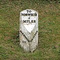 Drayton Milestone - geograph.org.uk - 1391707.jpg 640 × 640; 196 KB
-
 Drayton Stores - geograph.org.uk - 3816270.jpg 640 × 480; 62 KB
-
 Drayton Village Name sign on Drayton Road - geograph.org.uk - 3678928.jpg 2,983 × 2,241; 2.56 MB
-
 Drewray Woods Public Footpath-Track - geograph.org.uk - 2912867.jpg 640 × 480; 141 KB
-
 Entering Drayton on Drayton Lane - geograph.org.uk - 3678915.jpg 3,072 × 2,304; 890 KB
-
 Entrance to property off Low Road - geograph.org.uk - 3885730.jpg 640 × 480; 204 KB
-
 Field used for car boot sales - geograph.org.uk - 2527045.jpg 640 × 480; 112 KB
-
 Flowering shrubs in Station Road - geograph.org.uk - 3885887.jpg 640 × 480; 224 KB
-

-
 Freshwater Way, Thorpe Marriott - geograph.org.uk - 6079898.jpg 3,264 × 2,448; 1.57 MB
-
 Gracies of Drayton Cafe - geograph.org.uk - 5541992.jpg 640 × 480; 65 KB
-
 Hall Lane, Drayton - geograph.org.uk - 3678951.jpg 3,029 × 2,276; 1.43 MB
-
 Hall Lane, Drayton - geograph.org.uk - 3679223.jpg 2,965 × 2,227; 1.07 MB
-
 Hall Lane, Drayton - geograph.org.uk - 6079923.jpg 3,264 × 2,448; 2.14 MB
-
 House in Station Road - geograph.org.uk - 3885901.jpg 640 × 480; 182 KB
-
 Houses on Drayton Grove, Drayton - geograph.org.uk - 6079900.jpg 3,264 × 2,448; 1.72 MB
-
 Houses on Drayton High Road - geograph.org.uk - 5541996.jpg 640 × 480; 94 KB
-
 Industrial building beside Station Road - geograph.org.uk - 3885894.jpg 640 × 480; 160 KB
-
 Industrial buildings beside Station Road - geograph.org.uk - 3885907.jpg 640 × 480; 140 KB
-
-
 Long Dale, Thorpe Marriott - geograph.org.uk - 6079899.jpg 2,728 × 2,046; 1.18 MB
-
 National Cycle Route 1, Drayton - geograph.org.uk - 5541989.jpg 640 × 480; 135 KB
-
 North side of the Wensum Valley - geograph.org.uk - 6079918.jpg 3,264 × 2,448; 1.84 MB
-
 Ofo bike on Costessey Lane - geograph.org.uk - 5995835.jpg 1,600 × 1,200; 574 KB
-
 Old trees growing by Drayton Green Lanes - geograph.org.uk - 3885955.jpg 640 × 480; 282 KB
-
 OS Flush Bracket 10114 - geograph.org.uk - 1857859.jpg 1,024 × 768; 240 KB
-

-
 Path to Drayton Drewray - geograph.org.uk - 5048241.jpg 640 × 431; 325 KB
-
 Pendlesham Rise, Thorpe Marriott - geograph.org.uk - 3116664.jpg 640 × 480; 77 KB
-
 Petrol station, Drayton - geograph.org.uk - 5995837.jpg 1,600 × 1,140; 275 KB
-

-
 Reepham Road past Bugg's Grave - geograph.org.uk - 5234923.jpg 640 × 360; 271 KB
-
 Reepham Road, Drayton - geograph.org.uk - 3677768.jpg 3,072 × 2,304; 1.28 MB
-
 Reepham Road, Drayton - geograph.org.uk - 3678177.jpg 3,029 × 2,276; 1.47 MB
-
 Reepham Road, Drayton - geograph.org.uk - 3678900.jpg 3,028 × 2,305; 1.26 MB
-
 Reepham Road, Thorpe Marriot - geograph.org.uk - 3678212.jpg 3,072 × 2,304; 1.55 MB
-
 Reepham Road, Thorpe Marriot - geograph.org.uk - 3678237.jpg 2,788 × 2,094; 1.09 MB
-
 River Wensum - geograph.org.uk - 5995848.jpg 1,600 × 1,200; 503 KB
-
 River Wensum at Drayton Green Lane - geograph.org.uk - 277003.jpg 640 × 456; 86 KB
-
 River Wensum Drayton Green Lanes - geograph.org.uk - 3636636.jpg 640 × 434; 106 KB
-
 River Wensum Drayton Green Lanes - geograph.org.uk - 3659056.jpg 640 × 426; 86 KB
-
 River Wensum Drayton Green Lanes - geograph.org.uk - 3659061.jpg 640 × 480; 52 KB
-
 River Wensum Drayton Green Lanes - geograph.org.uk - 3659063.jpg 640 × 390; 69 KB
-
 River Wensum near Drayton Green Lane - geograph.org.uk - 3636584.jpg 640 × 480; 62 KB
-
 River Wensum near Drayton Low Road - geograph.org.uk - 3636599.jpg 640 × 392; 64 KB
-
 River Wensum south of Drayton - geograph.org.uk - 6079914.jpg 1,356 × 1,017; 770 KB
-
 River Wensum, Costessey - geograph.org.uk - 120380.jpg 640 × 480; 269 KB
-
 School Road, Drayton - geograph.org.uk - 3678955.jpg 2,772 × 2,305; 1.4 MB
-
 School Road, Drayton - geograph.org.uk - 3678958.jpg 3,072 × 2,304; 1.56 MB
-
 School Road, Drayton - geograph.org.uk - 3678960.jpg 3,072 × 2,304; 1.7 MB
-
 School Road, Drayton - geograph.org.uk - 3678961.jpg 3,072 × 2,304; 1.12 MB
-
 School Road, Thorpe Marriot - geograph.org.uk - 3678891.jpg 2,983 × 2,241; 1.44 MB
-
 Sign of The Otter public house - geograph.org.uk - 6079893.jpg 2,448 × 3,264; 1.73 MB
-

-

-

-

-
 Steps to the River Wensum - geograph.org.uk - 3885935.jpg 640 × 480; 256 KB
-
 Tesco's, Drayton - geograph.org.uk - 3816267.jpg 640 × 473; 57 KB
-
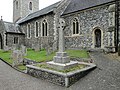 The Drayton War Memorial by Drayton church - geograph.org.uk - 4571619.jpg 3,456 × 2,592; 3.98 MB
-
 The Drayton War Memorial in Drayton church - geograph.org.uk - 4571610.jpg 2,592 × 3,456; 3.2 MB
-
 The new Reepham Road roundabout - geograph.org.uk - 5234897.jpg 640 × 503; 355 KB
-
 The Otter public house, Thorpe Marriott - geograph.org.uk - 6079892.jpg 3,264 × 2,448; 1.62 MB
-
 The Reepham Road roundabout - geograph.org.uk - 5234896.jpg 640 × 360; 253 KB
-
 The River Wensum - geograph.org.uk - 3885964.jpg 640 × 480; 201 KB
-
 The River Wensum near Drayton - geograph.org.uk - 3885967.jpg 640 × 480; 187 KB
-

-
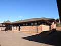 Thorpe Marriott village hall - geograph.org.uk - 6079895.jpg 3,264 × 2,448; 1.58 MB
-
 To Hellesdon on Low Road - geograph.org.uk - 3885737.jpg 640 × 480; 139 KB
-
 Traffic cones beside Reepham Road - geograph.org.uk - 5048256.jpg 640 × 480; 360 KB
-
 Tranquil scene on the River Wensum - geograph.org.uk - 3885941.jpg 640 × 480; 184 KB
-
 Trees growing beside the River Wensum - geograph.org.uk - 3885958.jpg 640 × 480; 222 KB
-
 Unusual field gate - geograph.org.uk - 759186.jpg 640 × 480; 119 KB
-
 View across Bloods Dale - geograph.org.uk - 3886059.jpg 640 × 480; 186 KB
-
 View across Reepham Road - geograph.org.uk - 5048263.jpg 640 × 480; 332 KB
-

-
 View along Station Road - geograph.org.uk - 3885897.jpg 640 × 480; 176 KB
-
 View along the River Wensum - geograph.org.uk - 3885965.jpg 640 × 480; 200 KB
-
 View from Drayton Green Lanes - geograph.org.uk - 3885975.jpg 640 × 480; 228 KB
-
 Wensum Valley - geograph.org.uk - 518162.jpg 640 × 480; 90 KB
-
 Willow trees by the River Wensum - geograph.org.uk - 3885960.jpg 640 × 480; 169 KB
-
 Baptist chapel and church hall, Costessey - geograph.org.uk - 120389.jpg 640 × 480; 196 KB
-
 Drayton, Norfolk - geograph.org.uk - 117854.jpg 640 × 480; 231 KB
-
 Marshes and bridge, Drayton - geograph.org.uk - 120377.jpg 640 × 480; 252 KB
-
 Old Hill, Hall Road, Drayton - geograph.org.uk - 389183.jpg 640 × 480; 133 KB
-

-
 River At Drayton - geograph.org.uk - 517018.jpg 640 × 480; 86 KB
-
 Stower Grange, Drayton - geograph.org.uk - 117859.jpg 640 × 480; 283 KB


_geograph-3419773-by-Ben-Brooksbank.jpg)


_-_geograph.org.uk_-_5234899.jpg)


_-_geograph.org.uk_-_5048251.jpg)


