Category:Drumoak (civil parish)
Scottish parish in Aberdeenshire, Scotland, UK | |||||
| Upload media | |||||
| Instance of | |||||
|---|---|---|---|---|---|
| Part of |
| ||||
| Named after | |||||
| Location |
| ||||
| Population |
| ||||
| Area |
| ||||
 | |||||
Subcategories
This category has the following 3 subcategories, out of 3 total.
C
- Coalford, Aberdeenshire (21 F)
D
Media in category "Drumoak (civil parish)"
The following 200 files are in this category, out of 338 total.
(previous page) (next page)-
 'By the Way' at Wardmill - geograph.org.uk - 5485859.jpg 4,440 × 3,331; 2.51 MB
-
 10th milestone - geograph.org.uk - 2710685.jpg 2,272 × 1,704; 6.06 MB
-
 A 'switch' in the track to North Quartains - geograph.org.uk - 3152748.jpg 1,824 × 1,368; 990 KB
-
 A barn off Couper's Road - geograph.org.uk - 3152676.jpg 1,824 × 1,368; 690 KB
-
 A boundary fence and wall - geograph.org.uk - 3152716.jpg 1,824 × 1,368; 983 KB
-
 A clump of trees near Drum Castle - geograph.org.uk - 3128756.jpg 1,824 × 1,368; 927 KB
-
 A drain from the pond in Drum Castle grounds - geograph.org.uk - 3132610.jpg 1,368 × 1,824; 1.4 MB
-

-
 A farm building near Broomfield - geograph.org.uk - 3152578.jpg 1,595 × 1,144; 678 KB
-
 A farm building near Newhall (2012) - geograph.org.uk - 3152555.jpg 640 × 480; 50 KB
-
 A minor road west from Newhall - geograph.org.uk - 3152565.jpg 1,289 × 1,017; 418 KB
-
 A moss covered dry stone wall - geograph.org.uk - 3153195.jpg 1,824 × 1,368; 1.02 MB
-
 A redeveloped dwelling by A93 - geograph.org.uk - 3130468.jpg 1,824 × 1,368; 986 KB
-
 A stone putti - geograph.org.uk - 3128812.jpg 1,368 × 1,824; 767 KB
-
 A track through Drumhill Wood - geograph.org.uk - 3152100.jpg 1,824 × 1,368; 1.06 MB
-
 A view of Lower Candyglirach - geograph.org.uk - 3152712.jpg 1,824 × 1,368; 584 KB
-
 A view to 'The Bowery' - geograph.org.uk - 3151674.jpg 1,824 × 1,368; 644 KB
-
 A view towards 'The Bowery' from near South Coldstream - geograph.org.uk - 3152123.jpg 1,824 × 1,368; 620 KB
-
 A view WNW from the Couper's Road - geograph.org.uk - 3152727.jpg 1,824 × 1,368; 868 KB
-
 A93 west of Peterculter - geograph.org.uk - 6305588.jpg 5,184 × 3,888; 4.09 MB
-
 Abandoned steading, Drum Castle - geograph.org.uk - 3712882.jpg 640 × 480; 82 KB
-
 Access lane to Newton of Drum - geograph.org.uk - 3151630.jpg 1,824 × 1,368; 1 MB
-
 Access lane to Quartains - geograph.org.uk - 3152266.jpg 1,824 × 1,368; 617 KB
-
 Access lane to South Coldstream - geograph.org.uk - 3151664.jpg 1,824 × 1,368; 1.28 MB
-
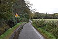
 Access lane to West Coldstream (2012) - geograph.org.uk - 3152341.jpg 1,371 × 943; 335 KB
-
 Access to Burnside - geograph.org.uk - 1245880.jpg 640 × 480; 121 KB
-
 Access to converted Broomfield Steading - geograph.org.uk - 3152594.jpg 1,733 × 1,097; 638 KB
-
 Access to East Quartains - geograph.org.uk - 5485699.jpg 4,487 × 2,873; 1.98 MB
-
 Access to Newhall - geograph.org.uk - 5485675.jpg 4,896 × 2,123; 2.29 MB
-
 An ancient multi-trunk tree - geograph.org.uk - 3128799.jpg 2,736 × 3,648; 2.03 MB
-
 An avenue of Douglas Firs - geograph.org.uk - 3132594.jpg 1,753 × 1,277; 943 KB
-
 An Insect Hotel at Drum Castle Gardens, Aberdeenshire, UK - geograph.org.uk - 5099004.jpg 2,516 × 1,678; 2.84 MB
-
 An ornamental wooden gate - geograph.org.uk - 3132602.jpg 1,691 × 1,170; 809 KB
-
 Aqueduct valve chamber - geograph.org.uk - 2859653.jpg 2,979 × 1,875; 6.51 MB
-
 Arable land, Drumoak - geograph.org.uk - 5628968.jpg 1,024 × 683; 409 KB
-
 Autumn trees beside the Deeside Way - geograph.org.uk - 6333879.jpg 6,000 × 4,000; 5.64 MB
-
 Avenue driveway to Newhall - geograph.org.uk - 5485684.jpg 4,442 × 2,529; 3.21 MB
-
 Barehillock Farm - geograph.org.uk - 1351583.jpg 640 × 427; 71 KB
-
 Barn near Newhall - geograph.org.uk - 5485671.jpg 4,896 × 3,672; 7.16 MB
-
 Beattie's Cottage - geograph.org.uk - 5164641.jpg 3,878 × 2,586; 1.14 MB
-
 Beattie's Cottages - geograph.org.uk - 5164648.jpg 3,810 × 2,540; 1.5 MB
-
 Birch wood, Keith's Muir - geograph.org.uk - 5629282.jpg 1,024 × 683; 581 KB
-
 Boundary stone wall between fields - geograph.org.uk - 3152296.jpg 1,824 × 1,368; 766 KB
-
 Bridge over the Coldstream Burn - geograph.org.uk - 2854251.jpg 2,700 × 1,801; 7.4 MB
-
 Bridge over the Gormack Burn - geograph.org.uk - 2862918.jpg 3,080 × 2,054; 7.02 MB
-
 Broomfield - geograph.org.uk - 1245843.jpg 640 × 405; 74 KB
-
 Broomfield Cottage - geograph.org.uk - 3152598.jpg 1,391 × 983; 290 KB
-
 Burnside farm - geograph.org.uk - 1246158.jpg 640 × 480; 84 KB
-
 Burnside junction - geograph.org.uk - 5485702.jpg 4,896 × 3,672; 6.5 MB
-
 Burnside Quartains - geograph.org.uk - 3152259.jpg 1,787 × 1,144; 822 KB
-
 By Hill of Park - geograph.org.uk - 5307393.jpg 4,272 × 2,848; 2.21 MB
-
 Calves at Drum - geograph.org.uk - 2005521.jpg 2,560 × 1,920; 1.76 MB
-
 Candyglirach - geograph.org.uk - 1026665.jpg 633 × 475; 176 KB
-
 Candyglirach Farm - geograph.org.uk - 1351553.jpg 640 × 427; 49 KB
-
 Candyglirach Farm - geograph.org.uk - 5307621.jpg 4,272 × 2,848; 3.45 MB
-
 Cattle at Drum - geograph.org.uk - 2006603.jpg 2,560 × 1,920; 1.82 MB
-
 Cattle by Hoghillock - geograph.org.uk - 5307599.jpg 4,272 × 2,848; 1.68 MB
-
 Chairs, Park Smiddy - geograph.org.uk - 5629300.jpg 1,024 × 683; 523 KB
-
 Church Hall, Drumoak - geograph.org.uk - 3151589.jpg 3,648 × 2,736; 1.96 MB
-
 Church of Scotland notice board, Drumoak Church - geograph.org.uk - 3151548.jpg 3,648 × 2,736; 1.4 MB
-
 Cleared area at Cairnton Wood - geograph.org.uk - 6305450.jpg 5,184 × 3,888; 5.79 MB
-
 Coldstream Burn - geograph.org.uk - 2851273.jpg 2,700 × 1,800; 7.76 MB
-
 Coldstream Burn - geograph.org.uk - 2854200.jpg 1,867 × 2,800; 7.63 MB
-
 Coldstream Burn - geograph.org.uk - 2854233.jpg 1,734 × 2,600; 6.59 MB
-
 Coldstream Burn - geograph.org.uk - 2859631.jpg 2,800 × 1,867; 6.54 MB
-
 Collonach Plantation - geograph.org.uk - 5307398.jpg 4,272 × 2,848; 5.89 MB
-
 Converted Broomfield steading - geograph.org.uk - 3152572.jpg 1,681 × 1,144; 463 KB
-
 Cottage in Sawmills - geograph.org.uk - 5485725.jpg 640 × 419; 73 KB
-
 Cottages at Sawmills - geograph.org.uk - 1245982.jpg 640 × 481; 91 KB
-
 Country junction - geograph.org.uk - 6334037.jpg 6,000 × 4,000; 7.37 MB
-
 Couper's Road - geograph.org.uk - 2835866.jpg 3,000 × 2,000; 7.32 MB
-
 Couper's Road - geograph.org.uk - 2835883.jpg 3,000 × 2,000; 7.15 MB
-
 Couper's Road - geograph.org.uk - 2835888.jpg 2,800 × 1,867; 7.7 MB
-
 Couper's Road - geograph.org.uk - 2835904.jpg 3,000 × 2,000; 7.44 MB
-
 Couper's Road - geograph.org.uk - 3714916.jpg 3,000 × 2,000; 7.6 MB
-
 Couper's Road - geograph.org.uk - 5307409.jpg 4,272 × 2,848; 2.59 MB
-
 Couper's Road - geograph.org.uk - 5307425.jpg 4,272 × 2,848; 2.32 MB
-
 Couper's Road crossroads - geograph.org.uk - 5485667.jpg 3,926 × 2,273; 2.7 MB
-

-
 Crossing the Gormack Burn - geograph.org.uk - 1245783.jpg 640 × 480; 76 KB
-
 Cultivation by Park - geograph.org.uk - 5307592.jpg 4,272 × 2,848; 1.45 MB
-
 Dalmaik Church - geograph.org.uk - 2849992.jpg 2,760 × 1,840; 5.3 MB
-
 Dalmaik Church - geograph.org.uk - 2850003.jpg 2,880 × 1,920; 5.9 MB
-
 Dalmaik Church - geograph.org.uk - 2850089.jpg 2,760 × 1,840; 6.15 MB
-
 Dalmaik Church - geograph.org.uk - 2850103.jpg 2,760 × 1,840; 5.93 MB
-
 Dalmaik Church - geograph.org.uk - 2850113.jpg 2,760 × 1,840; 6.72 MB
-
 Dalmaik Church - geograph.org.uk - 2850121.jpg 2,970 × 1,979; 7.29 MB
-
 Dalmaik Church - geograph.org.uk - 2850141.jpg 2,800 × 1,866; 7.24 MB
-
 Dalmaik Church - St Maik's Church - geograph.org.uk - 5732428.jpg 4,320 × 2,432; 4.22 MB
-
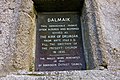
 Dalmaik Church. History - geograph.org.uk - 2849983.jpg 2,880 × 1,903; 6.72 MB
-
 Dalmaik old manse - geograph.org.uk - 2851156.jpg 3,000 × 1,967; 7.11 MB
-
 Deeside Railway trackbed - geograph.org.uk - 5629289.jpg 1,024 × 683; 551 KB
-
 Deeside Railway trackbed, Mills of Drum - geograph.org.uk - 5629337.jpg 1,024 × 683; 434 KB
-
 Deeside Railway trackbed, Mills of Drum - geograph.org.uk - 5629338.jpg 1,024 × 683; 442 KB
-
 Deeside Railway trackbed, Park - geograph.org.uk - 5629304.jpg 1,024 × 683; 563 KB
-
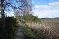
 Deeside Way - geograph.org.uk - 5628965.jpg 1,024 × 683; 304 KB
-
 Deeside Way - geograph.org.uk - 5628971.jpg 1,024 × 683; 358 KB
-
 Deeside Way in winter - geograph.org.uk - 6357617.jpg 4,000 × 6,000; 5.61 MB
-
 Deeside Way near Crathes - geograph.org.uk - 5629345.jpg 1,024 × 683; 509 KB
-
 Deeside Way near Crathes - geograph.org.uk - 5629346.jpg 1,024 × 683; 403 KB
-
 Deeside Way near Drumoak, Aberdeenshire - geograph.org.uk - 6174871.jpg 2,400 × 1,590; 1.87 MB
-
 Deeside Way sign - geograph.org.uk - 6305444.jpg 5,184 × 3,888; 7 MB
-
 Deeside Way west of Peterculter - geograph.org.uk - 6333873.jpg 6,000 × 4,000; 6.21 MB
-
 Deeside Way, Park - geograph.org.uk - 2838901.jpg 2,900 × 1,933; 7.64 MB
-
 Down to Park Bridge - geograph.org.uk - 5868349.jpg 4,797 × 3,597; 3.56 MB
-
 Downhill to Burnside junction - geograph.org.uk - 3152132.jpg 1,381 × 1,031; 711 KB
-
 Drive up to Drum Castle - geograph.org.uk - 1943391.jpg 640 × 480; 70 KB
-
 Drum Castle - geograph.org.uk - 5533433.jpg 640 × 480; 60 KB
-
 Drum Castle - geograph.org.uk - 5533437.jpg 640 × 427; 307 KB
-
 Drum Castle - geograph.org.uk - 5533441.jpg 640 × 427; 342 KB
-
 Drum Garden Centre - geograph.org.uk - 1820121.jpg 3,000 × 2,000; 6.46 MB
-
 Drum Garden Centre - geograph.org.uk - 1820131.jpg 630 × 473; 149 KB
-
 Drum Garden Centre - geograph.org.uk - 5164530.jpg 3,967 × 2,645; 1.96 MB
-
 Drum Wetland - geograph.org.uk - 5164656.jpg 4,272 × 2,848; 2.18 MB
-
 Drumhill and Trees - geograph.org.uk - 5164576.jpg 4,103 × 2,735; 2.24 MB
-
 Drumhill Croft - geograph.org.uk - 5164588.jpg 4,008 × 2,672; 1.34 MB
-
 Drumhill Triangulation Station, Aberdeenshire - geograph.org.uk - 5109168.jpg 2,710 × 1,795; 2.96 MB
-
 Drumhill Trig - geograph.org.uk - 5164598.jpg 4,023 × 2,683; 3.45 MB
-
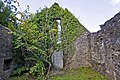
 Drumoak (Dalmaik) Old Kirk - geograph.org.uk - 6333994.jpg 4,511 × 3,924; 2.5 MB
-
 Drumoak (Dalmaik) old kirk - geograph.org.uk - 6334000.jpg 5,081 × 3,793; 4.52 MB
-
 Drumoak Kirk (view from the west) - geograph.org.uk - 5242105.jpg 3,008 × 2,000; 2.84 MB
-
 Drumoak Kirk - geograph.org.uk - 5242100.jpg 2,405 × 1,909; 1.96 MB
-
 Drumoak Primary School - geograph.org.uk - 5242111.jpg 1,940 × 1,453; 1.08 MB
-
 Dwellings by A93 - geograph.org.uk - 3130476.jpg 1,783 × 1,144; 711 KB
-
 East face of a shelter belt of trees - geograph.org.uk - 3152741.jpg 1,824 × 1,368; 736 KB
-
 East lodge, Park - geograph.org.uk - 6356658.jpg 5,122 × 3,782; 4.84 MB
-
 Easter Quartains - geograph.org.uk - 1245877.jpg 640 × 480; 74 KB
-
 Easter Quartains - geograph.org.uk - 5533469.jpg 640 × 427; 403 KB
-
 End of a winter day on the Deeside Way - geograph.org.uk - 6357625.jpg 6,000 × 4,000; 6.96 MB
-
 Entering Sawmills from the west - geograph.org.uk - 5485710.jpg 3,740 × 2,126; 1.84 MB
-
 Entrance to Broomfield - geograph.org.uk - 3152615.jpg 1,189 × 829; 378 KB
-
 Entrance to Drumview - geograph.org.uk - 3040178.jpg 999 × 749; 410 KB
-
 Entrance to Garden Centre - geograph.org.uk - 3129539.jpg 1,368 × 1,824; 946 KB
-
 Farm buildings at South Coldstream - geograph.org.uk - 3151723.jpg 1,824 × 1,368; 1.04 MB
-
 Farm track to Upper Mills of Crathes - geograph.org.uk - 6357632.jpg 4,000 × 6,000; 6.79 MB
-
 Farmland near Cullerlie - geograph.org.uk - 1598517.jpg 630 × 420; 144 KB
-
 Farmland Walk, Drum Castle - geograph.org.uk - 2005532.jpg 2,560 × 1,920; 1.71 MB
-
 Farmland, Park - geograph.org.uk - 5629292.jpg 1,024 × 683; 418 KB
-
 Felled Forest - geograph.org.uk - 5533458.jpg 640 × 427; 356 KB
-
 Field and Woods near Woodside - geograph.org.uk - 5533465.jpg 640 × 427; 337 KB
-
 Field at Horsewells - geograph.org.uk - 5533462.jpg 640 × 427; 425 KB
-
 Field Boulder - geograph.org.uk - 5164551.jpg 4,139 × 2,759; 1.84 MB
-
 Field boundary hedge between North and South Coldstream - geograph.org.uk - 3152088.jpg 1,824 × 1,368; 1,014 KB
-
 Field gates and boundary wall - geograph.org.uk - 3152686.jpg 1,788 × 1,336; 713 KB
-
 Field near Mills of Drum - geograph.org.uk - 5629332.jpg 1,024 × 683; 348 KB
-
 Field with cattle - geograph.org.uk - 5287979.jpg 1,200 × 800; 345 KB
-
 Field, Park - geograph.org.uk - 5629297.jpg 1,024 × 683; 270 KB
-
 Fields by Drum - geograph.org.uk - 2005541.jpg 2,560 × 1,920; 1.8 MB
-
 Fields close to Couper's Road - 2 - geograph.org.uk - 3460278.jpg 800 × 640; 265 KB
-
 Fields close to Couper's Road - geograph.org.uk - 3460273.jpg 800 × 640; 306 KB
-
 Fields near Coldstream - geograph.org.uk - 5533472.jpg 640 × 427; 359 KB
-
 Flooded cutting, Deeside Railway - geograph.org.uk - 5629329.jpg 1,024 × 683; 528 KB
-
 Fodder cage and view NW from near South Coldstream - geograph.org.uk - 3151743.jpg 1,824 × 1,368; 799 KB
-
 Football field, Drumoak - geograph.org.uk - 5629280.jpg 1,024 × 683; 302 KB
-
 Footbridge over the Gallow burn - geograph.org.uk - 1442467.jpg 1,960 × 2,940; 7.46 MB
-
 Footpath in Newmill Hill Forest - geograph.org.uk - 1083086.jpg 480 × 640; 215 KB
-
 Former church at Park - geograph.org.uk - 6066424.jpg 1,024 × 768; 78 KB
-
 Former free kirk, Park - geograph.org.uk - 6356690.jpg 4,330 × 3,668; 1.18 MB
-
 Former quarry, Drumhill Wood, Aberdeenshire - geograph.org.uk - 6516567.jpg 1,950 × 1,463; 1.12 MB
-

-
 Gallow Burn - geograph.org.uk - 2835967.jpg 2,700 × 1,799; 7.53 MB
-
 Gallow Hill - geograph.org.uk - 2830541.jpg 3,080 × 2,053; 7.49 MB
-
 Garden Centre interior - geograph.org.uk - 3129552.jpg 1,824 × 1,368; 825 KB
-
 Garden Centre, Mains of Drum - geograph.org.uk - 2005241.jpg 2,560 × 1,920; 1.77 MB
-
 Gated entrance to a waste dump - geograph.org.uk - 3152764.jpg 1,824 × 1,368; 815 KB
-
 Gatepost, West Lodge - geograph.org.uk - 5629319.jpg 1,024 × 683; 493 KB
-
 Geese by Park - geograph.org.uk - 5307384.jpg 4,272 × 2,848; 2.33 MB
-
 Glashmore Road - geograph.org.uk - 1351542.jpg 640 × 427; 94 KB
-
 Gormack Burn - geograph.org.uk - 6305585.jpg 5,184 × 3,888; 7.45 MB
-
 Green and Gold - geograph.org.uk - 5533454.jpg 640 × 427; 331 KB
-
 Hoghillock - geograph.org.uk - 1026667.jpg 633 × 475; 164 KB
-
 Hoghillock Farm - geograph.org.uk - 1351507.jpg 640 × 381; 50 KB
-
 Hut circle - geograph.org.uk - 2905774.jpg 3,600 × 1,637; 7.44 MB
-
 Hut circle - geograph.org.uk - 2905780.jpg 3,000 × 2,000; 7.37 MB
-
 Inky Mo's Hut - geograph.org.uk - 1442502.jpg 2,940 × 1,960; 7.4 MB
-
 Inky Mo's Hut - geograph.org.uk - 1442583.jpg 542 × 595; 124 KB
-
 Jackieshillock viewed from the east - geograph.org.uk - 5485824.jpg 4,896 × 3,672; 6.63 MB
-
 Junction for Drum Castle - geograph.org.uk - 5485749.jpg 3,297 × 2,668; 1.64 MB
-
 Junction for Morphiehowe - geograph.org.uk - 1245794.jpg 640 × 363; 53 KB
-
 Junction for West Coldstream - geograph.org.uk - 3152315.jpg 1,465 × 1,095; 346 KB
-
 Junction of minor roads - geograph.org.uk - 5485762.jpg 2,974 × 3,671; 2.21 MB
-

-
 Keiths' Muir - geograph.org.uk - 5629277.jpg 1,024 × 683; 480 KB
-
 Landscaped grounds and carpark - geograph.org.uk - 3130486.jpg 1,824 × 1,368; 762 KB
-
 Landscaping by Mains of Drum Garden Centre - geograph.org.uk - 2005259.jpg 2,560 × 1,920; 1.81 MB
-

-
 Line of old railway - geograph.org.uk - 6305464.jpg 5,184 × 3,888; 5.35 MB
-
 Little used and much overgrown path in Drumhill Woods - geograph.org.uk - 6302173.jpg 4,000 × 3,000; 4.68 MB
-
 Lochside Woodland - geograph.org.uk - 5307578.jpg 4,272 × 2,848; 2.33 MB
-
 Lochwood Cottage - geograph.org.uk - 5307579.jpg 4,272 × 2,848; 1.88 MB
-
 Log pile in Forest of Drum - geograph.org.uk - 3151752.jpg 1,824 × 1,368; 851 KB
-
 Logs by Todholes - geograph.org.uk - 5307605.jpg 640 × 427; 114 KB
-
 Looking along the Deeside Way - geograph.org.uk - 6357579.jpg 3,984 × 5,775; 4.88 MB
-
 Looking down Couper's Road - geograph.org.uk - 5307590.jpg 4,056 × 2,704; 4.3 MB
-
 Looking down the River Dee... - geograph.org.uk - 5239453.jpg 3,008 × 2,000; 2.51 MB
-
 Looking over Park Bridge, Drumoak - geograph.org.uk - 5239445.jpg 3,008 × 2,000; 2.63 MB
-
 Looking towards Quartains - geograph.org.uk - 5533478.jpg 640 × 427; 404 KB
-
 Looking upstream from Park Bridge - geograph.org.uk - 2494578.jpg 640 × 480; 58 KB
-
 Main Hut - geograph.org.uk - 1442652.jpg 3,025 × 2,016; 7.52 MB
-
 Main Hut - geograph.org.uk - 1442669.jpg 1,800 × 2,700; 7.05 MB


_-_geograph.org.uk_-_3152555.jpg)


_-_geograph.org.uk_-_3152341.jpg)


_Old_Kirk_-_geograph.org.uk_-_6333994.jpg)
_old_kirk_-_geograph.org.uk_-_6334000.jpg)
_-_geograph.org.uk_-_5242105.jpg)


&filefrom=Mains+of+Drum+-+Garden+Centre+-+geograph.org.uk+-+5269491.jpg#mw-category-media)