Category:Dry stone walls in Greater Manchester
Media in category "Dry stone walls in Greater Manchester"
The following 17 files are in this category, out of 17 total.
-
 A wall and several trees - geograph.org.uk - 713292.jpg 425 × 640; 92 KB
-
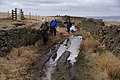 A wet part of the bridleway - geograph.org.uk - 1775009.jpg 3,872 × 2,592; 4.41 MB
-
 Cobbled Path - geograph.org.uk - 797069.jpg 640 × 480; 155 KB
-
 Damaged stone wall - geograph.org.uk - 4164381.jpg 1,024 × 768; 199 KB
-
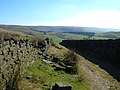
 Dry stone wall near The Height - geograph.org.uk - 3367924.jpg 1,024 × 682; 555 KB
-
 Dry stone wall under repair - geograph.org.uk - 705236.jpg 640 × 474; 85 KB
-
 Dry-stone Walling - geograph.org.uk - 1493539.jpg 640 × 480; 178 KB
-
 Drystone Wall on Rape Hill (2) - geograph.org.uk - 729722.jpg 640 × 427; 318 KB
-
 Drystone Wall on Rape Hill - geograph.org.uk - 729720.jpg 640 × 390; 253 KB
-
 Exercise Bars - geograph.org.uk - 1013086.jpg 640 × 480; 128 KB
-
 Footpath to Green Hill, High Crompton - geograph.org.uk - 705333.jpg 640 × 484; 115 KB
-
 Geese in a field - geograph.org.uk - 1231073.jpg 640 × 486; 130 KB
-
 Heap Brow - geograph.org.uk - 1244295.jpg 640 × 457; 422 KB
-
 Ox Hey Top, Castleshaw - geograph.org.uk - 387985.jpg 640 × 473; 117 KB
-
 Pennine Bridleway, Low Gate Lane - geograph.org.uk - 576217.jpg 640 × 480; 88 KB
-
 RUPP above Ogden - geograph.org.uk - 717017.jpg 640 × 463; 93 KB
-
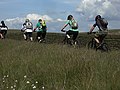 Single file on the Pennine Bridleway - geograph.org.uk - 1354828.jpg 640 × 480; 113 KB


_-_geograph.org.uk_-_729722.jpg)


