Category:Dull, Perth and Kinross
village in Perth and Kinross, Scotland, UK  | |||||
| Upload media | |||||
| Instance of | |||||
|---|---|---|---|---|---|
| Location |
| ||||
 | |||||
English: Dull is a village located in the county of Perth & Kinross in Scotland. Situated in the Highland part of the county, Dull consists of a single street of houses on the north side of the valley of the River Tay. The place-name means 'meadow' or 'haugh' in Gaelic. The parish church, unused since the 1970s , is on the site of an early Christian monastery founded by St Adomnán, Abbot of Iona (died 704). Several early Christian cross-slabs dating to the 7th or 8th century have been discovered in and around the parish graveyard. A slab carved with stylised warriors and horsemen in the Pictish style, uncovered during grave-digging in the 19th century, is displayed in the Museum of Scotland.
Simple English: Dull is a village located in the county of Perth & Kinross in Scotland. It is in the Highland part of the county. There is only one street of houses in Dull, on the north side of the valley of the River Tay. The place-name means 'meadow' in Gaelic. The parish church, unused since the 1970s , is on the site of an early Christian monastery founded by St. Adomnán, Abbot of Iona.
Media in category "Dull, Perth and Kinross"
The following 75 files are in this category, out of 75 total.
-
 Appin of Dull, Perthshire - geograph-3661098.jpg 4,608 × 3,456; 4.29 MB
-
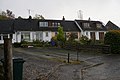 Bungalows in Dull - geograph.org.uk - 4219533.jpg 1,600 × 1,064; 569 KB
-
 Camserney Water Supply - geograph.org.uk - 684819.jpg 640 × 360; 92 KB
-
 Church in the village of Dull - geograph.org.uk - 4219516.jpg 1,600 × 1,064; 656 KB
-
 Church of Scotland at Dull - geograph.org.uk - 1238362.jpg 640 × 353; 55 KB
-
 Dull - geograph.org.uk - 4243269.jpg 800 × 533; 424 KB
-
 Dull - geograph.org.uk - 4244169.jpg 800 × 533; 436 KB
-
 Dull and Boring.JPG 4,000 × 3,000; 2.21 MB
-
 Dull Church - geograph.org.uk - 1883958.jpg 1,388 × 993; 226 KB
-
 Dull Church - geograph.org.uk - 2530297.jpg 4,320 × 3,240; 3.07 MB
-
 Dull Church - geograph.org.uk - 3661100.jpg 4,608 × 3,456; 4.72 MB
-
 Dull church.jpg 640 × 427; 123 KB
-
 Dull Churchyard - geograph.org.uk - 1003320.jpg 640 × 437; 94 KB
-
 Dull Cross - geograph.org.uk - 2037881.jpg 2,592 × 2,936; 1.15 MB
-
 Dull Parish Church - geograph.org.uk - 3153300.jpg 640 × 480; 75 KB
-
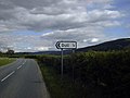
 Dull road sign, B846 - geograph.org.uk - 3699247.jpg 480 × 640; 62 KB
-
 Dull War Memorial - geograph.org.uk - 3699296.jpg 480 × 640; 70 KB
-
 Grouse shooters hut - geograph.org.uk - 684362.jpg 640 × 360; 41 KB
-
 Loch Farleyer plantation - geograph.org.uk - 684205.jpg 640 × 360; 56 KB
-
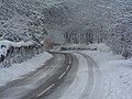 Snow Clearing on the A827 - geograph.org.uk - 136669.jpg 640 × 480; 103 KB
-
 Summit area of Weem Hill - geograph.org.uk - 684329.jpg 640 × 360; 51 KB
-
 The Cross at Dull - geograph.org.uk - 3699264.jpg 640 × 480; 135 KB
-
 Barn, Tullicro - geograph.org.uk - 1446753.jpg 427 × 640; 74 KB
-
 Bolfracks Hill - geograph.org.uk - 162049.jpg 640 × 480; 114 KB
-
 Bolfracks House - geograph.org.uk - 136663.jpg 640 × 480; 61 KB
-
 Bothy near Loch Farlayer - geograph.org.uk - 427090.jpg 640 × 480; 91 KB
-
 Burn flowing into Loch Farleyer - geograph.org.uk - 684215.jpg 640 × 480; 101 KB
-
 Cairn - geograph.org.uk - 291746.jpg 640 × 480; 57 KB
-
 Camserney - geograph.org.uk - 684094.jpg 640 × 360; 68 KB
-
 Carse Farm Stone Circle - geograph.org.uk - 504250.jpg 640 × 480; 97 KB
-
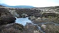
 Damp Moorland - geograph.org.uk - 684428.jpg 640 × 360; 42 KB
-
 Deer fence on Weem Hill - geograph.org.uk - 684342.jpg 640 × 360; 22 KB
-
 Drummond Hill Forest. - geograph.org.uk - 63226.jpg 640 × 480; 146 KB
-
 Edge of the forest, Drummond Hill. - geograph.org.uk - 63218.jpg 640 × 480; 91 KB
-
 Electricity pylon - geograph.org.uk - 291727.jpg 640 × 480; 50 KB
-
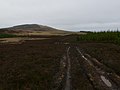
 Farm track - geograph.org.uk - 684092.jpg 640 × 360; 99 KB
-
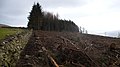 Felled forestry - geograph.org.uk - 684144.jpg 640 × 360; 57 KB
-
 Fenced Plantation - geograph.org.uk - 684141.jpg 640 × 360; 71 KB
-
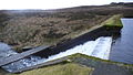 Footbridge and weir at Loch Farleyer - geograph.org.uk - 684200.jpg 640 × 360; 66 KB
-
 Ford over burn - geograph.org.uk - 684760.jpg 640 × 360; 65 KB
-
 Hill path to Shenavail - geograph.org.uk - 684229.jpg 640 × 360; 68 KB
-
 I'd rather get wet feet^ - geograph.org.uk - 684799.jpg 640 × 360; 75 KB
-
 Leaving the forestry - geograph.org.uk - 684721.jpg 640 × 480; 46 KB
-
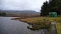
 Loch Farleyer - geograph.org.uk - 684159.jpg 640 × 360; 65 KB
-
 Loch Farleyer - geograph.org.uk - 684179.jpg 640 × 360; 66 KB
-
 Loch Farleyer - geograph.org.uk - 684187.jpg 640 × 360; 50 KB
-
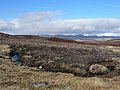
 Moorland - geograph.org.uk - 291740.jpg 640 × 480; 77 KB
-
 Moorland - geograph.org.uk - 353691.jpg 640 × 480; 79 KB
-
 Moorland burn - geograph.org.uk - 353699.jpg 640 × 480; 79 KB
-
 Moorland track - geograph.org.uk - 291733.jpg 640 × 480; 74 KB
-
 Poor construction - geograph.org.uk - 684704.jpg 640 × 480; 111 KB
-
 Potatoes and wild flowers, Comrie Farm - geograph.org.uk - 566337.jpg 640 × 480; 130 KB
-
 Power line crossing open moorland - geograph.org.uk - 353615.jpg 640 × 481; 148 KB
-
 Road to Camserney - geograph.org.uk - 300663.jpg 640 × 480; 76 KB
-
 Ruith Mhuilinn - geograph.org.uk - 493971.jpg 640 × 480; 139 KB
-
 Sheep - geograph.org.uk - 291767.jpg 640 × 479; 185 KB
-
 Signpost to the village of Dull - geograph.org.uk - 108551.jpg 640 × 480; 80 KB
-
 Silage store - geograph.org.uk - 684152.jpg 640 × 360; 73 KB
-
 Small cyclists in a big landscape - geograph.org.uk - 291731.jpg 640 × 480; 124 KB
-
 Stalkers hut - geograph.org.uk - 291741.jpg 640 × 485; 159 KB
-
 Thatched farm cottages - geograph.org.uk - 684077.jpg 640 × 360; 81 KB
-
 The B846 heading east at Tirine - geograph.org.uk - 136676.jpg 640 × 480; 85 KB
-
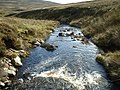
 The Urlar Burn - geograph.org.uk - 185290.jpg 640 × 480; 127 KB
-
 The West Lodge Bolfracks House - geograph.org.uk - 136665.jpg 640 × 480; 101 KB
-
 Track and line of beech trees - geograph.org.uk - 684135.jpg 640 × 360; 76 KB
-
 Track junction - geograph.org.uk - 684111.jpg 640 × 360; 66 KB
-
 Track to Loch Farleyer - geograph.org.uk - 684167.jpg 640 × 360; 72 KB
-
 Track to Lurgan - geograph.org.uk - 684109.jpg 640 × 360; 82 KB
-
 Track to Shenavail - geograph.org.uk - 684103.jpg 640 × 360; 84 KB
-
 Urlar Burn - geograph.org.uk - 291737.jpg 640 × 480; 209 KB
-
 Urlar Burn - geograph.org.uk - 291753.jpg 640 × 480; 82 KB
-
 View across the Appin of Dull - geograph.org.uk - 162054.jpg 640 × 480; 90 KB
-
 Water tank, Wester Carse - geograph.org.uk - 433544.jpg 640 × 480; 59 KB
-
 Weem Hill plantation - geograph.org.uk - 684313.jpg 640 × 360; 69 KB
-
 Woodland edge and Strath Tay - geograph.org.uk - 684127.jpg 640 × 360; 29 KB


