Category:Dumplington
English: Dumplington is a settlement in the unparished area Urmston, in the Trafford district, in the county of Greater Manchester, England.
human settlement in United Kingdom  | |||||
| Upload media | |||||
| Instance of | |||||
|---|---|---|---|---|---|
| Location | Urmston, Trafford, Greater Manchester, North West England, England | ||||
 | |||||
Media in category "Dumplington"
The following 38 files are in this category, out of 38 total.
-
-
 'Trafford City' sign - geograph.org.uk - 5157432.jpg 4,896 × 3,672; 3.66 MB
-
 A retail park with a sports and fitness theme - geograph.org.uk - 2664709.jpg 3,849 × 2,394; 5 MB
-
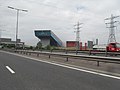
 Adamson Circle - geograph.org.uk - 5913746.jpg 4,000 × 3,000; 2.57 MB
-
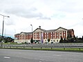
 All Saints RC Church - geograph.org.uk - 3516437.jpg 640 × 480; 97 KB
-
 Approaching dusk on Trafford Way - geograph.org.uk - 6293252.jpg 6,000 × 4,000; 7.09 MB
-
 B^Q Warehouse - Trafford Park - geograph.org.uk - 3058763.jpg 4,000 × 3,000; 3.95 MB
-
 Castle in the Air - geograph.org.uk - 5913744.jpg 4,000 × 3,000; 2.65 MB
-
 Chill Factor - Indoor Ski Slope - geograph.org.uk - 1943320.jpg 4,224 × 3,168; 5.81 MB
-
 Chill factore.jpg 2,200 × 1,576; 2.6 MB
-
 Chill Factore2.jpg 2,532 × 1,304; 1.63 MB
-
 Dinosaur Falls, Manchester - geograph.org.uk - 5613801.jpg 4,297 × 2,775; 1.78 MB
-
 Dumplington Electrical Substation - geograph.org.uk - 1972781.jpg 3,264 × 2,448; 1.92 MB
-
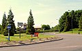
 Ellesmere Circle, roundabout - geograph.org.uk - 3516485.jpg 640 × 480; 62 KB
-
 Footpath off B5214 near Trafford Centre - geograph.org.uk - 5157322.jpg 4,896 × 3,672; 6.92 MB
-
 Gargoyle, All Saints Church - geograph.org.uk - 3516474.jpg 640 × 480; 39 KB
-
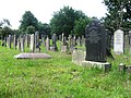 Graveyard off Old Barton Road - geograph.org.uk - 3516473.jpg 640 × 480; 117 KB
-

-
 Indoor Ski Slope - geograph.org.uk - 2259867.jpg 640 × 434; 38 KB
-
 Land for development at Dumplington - geograph.org.uk - 4419919.jpg 6,000 × 4,000; 5.59 MB
-
 Premier Inn opposite the Trafford Centre - geograph.org.uk - 5157198.jpg 4,896 × 3,672; 3.08 MB
-
 Public footpath off Trafford Boulevard B5214 - geograph.org.uk - 5157211.jpg 4,896 × 3,672; 6.97 MB
-
 Public footpath off Trafford Boulevard B5214 - geograph.org.uk - 5157219.jpg 4,896 × 3,672; 6.68 MB
-
 Public footpath off Trafford Boulevard B5214 - geograph.org.uk - 5157223.jpg 4,896 × 3,672; 6.84 MB
-
 Sculpture and fountain outside Venus - geograph.org.uk - 5157416.jpg 3,672 × 4,896; 3.86 MB
-
 Swinging Bridge - geograph.org.uk - 3516481.jpg 640 × 480; 81 KB
-
 Swinging Bridge - geograph.org.uk - 4419877.jpg 6,000 × 4,000; 7.66 MB
-
 The Chill Factor - geograph.org.uk - 2664691.jpg 4,398 × 2,409; 4.97 MB
-
 The Chill Factor, Trafford - geograph.org.uk - 3576788.jpg 1,024 × 768; 121 KB
-
 Trafford Boulevard-Bridgewater Circle - geograph.org.uk - 4643414.jpg 2,784 × 1,568; 2.14 MB
-
 Trafford Golf Centre and Chill Factore - geograph.org.uk - 5157293.jpg 4,896 × 3,672; 3.19 MB
-
 Trafford Golf Centre and Chill Factore - geograph.org.uk - 5157335.jpg 4,896 × 3,672; 6.97 MB
-
 Trafford, Chill Factore - geograph.org.uk - 5157352.jpg 4,064 × 3,148; 2.51 MB
-
 Trafford, waste ground (former car park) off M60 - geograph.org.uk - 5157374.jpg 4,896 × 3,672; 6.86 MB
-
 Venus - geograph.org.uk - 6228002.jpg 5,940 × 3,570; 1.76 MB
-
 Venus - office block at Trafford City - geograph.org.uk - 5913755.jpg 3,623 × 2,749; 2.17 MB
-
 Venus, office building opposite Trafford Centre - geograph.org.uk - 5157269.jpg 4,896 × 3,672; 6.77 MB
-
 Venus, office building opposite Trafford Centre - geograph.org.uk - 5157402.jpg 4,896 × 3,672; 6.61 MB


_off_M60_-_geograph.org.uk_-_5157374.jpg)


