Category:Dunbeath
English: Dunbeath ( Gaelic: Dùn Beithe) is a village in south-east Caithness, Scotland on the A9 road.
Nederlands: Dunbeath ( Schots-Gaelisch: Dùn Beithe) is een dorp in het zuidoosten van de Schotse Lieutenancy Caithness in de council Highland.
human settlement in Highland, Scotland, UK  | |||||
| Upload media | |||||
| Instance of | |||||
|---|---|---|---|---|---|
| Location |
| ||||
 | |||||
Subcategories
This category has the following 5 subcategories, out of 5 total.
Media in category "Dunbeath"
The following 75 files are in this category, out of 75 total.
-
 A natural weir in Dunbeath Water - geograph.org.uk - 5991907.jpg 1,024 × 769; 637 KB
-
 Admiralty Chart No 1823 Banff to Dunbeath Harbour, Published 1847, Corrections to 1945.jpg 9,893 × 6,783; 25.16 MB
-
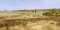
 Burial Chamber by Cuig - geograph.org.uk - 149522.jpg 640 × 480; 332 KB
-

-
 Canoe and Lobster Creel at Dunbeath - geograph.org.uk - 2444716.jpg 3,648 × 2,736; 2.18 MB
-
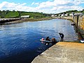
 Canoes at Dunbeath Harbour - geograph.org.uk - 2444693.jpg 2,581 × 1,952; 2.38 MB
-
 Cleit Mhor and Cleit Bheag - geograph.org.uk - 2458122.jpg 800 × 600; 124 KB
-
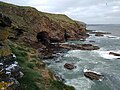
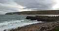
 Cliffs, cave and cove, near Dunbeath - geograph.org.uk - 2458081.jpg 800 × 600; 158 KB
-
 Coastline by Poll Gorm, Caithness - geograph.org.uk - 5413426.jpg 1,459 × 1,094; 430 KB
-
 Coastline near Dunbeath - geograph.org.uk - 1960217.jpg 3,573 × 2,628; 1,006 KB
-
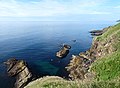
 Coastline near Inver, Caithness - geograph.org.uk - 2458140.jpg 800 × 600; 159 KB
-
 Disused petrol pump at Dunbeath - geograph.org.uk - 2530607.jpg 599 × 800; 190 KB
-
 Dun Beath - geograph.org.uk - 2366.jpg 572 × 428; 137 KB
-
 Dunbeath and District War Memorial (geograph 7811249).jpg 768 × 1,024; 117 KB
-
 Dunbeath Bay - geograph.org.uk - 3279414.jpg 640 × 251; 72 KB
-
 Dunbeath Bay - geograph.org.uk - 6216549.jpg 1,024 × 743; 223 KB
-
 Dunbeath bay - geograph.org.uk - 784856.jpg 640 × 480; 78 KB
-
 Dunbeath Brooch Anderson 1881b Fig 11 scotlandinearlyc00anderich 0042.jpg 678 × 1,383; 240 KB
-
 Dunbeath harbour - geograph.org.uk - 2167720.jpg 640 × 431; 93 KB
-
 Dunbeath Harbour - geograph.org.uk - 2266609.jpg 1,726 × 1,185; 1.71 MB
-
 Dunbeath Harbour - geograph.org.uk - 2443902.jpg 3,207 × 2,040; 1.22 MB
-
 Dunbeath Harbour and Pier - geograph.org.uk - 19186.jpg 640 × 478; 52 KB
-
 Dunbeath harbour and village - geograph.org.uk - 2568059.jpg 3,530 × 2,633; 2.04 MB
-
 Dunbeath Ice House - geograph.org.uk - 2444682.jpg 3,102 × 2,502; 1.8 MB
-
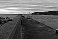 Dunbeath Pier - geograph.org.uk - 2133426.jpg 1,000 × 669; 161 KB
-
 Dunbeath pier and harbour entrance - geograph.org.uk - 481680.jpg 640 × 409; 76 KB
-
 Dunbeath Playing Field - geograph.org.uk - 2443915.jpg 3,648 × 2,736; 2.19 MB
-
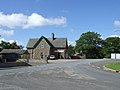 Dunbeath Post Office - geograph.org.uk - 482244.jpg 640 × 480; 74 KB
-
 Dunbeath Post Office and Shop - geograph.org.uk - 2133424.jpg 1,000 × 669; 194 KB
-
 Dunbeath Post Office and shop - geograph.org.uk - 3984801.jpg 640 × 420; 68 KB
-
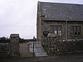 Dunbeath Ross church - geograph.org.uk - 1292486.jpg 640 × 480; 68 KB
-
 Dunbeath storehouse - geograph.org.uk - 1117018.jpg 640 × 480; 82 KB
-
 Dunbeath storehouse and Harbour Wall - geograph.org.uk - 1121441.jpg 640 × 480; 50 KB
-
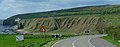
 Dunbeath Village and "New A9" - geograph.org.uk - 1130597.jpg 640 × 480; 78 KB
-
 Dunbeath War Memorial - geograph.org.uk - 3984803.jpg 640 × 480; 47 KB
-
 Dunbeath Water - geograph.org.uk - 2444728.jpg 2,681 × 1,944; 2.08 MB
-
 Dunbeath water upstream - geograph.org.uk - 544800.jpg 640 × 468; 107 KB
-
 Ice House, Dunbeath Harbour - geograph.org.uk - 573618.jpg 640 × 480; 100 KB
-
 Icehouse, Dunbeath - geograph.org.uk - 973770.jpg 640 × 426; 86 KB
-
 Inver Guest House - geograph.org.uk - 782040.jpg 640 × 341; 60 KB
-
 Markethill above Dunbeath - geograph.org.uk - 157824.jpg 640 × 424; 282 KB
-
 Old and New bridges at Dunbeath - geograph.org.uk - 85593.jpg 640 × 480; 167 KB
-
 Old filling station at Castle Hill - geograph.org.uk - 544042.jpg 640 × 512; 76 KB
-
 One Canoe Ashore - geograph.org.uk - 2444702.jpg 3,648 × 2,736; 2.4 MB
-
 Ordnance Survey One-Inch Sheet 16 Wick, Published 1959.jpg 8,276 × 9,893; 7.01 MB
-
 Ordnance Survey One-Inch Sheet 17 Helmsdale, Published 1947.jpg 12,154 × 9,430; 10.25 MB
-
 Pier at Dunbeath Harbour - geograph.org.uk - 4910541.jpg 640 × 344; 50 KB
-
 Razorbills on Cleit Mhor - geograph.org.uk - 2458109.jpg 800 × 600; 147 KB
-
 Rocks in Dunbeath Bay - geograph.org.uk - 5862098.jpg 640 × 419; 75 KB
-
 Ruined croft - geograph.org.uk - 775059.jpg 640 × 480; 103 KB
-
 Sea stacks at Cleit Mhor - geograph.org.uk - 1960516.jpg 3,648 × 2,736; 4.56 MB
-
 Sea-pinks on the cliff top - geograph.org.uk - 2458479.jpg 800 × 600; 249 KB
-
 Smiles 1878 robertdickbaker00smil 0239 Dunbeath.jpg 1,919 × 1,496; 352 KB
-
 Telford's Bridge Dunbeath - geograph.org.uk - 2443948.jpg 3,648 × 2,736; 2.38 MB
-
 Two bridges (geograph 5991904).jpg 1,024 × 769; 506 KB
-

-
 Upper Portomin Road - geograph.org.uk - 482219.jpg 640 × 480; 111 KB
-
 Abandoned house - geograph.org.uk - 780672.jpg 640 × 482; 111 KB
-
 Achavrole croft - geograph.org.uk - 529428.jpg 640 × 320; 67 KB
-
 Achavrole croft house - geograph.org.uk - 529426.jpg 640 × 350; 58 KB
-
 Ballentink - geograph.org.uk - 149523.jpg 640 × 480; 327 KB
-
 Bridge by Achorn - geograph.org.uk - 149801.jpg 640 × 480; 306 KB
-
 Derelict croft - geograph.org.uk - 482251.jpg 640 × 454; 55 KB
-
 Derelict croft house - geograph.org.uk - 544809.jpg 640 × 480; 85 KB
-
 Derelict farm - geograph.org.uk - 543199.jpg 640 × 480; 87 KB
-
 Dunbeath Heritage Centre - geograph.org.uk - 482231.jpg 640 × 415; 65 KB
-
 Dunbeath water - geograph.org.uk - 545596.jpg 640 × 480; 83 KB
-
 Footbridge over Dunbeath Water - geograph.org.uk - 481659.jpg 640 × 480; 116 KB
-
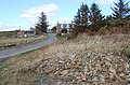
 Looking across the A9 from Lairdhay - geograph.org.uk - 481615.jpg 640 × 480; 86 KB
-
 Looking south down the A9 - geograph.org.uk - 481606.jpg 640 × 480; 73 KB
-
 Old road bridge, Dunbeath - geograph.org.uk - 482205.jpg 640 × 443; 85 KB
-
 Power lines alongside road - geograph.org.uk - 544806.jpg 640 × 504; 81 KB
-
 Road northwest at Ballach - geograph.org.uk - 544805.jpg 640 × 480; 76 KB
-
 Ruined croft in an enclosure - geograph.org.uk - 482378.jpg 640 × 404; 64 KB
-
 The Dunbeath Bridges - geograph.org.uk - 482198.jpg 640 × 480; 126 KB


.jpg)


.jpg)


